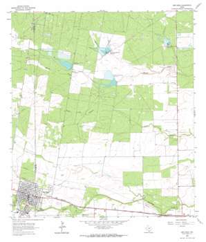
San Diego Topo Map Texas
To zoom in, hover over the map of San Diego
USGS Topo Quad 27098g2 - 1:24,000 scale
| Topo Map Name: | San Diego |
| USGS Topo Quad ID: | 27098g2 |
| Print Size: | ca. 21 1/4" wide x 27" high |
| Southeast Coordinates: | 27.75° N latitude / 98.125° W longitude |
| Map Center Coordinates: | 27.8125° N latitude / 98.1875° W longitude |
| U.S. State: | TX |
| Filename: | o27098g2.jpg |
| Download Map JPG Image: | San Diego topo map 1:24,000 scale |
| Map Type: | Topographic |
| Topo Series: | 7.5´ |
| Map Scale: | 1:24,000 |
| Source of Map Images: | United States Geological Survey (USGS) |
| Alternate Map Versions: |
San Diego TX 1963, updated 1964 Download PDF Buy paper map San Diego TX 1963, updated 1964 Download PDF Buy paper map San Diego TX 2010 Download PDF Buy paper map San Diego TX 2013 Download PDF Buy paper map San Diego TX 2016 Download PDF Buy paper map |
1:24,000 Topo Quads surrounding San Diego
> Back to 27098e1 at 1:100,000 scale
> Back to 27098a1 at 1:250,000 scale
> Back to U.S. Topo Maps home
San Diego topo map: Gazetteer
San Diego: Dams
Chiltipin-San Fernando Dam Number 6 elevation 97m 318′Chiltipin-San Fernando Dam Number 7 elevation 82m 269′
Chiltipin-San Fernando Dam Number 8 elevation 90m 295′
Chiltipin-San Fernando Dam Number 9 elevation 83m 272′
Soil Conservation Service 6 Dam elevation 95m 311′
Soil Conservation Service 7 Dam elevation 86m 282′
Soil Conservation Service 8 Dam elevation 89m 291′
Soil Conservation Service 9 Dam elevation 81m 265′
San Diego: Oilfields
San Diego Oil Field elevation 115m 377′San Diego: Populated Places
County Road 111 Colonia elevation 89m 291′Highland Addition Colonia elevation 96m 314′
Loma Linda East Colonia elevation 89m 291′
Mi Tierra Colonia elevation 101m 331′
Muil elevation 90m 295′
San Diego elevation 94m 308′
Springfield elevation 85m 278′
San Diego: Reservoirs
Soil Conservation Service Site 6 Reservoir elevation 95m 311′Soil Conservation Service Site 7 Reservoir elevation 86m 282′
Soil Conservation Service Site 8 Reservoir elevation 89m 291′
Soil Conservation Service Site 9 Reservoir elevation 81m 265′
San Diego: Streams
Rosita Creek elevation 85m 278′Toro Creek elevation 86m 282′
San Diego digital topo map on disk
Buy this San Diego topo map showing relief, roads, GPS coordinates and other geographical features, as a high-resolution digital map file on DVD:


