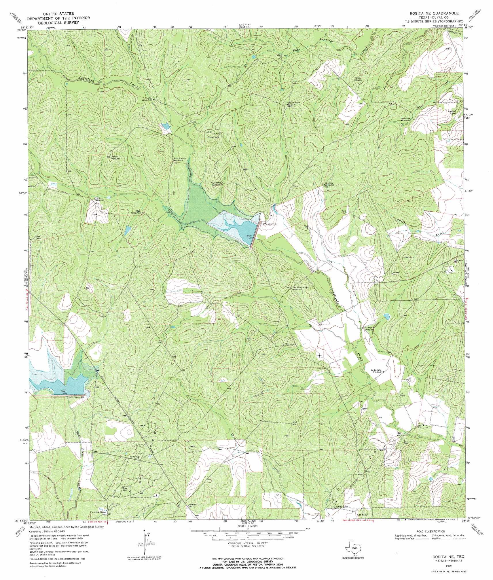
Rosita Ne Topo Map Texas
To zoom in, hover over the map of Rosita Ne
USGS Topo Quad 27098h3 - 1:24,000 scale
| Topo Map Name: | Rosita Ne |
| USGS Topo Quad ID: | 27098h3 |
| Print Size: | ca. 21 1/4" wide x 27" high |
| Southeast Coordinates: | 27.875° N latitude / 98.25° W longitude |
| Map Center Coordinates: | 27.9375° N latitude / 98.3125° W longitude |
| U.S. State: | TX |
| Filename: | o27098h3.jpg |
| Download Map JPG Image: | Rosita Ne topo map 1:24,000 scale |
| Map Type: | Topographic |
| Topo Series: | 7.5´ |
| Map Scale: | 1:24,000 |
| Source of Map Images: | United States Geological Survey (USGS) |
| Alternate Map Versions: |
Rosita NE TX 1969, updated 1972 Download PDF Buy paper map Rosita NE TX 2010 Download PDF Buy paper map Rosita NE TX 2013 Download PDF Buy paper map Rosita NE TX 2016 Download PDF Buy paper map |
1:24,000 Topo Quads surrounding Rosita Ne
Loma Alta Ne |
La Chusa Hill |
Clegg Ne |
Elm Creek |
Crater Ridge |
Loma Alta |
Clegg Sw |
Clegg |
Anna Rose |
Midway |
Freer North |
Rosita Nw |
Rosita Ne |
Shaeffer Ranch |
San Diego Ne |
Freer South |
Rosita |
Rosita Se |
San Diego |
Alice North |
Parrilla Creek Ne |
Benavides Nw |
Benavides Ne |
Ben Bolt Nw |
Alice South |
> Back to 27098e1 at 1:100,000 scale
> Back to 27098a1 at 1:250,000 scale
> Back to U.S. Topo Maps home
Rosita Ne topo map: Gazetteer
Rosita Ne: Dams
Soil Conservation Service 2 Dam elevation 135m 442′Soil Conservation Service Site 2 Dam elevation 132m 433′
Rosita Ne: Reservoirs
Soil Conservation Service Site 2 Reservoir elevation 132m 433′Soil Conservation Service Site 2 Reservoir elevation 135m 442′
Rosita Ne digital topo map on disk
Buy this Rosita Ne topo map showing relief, roads, GPS coordinates and other geographical features, as a high-resolution digital map file on DVD: