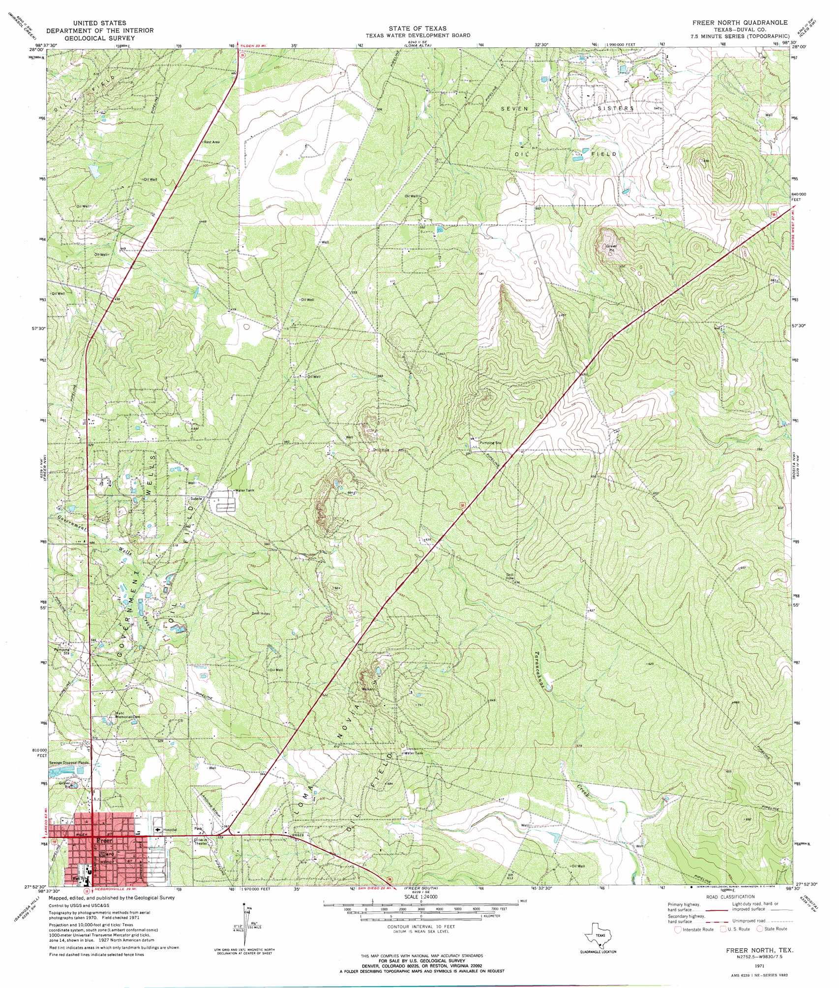
Freer North Topo Map Texas
To zoom in, hover over the map of Freer North
USGS Topo Quad 27098h5 - 1:24,000 scale
| Topo Map Name: | Freer North |
| USGS Topo Quad ID: | 27098h5 |
| Print Size: | ca. 21 1/4" wide x 27" high |
| Southeast Coordinates: | 27.875° N latitude / 98.5° W longitude |
| Map Center Coordinates: | 27.9375° N latitude / 98.5625° W longitude |
| U.S. State: | TX |
| Filename: | o27098h5.jpg |
| Download Map JPG Image: | Freer North topo map 1:24,000 scale |
| Map Type: | Topographic |
| Topo Series: | 7.5´ |
| Map Scale: | 1:24,000 |
| Source of Map Images: | United States Geological Survey (USGS) |
| Alternate Map Versions: |
Freer North TX 1971, updated 1974 Download PDF Buy paper map Freer North TX 2010 Download PDF Buy paper map Freer North TX 2013 Download PDF Buy paper map Freer North TX 2016 Download PDF Buy paper map |
1:24,000 Topo Quads surrounding Freer North
Piedra Creek Ne |
Loma Alta Nw |
Loma Alta Ne |
La Chusa Hill |
Clegg Ne |
Piedra Creek Se |
Mirasol Creek |
Loma Alta |
Clegg Sw |
Clegg |
Biel Lake Ne |
Freer Nw |
Freer North |
Rosita Nw |
Rosita Ne |
Biel Lake Se |
Sarnosa Hill |
Freer South |
Rosita |
Rosita Se |
Mills Bennett |
Parrilla Creek Nw |
Parrilla Creek Ne |
Benavides Nw |
Benavides Ne |
> Back to 27098e1 at 1:100,000 scale
> Back to 27098a1 at 1:250,000 scale
> Back to U.S. Topo Maps home
Freer North topo map: Gazetteer
Freer North: Airports
Duval-Freer Airport elevation 167m 547′Freer North: Populated Places
Coronado Perez Addition Colonia elevation 170m 557′East Pearson Street Colonia elevation 162m 531′
Freer elevation 158m 518′
School Heights Addition Number 2 Colonia elevation 166m 544′
Freer North digital topo map on disk
Buy this Freer North topo map showing relief, roads, GPS coordinates and other geographical features, as a high-resolution digital map file on DVD: