Callaghan Ranch North Topo Map Texas
To zoom in, hover over the map of Callaghan Ranch North
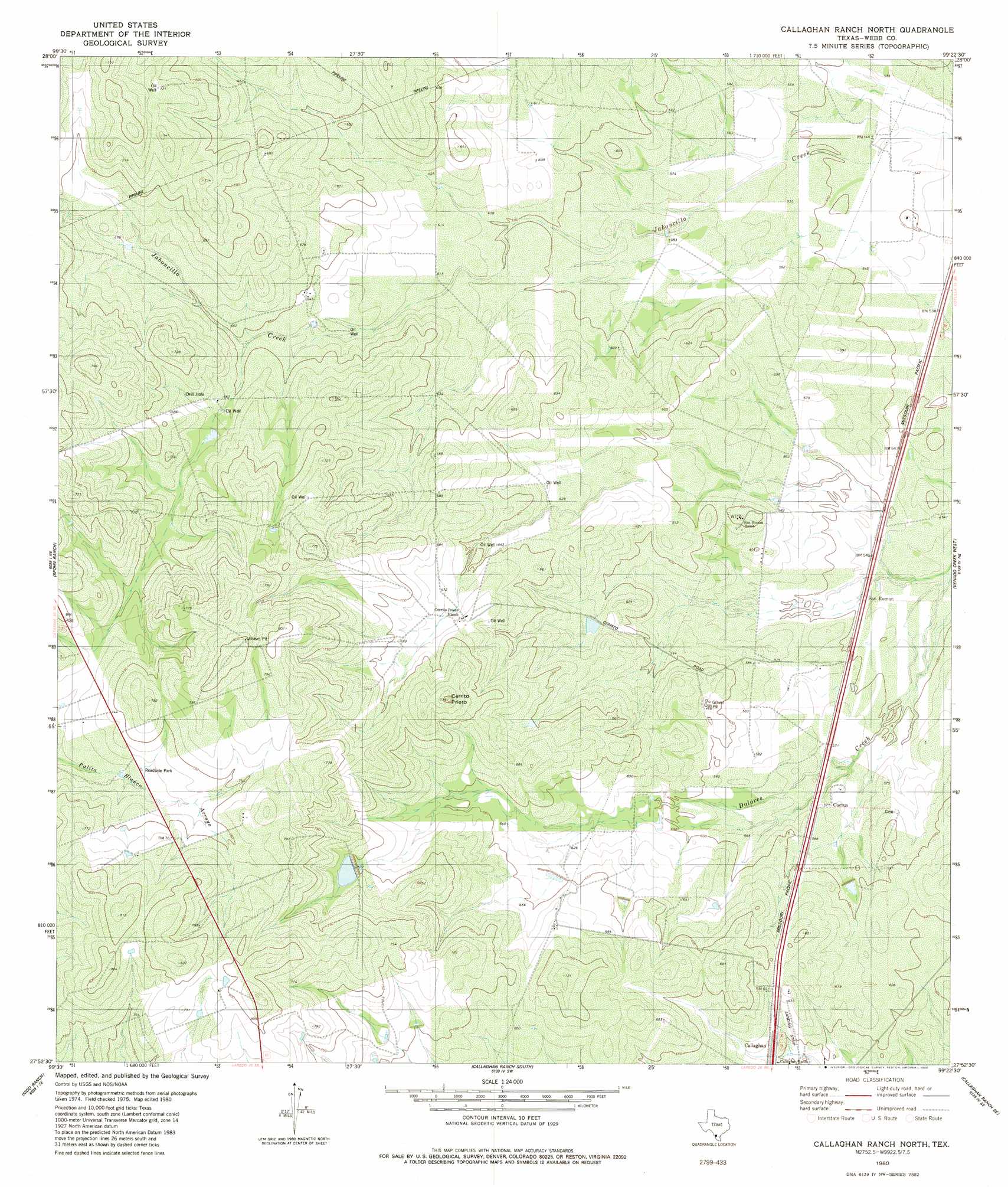
USGS Topo Quad 27099h4 - 1:24,000 scale
| Topo Map Name: | Callaghan Ranch North |
| USGS Topo Quad ID: | 27099h4 |
| Print Size: | ca. 21 1/4" wide x 27" high |
| Southeast Coordinates: | 27.875° N latitude / 99.375° W longitude |
| Map Center Coordinates: | 27.9375° N latitude / 99.4375° W longitude |
| U.S. State: | TX |
| Filename: | o27099h4.jpg |
| Download Map JPG Image: | Callaghan Ranch North topo map 1:24,000 scale |
| Map Type: | Topographic |
| Topo Series: | 7.5´ |
| Map Scale: | 1:24,000 |
| Source of Map Images: | United States Geological Survey (USGS) |
| Alternate Map Versions: |
Callaghan Ranch North TX 1980, updated 1980 Download PDF Buy paper map Callaghan Ranch North TX 2010 Download PDF Buy paper map Callaghan Ranch North TX 2013 Download PDF Buy paper map Callaghan Ranch North TX 2016 Download PDF Buy paper map |
1:24,000 Topo Quads surrounding Callaghan Ranch North
Velenzuela Creek |
Piloncillo Hill |
Mesteno Creek North |
Atlee |
Caiman Creek Nw |
Galvan Ranch |
Telephone Tanks |
Mesteno Creek South |
Encinal |
Live Oak Creek |
Las Tiendas |
Spohn Ranch |
Callaghan Ranch North |
Venado Creek West |
Venado Creek East |
Cerritos Blancos |
Nido Ranch |
Callaghan Ranch South |
Callaghan Ranch Se |
Pato Creek |
Dolores Ranch |
Cuervo Creek |
Orvil |
Cibolo Ranch |
Piedra Parada Tank |
> Back to 27099e1 at 1:100,000 scale
> Back to 27098a1 at 1:250,000 scale
> Back to U.S. Topo Maps home
Callaghan Ranch North topo map: Gazetteer
Callaghan Ranch North: Airports
Callaghan Ranch Airport elevation 187m 613′Lewis Ranch Airport elevation 164m 538′
Callaghan Ranch North: Dams
Hirsch Estate Lake Number 2 Dam elevation 212m 695′Swisher Lake Dam elevation 186m 610′
Callaghan Ranch North: Populated Places
Cactus elevation 178m 583′Callaghan elevation 186m 610′
Los Huisaches Colonia elevation 225m 738′
Los Huisaches Number 2 Colonia elevation 235m 770′
San Ramon elevation 165m 541′
Callaghan Ranch North: Reservoirs
Hirsch Estate Lake Number 2 elevation 212m 695′Swisher Lake elevation 186m 610′
Callaghan Ranch North: Summits
Cerrito Prieto elevation 233m 764′Callaghan Ranch North digital topo map on disk
Buy this Callaghan Ranch North topo map showing relief, roads, GPS coordinates and other geographical features, as a high-resolution digital map file on DVD: