Spohn Ranch Topo Map Texas
To zoom in, hover over the map of Spohn Ranch
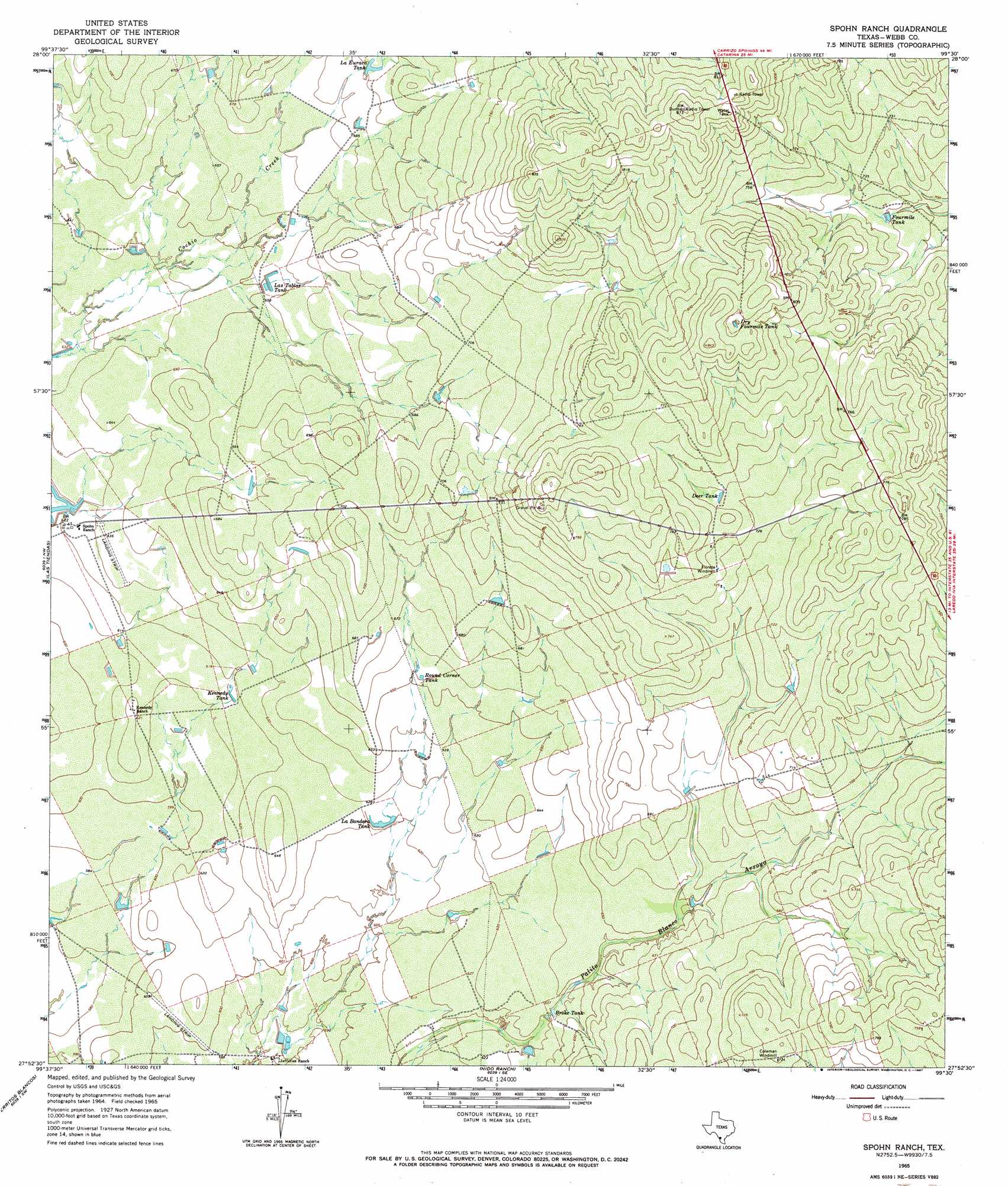
USGS Topo Quad 27099h5 - 1:24,000 scale
| Topo Map Name: | Spohn Ranch |
| USGS Topo Quad ID: | 27099h5 |
| Print Size: | ca. 21 1/4" wide x 27" high |
| Southeast Coordinates: | 27.875° N latitude / 99.5° W longitude |
| Map Center Coordinates: | 27.9375° N latitude / 99.5625° W longitude |
| U.S. State: | TX |
| Filename: | o27099h5.jpg |
| Download Map JPG Image: | Spohn Ranch topo map 1:24,000 scale |
| Map Type: | Topographic |
| Topo Series: | 7.5´ |
| Map Scale: | 1:24,000 |
| Source of Map Images: | United States Geological Survey (USGS) |
| Alternate Map Versions: |
Spohn Ranch TX 1965, updated 1967 Download PDF Buy paper map Spohn Ranch TX 2010 Download PDF Buy paper map Spohn Ranch TX 2013 Download PDF Buy paper map Spohn Ranch TX 2016 Download PDF Buy paper map |
1:24,000 Topo Quads surrounding Spohn Ranch
Landrum Tank |
Velenzuela Creek |
Piloncillo Hill |
Mesteno Creek North |
Atlee |
Dos Hermanos Peaks |
Galvan Ranch |
Telephone Tanks |
Mesteno Creek South |
Encinal |
Pinto Creek |
Las Tiendas |
Spohn Ranch |
Callaghan Ranch North |
Venado Creek West |
San Pedro Hill |
Cerritos Blancos |
Nido Ranch |
Callaghan Ranch South |
Callaghan Ranch Se |
Fort Mcintosh 3 Ne |
Dolores Ranch |
Cuervo Creek |
Orvil |
Cibolo Ranch |
> Back to 27099e1 at 1:100,000 scale
> Back to 27098a1 at 1:250,000 scale
> Back to U.S. Topo Maps home
Spohn Ranch topo map: Gazetteer
Spohn Ranch: Populated Places
La Moca Ranch Colonia elevation 216m 708′Spohn Ranch: Reservoirs
Broke Tank elevation 192m 629′Deer Tank elevation 225m 738′
Dry Fourmile Tank elevation 247m 810′
Fourmile Tank elevation 216m 708′
Kennedy Tank elevation 188m 616′
La Bandera Tank elevation 189m 620′
La Euraca Tank elevation 211m 692′
Las Tablas Tank elevation 201m 659′
Round Corner Tank elevation 199m 652′
Spohn Ranch digital topo map on disk
Buy this Spohn Ranch topo map showing relief, roads, GPS coordinates and other geographical features, as a high-resolution digital map file on DVD: