Las Tiendas Topo Map Texas
To zoom in, hover over the map of Las Tiendas
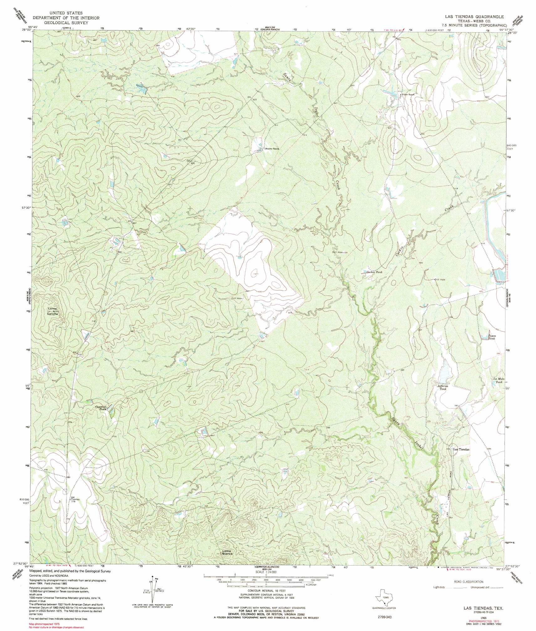
USGS Topo Quad 27099h6 - 1:24,000 scale
| Topo Map Name: | Las Tiendas |
| USGS Topo Quad ID: | 27099h6 |
| Print Size: | ca. 21 1/4" wide x 27" high |
| Southeast Coordinates: | 27.875° N latitude / 99.625° W longitude |
| Map Center Coordinates: | 27.9375° N latitude / 99.6875° W longitude |
| U.S. State: | TX |
| Filename: | o27099h6.jpg |
| Download Map JPG Image: | Las Tiendas topo map 1:24,000 scale |
| Map Type: | Topographic |
| Topo Series: | 7.5´ |
| Map Scale: | 1:24,000 |
| Source of Map Images: | United States Geological Survey (USGS) |
| Alternate Map Versions: |
Las Tiendas TX 1965, updated 1967 Download PDF Buy paper map Las Tiendas TX 1965, updated 1992 Download PDF Buy paper map Las Tiendas TX 2010 Download PDF Buy paper map Las Tiendas TX 2013 Download PDF Buy paper map Las Tiendas TX 2016 Download PDF Buy paper map |
1:24,000 Topo Quads surrounding Las Tiendas
East Losa Tank |
Landrum Tank |
Velenzuela Creek |
Piloncillo Hill |
Mesteno Creek North |
Tordillo Creek |
Dos Hermanos Peaks |
Galvan Ranch |
Telephone Tanks |
Mesteno Creek South |
Big Apache Hill |
Pinto Creek |
Las Tiendas |
Spohn Ranch |
Callaghan Ranch North |
Palafox Sw |
San Pedro Hill |
Cerritos Blancos |
Nido Ranch |
Callaghan Ranch South |
Fort Mcintosh 3 Ne |
Dolores Ranch |
Cuervo Creek |
Orvil |
> Back to 27099e1 at 1:100,000 scale
> Back to 27098a1 at 1:250,000 scale
> Back to U.S. Topo Maps home
Las Tiendas topo map: Gazetteer
Las Tiendas: Dams
Chupahueso Lake Number 1 Dam elevation 176m 577′Chupahueso Lake Number 2 Dam elevation 177m 580′
Spohn Ranch Lake Dam elevation 186m 610′
Las Tiendas: Populated Places
Las Tiendas elevation 185m 606′Las Tiendas: Reservoirs
Cascavel Tank elevation 213m 698′Chupahueso Lake Number 2 elevation 177m 580′
Cochio Tank elevation 183m 600′
Jefferies Tank elevation 177m 580′
La Mula Tank elevation 180m 590′
Spohn Ranch Lake elevation 186m 610′
Tapon Tank elevation 183m 600′
Las Tiendas: Streams
Cochio Creek elevation 177m 580′Las Tiendas: Summits
Loma Blanca elevation 229m 751′Loma Caliche elevation 241m 790′
Las Tiendas digital topo map on disk
Buy this Las Tiendas topo map showing relief, roads, GPS coordinates and other geographical features, as a high-resolution digital map file on DVD: