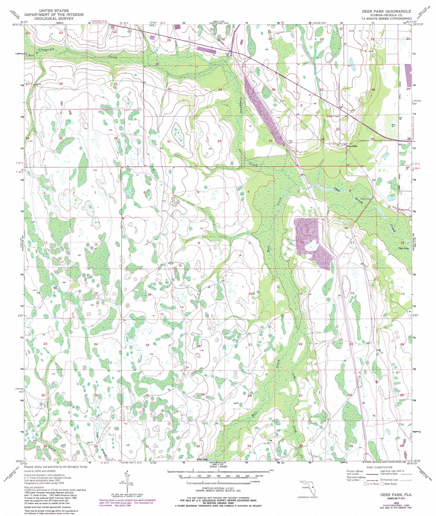
Deer Park Topo Map Florida
To zoom in, hover over the map of Deer Park
USGS Topo Quad 28080a8 - 1:24,000 scale
| Topo Map Name: | Deer Park |
| USGS Topo Quad ID: | 28080a8 |
| Print Size: | ca. 21 1/4" wide x 27" high |
| Southeast Coordinates: | 28° N latitude / 80.875° W longitude |
| Map Center Coordinates: | 28.0625° N latitude / 80.9375° W longitude |
| U.S. State: | FL |
| Filename: | O28080A8.jpg |
| Download Map JPG Image: | Deer Park topo map 1:24,000 scale |
| Map Type: | Topographic |
| Topo Series: | 7.5´ |
| Map Scale: | 1:24,000 |
| Source of Map Images: | United States Geological Survey (USGS) |
| Alternate Map Versions: |
Deer Park FL 1953, updated 1954 Download PDF Buy paper map Deer Park FL 1953, updated 1964 Download PDF Buy paper map Deer Park FL 1953, updated 1973 Download PDF Buy paper map Deer Park FL 1953, updated 1981 Download PDF Buy paper map Deer Park FL 1953, updated 1986 Download PDF Buy paper map Deer Park FL 2012 Download PDF Buy paper map Deer Park FL 2015 Download PDF Buy paper map |
1:24,000 Topo Quads surrounding Deer Park
Narcoossee |
Narcoossee Se |
Lake Poinsett Sw |
Lake Poinsett |
Cocoa |
Ashton |
Holopaw |
Deer Park Nw |
Deer Park Ne |
Eau Gallie |
Holopaw Sw |
Holopaw Se |
Deer Park |
Deer Park Se |
Melbourne West |
Lake Marian Nw |
Lake Marian Ne |
Kenansville |
Kenansville Ne |
Fellsmere Nw |
Lake Marian Sw |
Lake Marian Se |
Kenansville Sw |
Kenansville Se |
Fellsmere Sw |
> Back to 28080a1 at 1:100,000 scale
> Back to 28080a1 at 1:250,000 scale
> Back to U.S. Topo Maps home
Deer Park topo map: Gazetteer
Deer Park: Airports
Bruner Groves Airport elevation 12m 39′Deer Park: Lakes
Billy Lake elevation 9m 29′Deer Park: Parks
Bull Creek Wildlife Management Area elevation 13m 42′Deer Park: Populated Places
Deer Park elevation 13m 42′Deer Park: Streams
Bull Creek elevation 7m 22′Crabgrass Creek elevation 7m 22′
Little Creek elevation 7m 22′
West Branch Crabgrass Creek elevation 11m 36′
Deer Park digital topo map on disk
Buy this Deer Park topo map showing relief, roads, GPS coordinates and other geographical features, as a high-resolution digital map file on DVD: