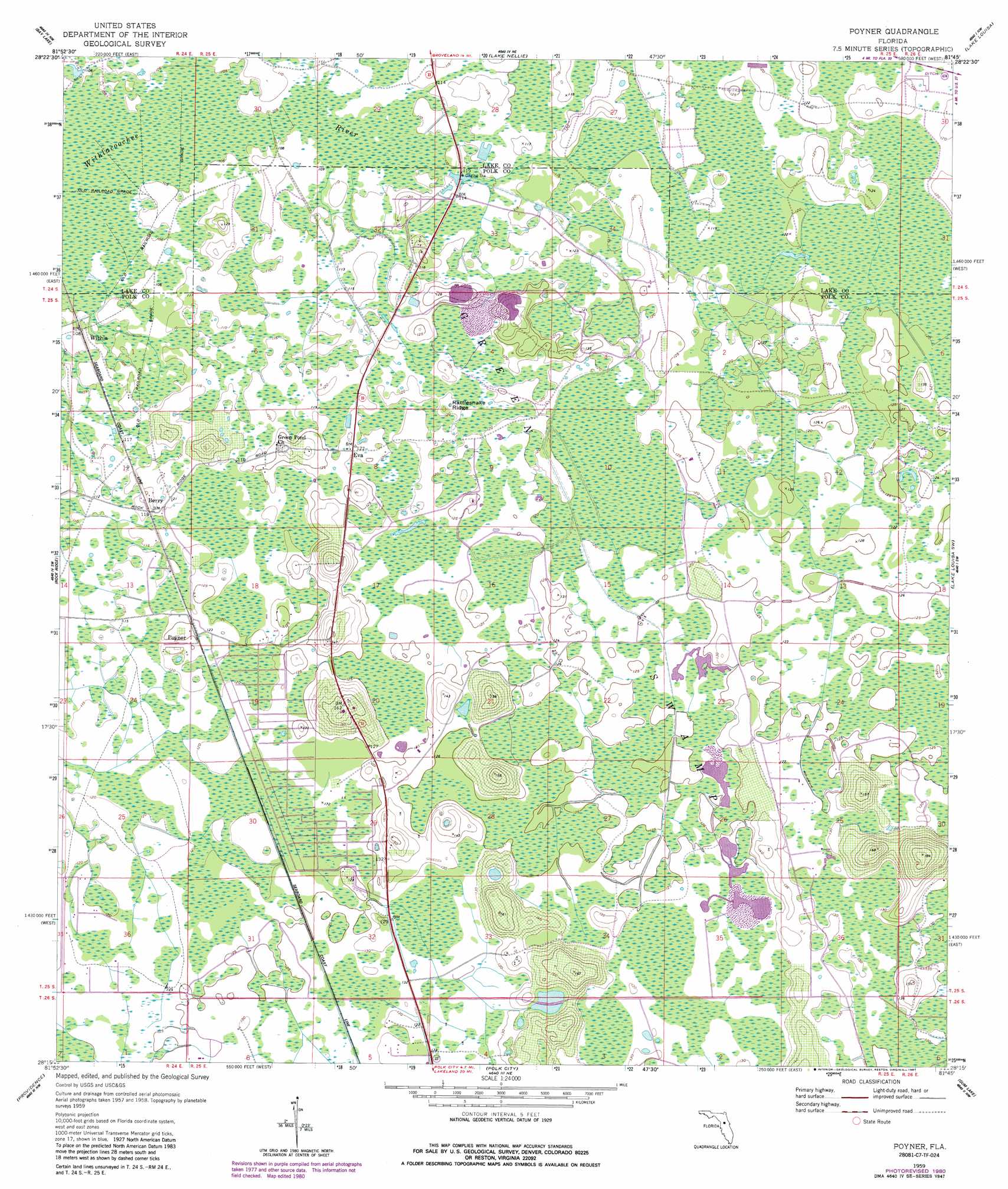
Poyner Topo Map Florida
To zoom in, hover over the map of Poyner
USGS Topo Quad 28081c7 - 1:24,000 scale
| Topo Map Name: | Poyner |
| USGS Topo Quad ID: | 28081c7 |
| Print Size: | ca. 21 1/4" wide x 27" high |
| Southeast Coordinates: | 28.25° N latitude / 81.75° W longitude |
| Map Center Coordinates: | 28.3125° N latitude / 81.8125° W longitude |
| U.S. State: | FL |
| Filename: | O28081C7.jpg |
| Download Map JPG Image: | Poyner topo map 1:24,000 scale |
| Map Type: | Topographic |
| Topo Series: | 7.5´ |
| Map Scale: | 1:24,000 |
| Source of Map Images: | United States Geological Survey (USGS) |
| Alternate Map Versions: |
Poyner FL 1959, updated 1960 Download PDF Buy paper map Poyner FL 1959, updated 1972 Download PDF Buy paper map Poyner FL 1959, updated 1981 Download PDF Buy paper map Poyner FL 1959, updated 1987 Download PDF Buy paper map Poyner FL 2012 Download PDF Buy paper map Poyner FL 2015 Download PDF Buy paper map |
1:24,000 Topo Quads surrounding Poyner
Webster |
Mascotte |
Clermont West |
Clermont East |
Winter Garden |
Clay Sink |
Bay Lake |
Lake Nellie |
Lake Louisa |
Windermere |
Branchborough |
Rock Ridge |
Poyner |
Lake Louisa Sw |
Intercession City |
Socrum |
Providence |
Polk City |
Gum Lake |
Davenport |
Plant City East |
Lakeland |
Auburndale |
Winter Haven |
Dundee |
> Back to 28081a1 at 1:100,000 scale
> Back to 28080a1 at 1:250,000 scale
> Back to U.S. Topo Maps home
Poyner topo map: Gazetteer
Poyner: Airports
Paradise Ultralight Airpark elevation 35m 114′Poyner: Populated Places
Berry elevation 36m 118′Eva elevation 36m 118′
Poyner elevation 38m 124′
Withla elevation 32m 104′
Poyner: Ridges
Rattlesnake Ridge elevation 37m 121′Poyner digital topo map on disk
Buy this Poyner topo map showing relief, roads, GPS coordinates and other geographical features, as a high-resolution digital map file on DVD: