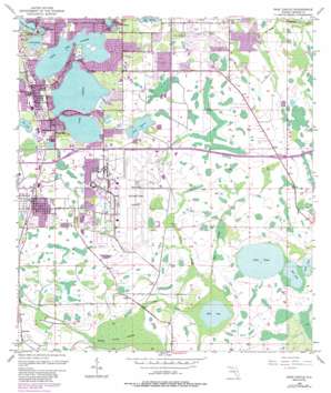
Pine Castle Topo Map Florida
To zoom in, hover over the map of Pine Castle
USGS Topo Quad 28081d3 - 1:24,000 scale
| Topo Map Name: | Pine Castle |
| USGS Topo Quad ID: | 28081d3 |
| Print Size: | ca. 21 1/4" wide x 27" high |
| Southeast Coordinates: | 28.375° N latitude / 81.25° W longitude |
| Map Center Coordinates: | 28.4375° N latitude / 81.3125° W longitude |
| U.S. State: | FL |
| Filename: | O28081D3.jpg |
| Download Map JPG Image: | Pine Castle topo map 1:24,000 scale |
| Map Type: | Topographic |
| Topo Series: | 7.5´ |
| Map Scale: | 1:24,000 |
| Source of Map Images: | United States Geological Survey (USGS) |
| Alternate Map Versions: |
Pine Castle FL 1953, updated 1955 Download PDF Buy paper map Pine Castle FL 1953, updated 1964 Download PDF Buy paper map Pine Castle FL 1953, updated 1972 Download PDF Buy paper map Pine Castle FL 1953, updated 1981 Download PDF Buy paper map Pine Castle FL 1953, updated 1987 Download PDF Buy paper map Pine Castle FL 1953, updated 1987 Download PDF Buy paper map Pine Castle FL 2012 Download PDF Buy paper map Pine Castle FL 2015 Download PDF Buy paper map |
1:24,000 Topo Quads surrounding Pine Castle
> Back to 28081a1 at 1:100,000 scale
> Back to 28080a1 at 1:250,000 scale
> Back to U.S. Topo Maps home
Pine Castle topo map: Gazetteer
Pine Castle: Airports
Lake Conway North Seaplane Base elevation 26m 85′Orlando International Airport elevation 24m 78′
Pine Castle: Guts
Bull Slough elevation 23m 75′Mare Prairie elevation 24m 78′
Pine Castle: Islands
Oak Island elevation 26m 85′Pine Castle: Lakes
Bay Lake elevation 28m 91′Bear Head Lake elevation 28m 91′
Lake Anderson elevation 25m 82′
Lake Conway elevation 26m 85′
Lake Gatlin elevation 26m 85′
Lake Gem Mary elevation 33m 108′
Lake Inwood elevation 26m 85′
Lake Jennie Jewel elevation 27m 88′
Lake Nona elevation 23m 75′
Lake Warren elevation 25m 82′
Little Lake Conway elevation 26m 85′
Mud Lake elevation 21m 68′
Red Lake elevation 23m 75′
Pine Castle: Populated Places
Bali Hai Mobile Village elevation 29m 95′Belle Isle elevation 29m 95′
Belle Isle Oaks Mobile Home Park elevation 27m 88′
Canal Addition (historical) elevation 28m 91′
Carriage Court East Mobile Home Park elevation 27m 88′
Charlin Heights Mobile Home Park elevation 28m 91′
Conway Circle Mobile Home Park elevation 28m 91′
Edgewood elevation 29m 95′
Flamingo elevation 26m 85′
Golden Acres Trailer Park elevation 28m 91′
Lake Conway Park (historical) elevation 27m 88′
Mai Tai Village Mobile Home Park elevation 27m 88′
Meadow Woods elevation 23m 75′
Nela Isle Annex (historical) elevation 27m 88′
Pine Castle elevation 30m 98′
South Lake Conway Villa elevation 27m 88′
Starlight Ranch Mobile Home Estates elevation 29m 95′
Taft elevation 29m 95′
Pine Castle: Post Offices
Lee Vista Post Office elevation 27m 88′Pine Castle Post Office elevation 29m 95′
Pine Castle: Swamps
Boggy Creek Swamp elevation 21m 68′Pine Castle digital topo map on disk
Buy this Pine Castle topo map showing relief, roads, GPS coordinates and other geographical features, as a high-resolution digital map file on DVD:


