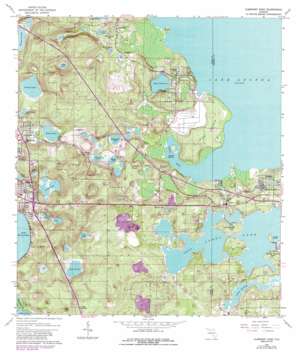
Clermont East Topo Map Florida
To zoom in, hover over the map of Clermont East
USGS Topo Quad 28081e6 - 1:24,000 scale
| Topo Map Name: | Clermont East |
| USGS Topo Quad ID: | 28081e6 |
| Print Size: | ca. 21 1/4" wide x 27" high |
| Southeast Coordinates: | 28.5° N latitude / 81.625° W longitude |
| Map Center Coordinates: | 28.5625° N latitude / 81.6875° W longitude |
| U.S. State: | FL |
| Filename: | O28081E6.jpg |
| Download Map JPG Image: | Clermont East topo map 1:24,000 scale |
| Map Type: | Topographic |
| Topo Series: | 7.5´ |
| Map Scale: | 1:24,000 |
| Source of Map Images: | United States Geological Survey (USGS) |
| Alternate Map Versions: |
Clermont East FL 1962, updated 1964 Download PDF Buy paper map Clermont East FL 1962, updated 1972 Download PDF Buy paper map Clermont East FL 1962, updated 1981 Download PDF Buy paper map Clermont East FL 1962, updated 1987 Download PDF Buy paper map Clermont East FL 2012 Download PDF Buy paper map Clermont East FL 2015 Download PDF Buy paper map |
1:24,000 Topo Quads surrounding Clermont East
> Back to 28081e1 at 1:100,000 scale
> Back to 28080a1 at 1:250,000 scale
> Back to U.S. Topo Maps home
Clermont East topo map: Gazetteer
Clermont East: Bays
Gourd Neck elevation 20m 65′Clermont East: Islands
Deer Island elevation 31m 101′Hull Island elevation 22m 72′
Pine Island elevation 29m 95′
Smiths Island elevation 23m 75′
Turkey Island elevation 30m 98′
Clermont East: Lakes
Big Breedlove Lake elevation 23m 75′Blacks Lake elevation 24m 78′
Blacks Still Lake elevation 24m 78′
Camp Lake elevation 25m 82′
Clarence Lake elevation 24m 78′
East Lake elevation 27m 88′
Grassy Lake elevation 25m 82′
Jacks Lake elevation 25m 82′
Johns Lake elevation 28m 91′
Jones Lake elevation 24m 78′
Lake Apopka elevation 20m 65′
Lake Avalon elevation 28m 91′
Lake Charles elevation 26m 85′
Lake Felter elevation 26m 85′
Lake Florence elevation 22m 72′
Little Grassy Lake elevation 25m 82′
Lost Lake elevation 25m 82′
Mud Bottom Lake elevation 24m 78′
Plum Lake elevation 25m 82′
Sawgrass Pond elevation 21m 68′
Teardrop Lake elevation 25m 82′
Wilma Lake elevation 25m 82′
Clermont East: Parks
East Ridge High School Football Stadium elevation 38m 124′Hancock Recreation Area elevation 79m 259′
William McKinley Park elevation 62m 203′
Clermont East: Populated Places
Castle Hill elevation 53m 173′Ferndale elevation 31m 101′
Hickory Heights Trailer Park elevation 26m 85′
Killarney elevation 40m 131′
Killarney Mobile Home Park elevation 25m 82′
Minnehaha Trailer Park elevation 36m 118′
Minneola elevation 30m 98′
Minneola Court Mobile Home Park elevation 36m 118′
Mohawk elevation 43m 141′
Montverde elevation 33m 108′
Montverde Junction elevation 44m 144′
Oakland elevation 37m 121′
Orange Mountain elevation 52m 170′
Reavills Corner elevation 41m 134′
Roan elevation 24m 78′
Skytop elevation 30m 98′
South Shore Mobile Home Park elevation 25m 82′
Waits Junction elevation 28m 91′
Clermont East: Post Offices
Ferndale Post Office elevation 29m 95′Minneola Post Office elevation 36m 118′
Montverde Post Office elevation 32m 104′
Oakland Florida Post Office elevation 37m 121′
Oakland Post Office elevation 36m 118′
Clermont East: Reservoirs
Lake Siena elevation 20m 65′Clermont East: Springs
Apopka Springs elevation 20m 65′Clermont East digital topo map on disk
Buy this Clermont East topo map showing relief, roads, GPS coordinates and other geographical features, as a high-resolution digital map file on DVD:


