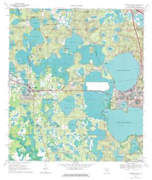
Clermont West Topo Map Florida
To zoom in, hover over the map of Clermont West
USGS Topo Quad 28081e7 - 1:24,000 scale
| Topo Map Name: | Clermont West |
| USGS Topo Quad ID: | 28081e7 |
| Print Size: | ca. 21 1/4" wide x 27" high |
| Southeast Coordinates: | 28.5° N latitude / 81.75° W longitude |
| Map Center Coordinates: | 28.5625° N latitude / 81.8125° W longitude |
| U.S. State: | FL |
| Filename: | O28081E7.jpg |
| Download Map JPG Image: | Clermont West topo map 1:24,000 scale |
| Map Type: | Topographic |
| Topo Series: | 7.5´ |
| Map Scale: | 1:24,000 |
| Source of Map Images: | United States Geological Survey (USGS) |
| Alternate Map Versions: |
Clermont West FL 1969, updated 1971 Download PDF Buy paper map Clermont West FL 1969, updated 1977 Download PDF Buy paper map Clermont West FL 2012 Download PDF Buy paper map Clermont West FL 2015 Download PDF Buy paper map |
1:24,000 Topo Quads surrounding Clermont West
> Back to 28081e1 at 1:100,000 scale
> Back to 28080a1 at 1:250,000 scale
> Back to U.S. Topo Maps home
Clermont West topo map: Gazetteer
Clermont West: Airports
Klinger Aero Airport elevation 33m 108′Sheets Airport elevation 33m 108′
Clermont West: Bays
Crystal Cove elevation 29m 95′Cypress Cove elevation 29m 95′
Clermont West: Capes
Hooks Point elevation 31m 101′Clermont West: Islands
Bryant Island elevation 30m 98′Edges Island elevation 31m 101′
Hunt Island elevation 33m 108′
Wilson Island elevation 40m 131′
Clermont West: Lakes
Apshawa Lake elevation 25m 82′Big Bear Lake elevation 31m 101′
Black Lake elevation 31m 101′
Center Lake elevation 27m 88′
Cherry Lake elevation 29m 95′
Clear Lake elevation 26m 85′
Cook Lake elevation 29m 95′
Crescent Lake elevation 29m 95′
Crystal Lake elevation 28m 91′
Deacon Lake elevation 25m 82′
Dukes Lake elevation 30m 98′
Edgewood Lake elevation 25m 82′
Indianhouse Lake elevation 25m 82′
Lake Audrey elevation 33m 108′
Lake Catherine elevation 29m 95′
Lake David elevation 30m 98′
Lake Desire elevation 29m 95′
Lake Dot elevation 28m 91′
Lake Douglas elevation 29m 95′
Lake Emma elevation 28m 91′
Lake Hiawatha elevation 29m 95′
Lake Lucy elevation 28m 91′
Lake Minnehaha elevation 29m 95′
Lake Minneola elevation 29m 95′
Lake Palatlakaha elevation 29m 95′
Lake Spencer elevation 25m 82′
Lake Sunnyside elevation 27m 88′
Lake Susan elevation 29m 95′
Lake Wash elevation 30m 98′
Lake Winona elevation 29m 95′
Little Bear Lake elevation 31m 101′
Long Lake elevation 28m 91′
Middle Bear Lake elevation 31m 101′
Olsen Lake elevation 29m 95′
Ralph Lake elevation 30m 98′
Sams Lake elevation 25m 82′
Schoolhouse Lake elevation 25m 82′
Shady Nook Lake elevation 27m 88′
Shepherd Lake elevation 25m 82′
Sparkling Water Lake elevation 29m 95′
Spring Lake elevation 28m 91′
Spring Lake elevation 26m 85′
Stewart Lake elevation 29m 95′
Sumner Lake elevation 29m 95′
Sunset Lake elevation 30m 98′
West Lake elevation 29m 95′
Wilson Lake elevation 29m 95′
Clermont West: Parks
Clarence Bishop Memorial Field elevation 48m 157′Emmauel Camp elevation 35m 114′
Lake David Park elevation 31m 101′
Palatlakaha Recreation Area elevation 41m 134′
South Lake High School Stadium elevation 34m 111′
Clermont West: Populated Places
Clermont elevation 43m 141′Emerald Lakes Mobile Village elevation 29m 95′
Groveland elevation 31m 101′
Highlands Mobile Home Park elevation 62m 203′
Jones Cypress Cove Resort Mobile Home Park elevation 31m 101′
Oak Lane Mobile Home Park elevation 30m 98′
Timber Village Mobile Home Park elevation 31m 101′
Clermont West: Post Offices
Clermont Post Office elevation 40m 131′Groveland Post Office elevation 31m 101′
Clermont West: Swamps
Mill Stream Swamp elevation 32m 104′Clermont West digital topo map on disk
Buy this Clermont West topo map showing relief, roads, GPS coordinates and other geographical features, as a high-resolution digital map file on DVD:


