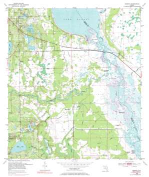
Geneva Topo Map Florida
To zoom in, hover over the map of Geneva
USGS Topo Quad 28081f1 - 1:24,000 scale
| Topo Map Name: | Geneva |
| USGS Topo Quad ID: | 28081f1 |
| Print Size: | ca. 21 1/4" wide x 27" high |
| Southeast Coordinates: | 28.625° N latitude / 81° W longitude |
| Map Center Coordinates: | 28.6875° N latitude / 81.0625° W longitude |
| U.S. State: | FL |
| Filename: | O28081F1.jpg |
| Download Map JPG Image: | Geneva topo map 1:24,000 scale |
| Map Type: | Topographic |
| Topo Series: | 7.5´ |
| Map Scale: | 1:24,000 |
| Source of Map Images: | United States Geological Survey (USGS) |
| Alternate Map Versions: |
Geneva FL 1953, updated 1955 Download PDF Buy paper map Geneva FL 1953, updated 1965 Download PDF Buy paper map Geneva FL 1953, updated 1972 Download PDF Buy paper map Geneva FL 1953, updated 1985 Download PDF Buy paper map Geneva FL 1953, updated 1985 Download PDF Buy paper map Geneva FL 2012 Download PDF Buy paper map Geneva FL 2015 Download PDF Buy paper map |
1:24,000 Topo Quads surrounding Geneva
> Back to 28081e1 at 1:100,000 scale
> Back to 28080a1 at 1:250,000 scale
> Back to U.S. Topo Maps home
Geneva topo map: Gazetteer
Geneva: Airports
Big Oaks Ranch Airport elevation 7m 22′Southerland Strip elevation 3m 9′
Geneva: Bays
Raulerson Cove elevation 0m 0′Geneva: Guts
Gopher Slough elevation 0m 0′Jordan Slough elevation 0m 0′
Geneva: Islands
Cow Island elevation 2m 6′Geneva: Lakes
Lake Geneva elevation 8m 26′Lake Gore elevation 12m 39′
Lake Proctor elevation 9m 29′
Long Lake elevation 8m 26′
Mill Lake elevation 12m 39′
Moran Lake elevation 8m 26′
Puzzle Lake elevation 0m 0′
Still Lake elevation 9m 29′
Taylor Lake elevation 8m 26′
Geneva: Populated Places
Buda elevation 15m 49′Chuluota elevation 18m 59′
Geneva elevation 19m 62′
Snow Hill elevation 13m 42′
Geneva: Post Offices
Geneva Post Office elevation 21m 68′Geneva: Streams
Big Run elevation 1m 3′Econlockhatchee River elevation 0m 0′
Futch Run elevation 1m 3′
Jackson Creek elevation 2m 6′
Little Run elevation 0m 0′
Mills Branch elevation 12m 39′
Mills Creek elevation 1m 3′
Roberts Branch elevation 1m 3′
Silcox Branch elevation 11m 36′
Turkey Creek elevation 1m 3′
Geneva: Summits
Buck Point Mound elevation 3m 9′Buzzard Roost elevation 2m 6′
Heiffer Mound elevation 2m 6′
Moccasin Mound elevation 3m 9′
Noah Mound elevation 1m 3′
Palmer-Taylor Mound elevation 2m 6′
Saddle Mound elevation 3m 9′
Geneva digital topo map on disk
Buy this Geneva topo map showing relief, roads, GPS coordinates and other geographical features, as a high-resolution digital map file on DVD:


