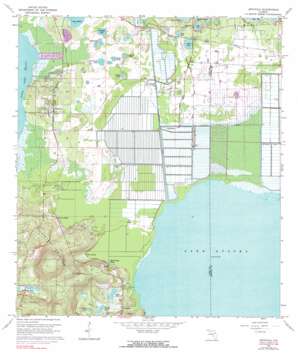
Astatula Topo Map Florida
To zoom in, hover over the map of Astatula
USGS Topo Quad 28081f6 - 1:24,000 scale
| Topo Map Name: | Astatula |
| USGS Topo Quad ID: | 28081f6 |
| Print Size: | ca. 21 1/4" wide x 27" high |
| Southeast Coordinates: | 28.625° N latitude / 81.625° W longitude |
| Map Center Coordinates: | 28.6875° N latitude / 81.6875° W longitude |
| U.S. State: | FL |
| Filename: | O28081F6.jpg |
| Download Map JPG Image: | Astatula topo map 1:24,000 scale |
| Map Type: | Topographic |
| Topo Series: | 7.5´ |
| Map Scale: | 1:24,000 |
| Source of Map Images: | United States Geological Survey (USGS) |
| Alternate Map Versions: |
Astatula FL 1962, updated 1964 Download PDF Buy paper map Astatula FL 1962, updated 1972 Download PDF Buy paper map Astatula FL 1962, updated 1983 Download PDF Buy paper map Astatula FL 1962, updated 1983 Download PDF Buy paper map Astatula FL 2012 Download PDF Buy paper map Astatula FL 2015 Download PDF Buy paper map |
1:24,000 Topo Quads surrounding Astatula
> Back to 28081e1 at 1:100,000 scale
> Back to 28080a1 at 1:250,000 scale
> Back to U.S. Topo Maps home
Astatula topo map: Gazetteer
Astatula: Airports
Bob White Field elevation 23m 75′Clay Island Airstrip (historical) elevation 21m 68′
Henderson Field (historical) elevation 27m 88′
Long and Scott Farms Airport elevation 23m 75′
Orlando North Air Park elevation 24m 78′
Zellwin Farms Airport (historical) elevation 21m 68′
Astatula: Canals
Apopka Beauclair Canal elevation 20m 65′McDonald Canal elevation 20m 65′
Astatula: Dams
Lake Apopka Lock and Dam elevation 21m 68′Astatula: Lakes
Birdeye Lake elevation 20m 65′Birdseye Lake elevation 20m 65′
Dague Lake elevation 22m 72′
Daque Lake elevation 22m 72′
Gizzard Lake elevation 27m 88′
Horseshoe Lake elevation 18m 59′
Horseshoe Lake elevation 25m 82′
King Lake elevation 23m 75′
Lake Bell elevation 20m 65′
Lake Jem elevation 20m 65′
Lake Lena elevation 22m 72′
Lake Merritt elevation 23m 75′
Meeks Lake elevation 24m 78′
Pretty Lake elevation 26m 85′
Saddle Bag Lake elevation 21m 68′
Summerall Lake elevation 23m 75′
Wolfs Head Lake elevation 21m 68′
Astatula: Parks
Lake Jem Park & Boat Ramp elevation 21m 68′Astatula: Populated Places
Astatula elevation 29m 95′Clay Island elevation 21m 68′
Hide - a - Way Harbor Mobile Home Park elevation 22m 72′
Howey Height elevation 29m 95′
Lake Jem elevation 26m 85′
Astatula: Post Offices
Astatula Post Office elevation 25m 82′Astatula: Springs
Bear Spring elevation 22m 72′Astatula: Summits
Sugarloaf Mountain elevation 94m 308′Astatula digital topo map on disk
Buy this Astatula topo map showing relief, roads, GPS coordinates and other geographical features, as a high-resolution digital map file on DVD:


