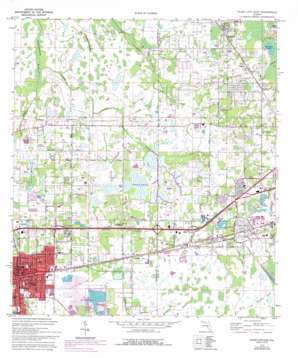
Plant City East Topo Map Florida
To zoom in, hover over the map of Plant City East
USGS Topo Quad 28082a1 - 1:24,000 scale
| Topo Map Name: | Plant City East |
| USGS Topo Quad ID: | 28082a1 |
| Print Size: | ca. 21 1/4" wide x 27" high |
| Southeast Coordinates: | 28° N latitude / 82° W longitude |
| Map Center Coordinates: | 28.0625° N latitude / 82.0625° W longitude |
| U.S. State: | FL |
| Filename: | O28082A1.jpg |
| Download Map JPG Image: | Plant City East topo map 1:24,000 scale |
| Map Type: | Topographic |
| Topo Series: | 7.5´ |
| Map Scale: | 1:24,000 |
| Source of Map Images: | United States Geological Survey (USGS) |
| Alternate Map Versions: |
Plant City FL 1944, updated 1963 Download PDF Buy paper map Plant City East FL 1975, updated 1977 Download PDF Buy paper map Plant City East FL 1975, updated 1987 Download PDF Buy paper map Plant City East FL 1975, updated 1993 Download PDF Buy paper map Plant City East FL 1994, updated 2000 Download PDF Buy paper map Plant City East FL 2012 Download PDF Buy paper map Plant City East FL 2015 Download PDF Buy paper map |
1:24,000 Topo Quads surrounding Plant City East
> Back to 28082a1 at 1:100,000 scale
> Back to 28082a1 at 1:250,000 scale
> Back to U.S. Topo Maps home
Plant City East topo map: Gazetteer
Plant City East: Canals
East Canal elevation 31m 101′Plant City East: Crossings
Interchange 22 elevation 38m 124′Interchange 25 elevation 37m 121′
Interchange 27 elevation 39m 127′
Interchange 28 elevation 41m 134′
Plant City East: Lakes
Lake Galloway elevation 38m 124′Lake Winston elevation 41m 134′
Plant City East: Parks
Ellis Park elevation 38m 124′Gilchrist Park elevation 36m 118′
Sansone Community Park elevation 40m 131′
Plant City East: Populated Places
Alabama elevation 38m 124′Apache Trace elevation 45m 147′
Barlee elevation 39m 127′
Bell Ringer Mobile Home Park elevation 39m 127′
Bella Vista Mobile Home Park elevation 39m 127′
Big Water elevation 43m 141′
Blackwater elevation 34m 111′
Bracewell Heights elevation 36m 118′
Brenmar Acres elevation 46m 150′
Briarwood Estates Mobile Home Community elevation 33m 108′
Bristol Park elevation 41m 134′
Brookers Mobile Home Court elevation 43m 141′
Cameron Acres elevation 37m 121′
Camp T F Addition elevation 42m 137′
Cato elevation 32m 104′
Cauleys Mobile Home Park elevation 41m 134′
Chapmans Mobile Home Park elevation 40m 131′
Cherry Park elevation 39m 127′
Clifford Ham elevation 41m 134′
Collins Park elevation 41m 134′
Colonial Village elevation 41m 134′
Colonial Woods elevation 39m 127′
Country Aire elevation 32m 104′
Country Oak Park elevation 43m 141′
Country Villa Mobile Home Court elevation 46m 150′
Daily elevation 38m 124′
Deer Creek Hollow elevation 30m 98′
Dell Oaks elevation 45m 147′
Dorene Terrace elevation 40m 131′
Drew elevation 42m 137′
East Side elevation 40m 131′
Elim Mobile Home Park elevation 38m 124′
Ernest Hansen Estate elevation 42m 137′
Evergreen Mobile Home Park elevation 42m 137′
Four Bar Estates elevation 38m 124′
Four Seasons elevation 37m 121′
Futch Acres elevation 41m 134′
Futch Place elevation 41m 134′
Galloway elevation 42m 137′
Gibson Terrace elevation 39m 127′
Gilbertsen Acres elevation 33m 108′
Gilchrist elevation 37m 121′
Gilchrist Heights elevation 36m 118′
Glendale elevation 41m 134′
Gordon Oaks elevation 38m 124′
Haggard elevation 38m 124′
Ham Oaks elevation 32m 104′
Hibiscus Gardens Mobile Home Park elevation 40m 131′
Hill Crest elevation 41m 134′
Hobby elevation 41m 134′
Holiday Mobile Home Park elevation 41m 134′
Illinois Trailer Park elevation 40m 131′
Jones Colony Acres elevation 43m 141′
Kathleen elevation 44m 144′
Kings Village elevation 42m 137′
Lakeland Gardens Mobile Home Park elevation 40m 131′
Lee Villa elevation 42m 137′
Lincoln Park elevation 39m 127′
Lincoln Park East elevation 40m 131′
Lincoln Park Heights elevation 41m 134′
Lincoln Park South elevation 39m 127′
Marshall Heights elevation 42m 137′
Marshall Terrace elevation 42m 137′
Martins Acres elevation 32m 104′
Maxwell Acres elevation 40m 131′
Mayday Oaks elevation 43m 141′
McDavid Terrace elevation 37m 121′
Meadowbrook Mobile Home Park elevation 40m 131′
Midway elevation 34m 111′
Midway Acres elevation 38m 124′
Midway Gardens elevation 44m 144′
Midway Groves elevation 41m 134′
Mimosa Park elevation 38m 124′
Mount Enon elevation 50m 164′
Mystic Oaks elevation 34m 111′
North Gibson Terrace elevation 38m 124′
Oak Dale elevation 41m 134′
Oakdale Mobile Home Park elevation 45m 147′
Oakmont Mobile Home Park elevation 40m 131′
Old Hickery elevation 31m 101′
Orange Crest elevation 43m 141′
Palm Heights elevation 41m 134′
Paradise Oaks elevation 31m 101′
Phillips Trail elevation 41m 134′
Pinehurst North elevation 39m 127′
Pineview elevation 40m 131′
Plant City elevation 39m 127′
Ramblin Oaks elevation 30m 98′
Roseland Park elevation 40m 131′
Rosemont elevation 41m 134′
Schneider elevation 40m 131′
Seminole Sand elevation 43m 141′
Shangri La Mobile Home Park elevation 41m 134′
Shannon Terrace elevation 36m 118′
Soggy Bottom Acres elevation 30m 98′
South Farmington elevation 42m 137′
Stalvey Oaks elevation 35m 114′
Strawberry Terrace South elevation 39m 127′
Sweats elevation 39m 127′
Swilley Acres elevation 30m 98′
Swindell Acres elevation 42m 137′
Swindell Road Mobile Home Park elevation 37m 121′
Terry Park elevation 41m 134′
Twin Palms Mobile Home Park elevation 40m 131′
Vilma Acres elevation 43m 141′
Vitelli Acres elevation 36m 118′
Washington Park elevation 38m 124′
Water Oak elevation 38m 124′
Westbrook elevation 40m 131′
Wiggins elevation 38m 124′
Wilder Oaks elevation 45m 147′
Wilder Park elevation 44m 144′
Wilder Reserve elevation 42m 137′
Wilder Trace elevation 45m 147′
Wilder Woods elevation 41m 134′
Wildes Pond elevation 36m 118′
Winston elevation 42m 137′
Wyatt Acres elevation 34m 111′
Youmans elevation 44m 144′
Plant City East: Swamps
Wiggins Prairie elevation 34m 111′Plant City East digital topo map on disk
Buy this Plant City East topo map showing relief, roads, GPS coordinates and other geographical features, as a high-resolution digital map file on DVD:


