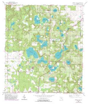
Spring Lake Topo Map Florida
To zoom in, hover over the map of Spring Lake
USGS Topo Quad 28082d3 - 1:24,000 scale
| Topo Map Name: | Spring Lake |
| USGS Topo Quad ID: | 28082d3 |
| Print Size: | ca. 21 1/4" wide x 27" high |
| Southeast Coordinates: | 28.375° N latitude / 82.25° W longitude |
| Map Center Coordinates: | 28.4375° N latitude / 82.3125° W longitude |
| U.S. State: | FL |
| Filename: | O28082D3.jpg |
| Download Map JPG Image: | Spring Lake topo map 1:24,000 scale |
| Map Type: | Topographic |
| Topo Series: | 7.5´ |
| Map Scale: | 1:24,000 |
| Source of Map Images: | United States Geological Survey (USGS) |
| Alternate Map Versions: |
Spring Lake FL 1954, updated 1955 Download PDF Buy paper map Spring Lake FL 1954, updated 1971 Download PDF Buy paper map Spring Lake FL 1954, updated 1981 Download PDF Buy paper map Spring Lake FL 1954, updated 1988 Download PDF Buy paper map Spring Lake FL 2012 Download PDF Buy paper map Spring Lake FL 2015 Download PDF Buy paper map |
1:24,000 Topo Quads surrounding Spring Lake
> Back to 28082a1 at 1:100,000 scale
> Back to 28082a1 at 1:250,000 scale
> Back to U.S. Topo Maps home
Spring Lake topo map: Gazetteer
Spring Lake: Lakes
Charlotte Pond elevation 31m 101′Dollar Pond elevation 26m 85′
Flag Pond elevation 26m 85′
Gold Lake elevation 26m 85′
Hancock Lake elevation 32m 104′
Harrison Lake elevation 28m 91′
Jessamine Lake elevation 43m 141′
Lake Iola elevation 45m 147′
Long Pond elevation 27m 88′
McClendon Lake elevation 33m 108′
Middle Lake elevation 32m 104′
Moody Lake elevation 32m 104′
Mountain Lake elevation 30m 98′
Mud Lake elevation 33m 108′
Neff Lake elevation 30m 98′
Nicks Lake elevation 34m 111′
Patsy Pond elevation 22m 72′
Robison Lake elevation 27m 88′
Saint Clair Lake elevation 34m 111′
Sea Pond elevation 25m 82′
Simmon Pond elevation 25m 82′
Sparkman Lake elevation 26m 85′
Spring Lake elevation 56m 183′
Zuke Pond elevation 27m 88′
Spring Lake: Populated Places
Chukuchatta (historical) elevation 56m 183′Dixie elevation 69m 226′
Jessamine elevation 70m 229′
Saint Joseph elevation 67m 219′
Spring Lake elevation 67m 219′
Spring Lake: Summits
Hickory Hill elevation 73m 239′Spring Lake digital topo map on disk
Buy this Spring Lake topo map showing relief, roads, GPS coordinates and other geographical features, as a high-resolution digital map file on DVD:


