Weeki Wachee Spring Topo Map Florida
To zoom in, hover over the map of Weeki Wachee Spring
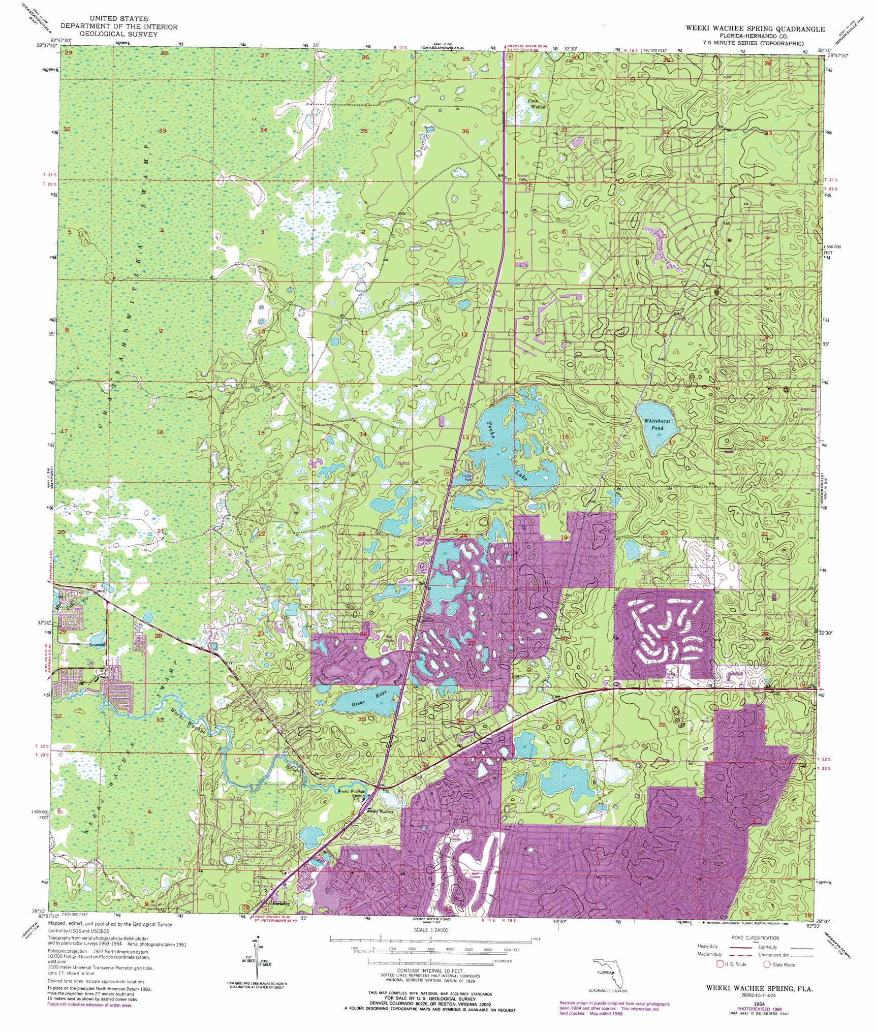
USGS Topo Quad 28082e5 - 1:24,000 scale
| Topo Map Name: | Weeki Wachee Spring |
| USGS Topo Quad ID: | 28082e5 |
| Print Size: | ca. 21 1/4" wide x 27" high |
| Southeast Coordinates: | 28.5° N latitude / 82.5° W longitude |
| Map Center Coordinates: | 28.5625° N latitude / 82.5625° W longitude |
| U.S. State: | FL |
| Filename: | O28082E5.jpg |
| Download Map JPG Image: | Weeki Wachee Spring topo map 1:24,000 scale |
| Map Type: | Topographic |
| Topo Series: | 7.5´ |
| Map Scale: | 1:24,000 |
| Source of Map Images: | United States Geological Survey (USGS) |
| Alternate Map Versions: |
Weekiwachee Springs FL 1954, updated 1955 Download PDF Buy paper map Weekiwachee Springs FL 1954, updated 1964 Download PDF Buy paper map Weeki Wachee Spring FL 1954, updated 1988 Download PDF Buy paper map Weeki Wachee Spring FL 2012 Download PDF Buy paper map Weeki Wachee Spring FL 2015 Download PDF Buy paper map |
1:24,000 Topo Quads surrounding Weeki Wachee Spring
Ozello |
Homosassa |
Lecanto |
Inverness |
|
Chassahowitzka Bay |
Chassahowitzka |
Brooksville Nw |
Nobelton |
|
Bayport |
Weeki Wachee Spring |
Brooksville |
Brooksville Se |
|
Aripeka |
Port Richey Ne |
Masaryktown |
Spring Lake |
|
Port Richey |
Fivay Junction |
Ehren |
San Antonio |
> Back to 28082e1 at 1:100,000 scale
> Back to 28082a1 at 1:250,000 scale
> Back to U.S. Topo Maps home
Weeki Wachee Spring topo map: Gazetteer
Weeki Wachee Spring: Lakes
Coon Wallow elevation 6m 19′Grear Hope Pond elevation 5m 16′
Tooke Lake elevation 6m 19′
Whitehurst Pond elevation 7m 22′
Weeki Wachee Spring: Populated Places
Berkeley elevation 9m 29′High Point elevation 18m 59′
Weeki Wachee elevation 10m 32′
Weeki Wachee Spring: Springs
Weeki Wachee Spring elevation 6m 19′Weeki Wachee Spring: Streams
Salt Creek elevation 2m 6′Weeki Wachee Spring: Swamps
Weeki Wachee Swamp elevation 2m 6′Weeki Wachee Spring digital topo map on disk
Buy this Weeki Wachee Spring topo map showing relief, roads, GPS coordinates and other geographical features, as a high-resolution digital map file on DVD: