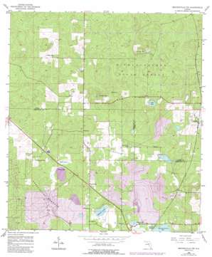
Brooksville Nw Topo Map Florida
To zoom in, hover over the map of Brooksville Nw
USGS Topo Quad 28082f4 - 1:24,000 scale
| Topo Map Name: | Brooksville Nw |
| USGS Topo Quad ID: | 28082f4 |
| Print Size: | ca. 21 1/4" wide x 27" high |
| Southeast Coordinates: | 28.625° N latitude / 82.375° W longitude |
| Map Center Coordinates: | 28.6875° N latitude / 82.4375° W longitude |
| U.S. State: | FL |
| Filename: | O28082F4.jpg |
| Download Map JPG Image: | Brooksville Nw topo map 1:24,000 scale |
| Map Type: | Topographic |
| Topo Series: | 7.5´ |
| Map Scale: | 1:24,000 |
| Source of Map Images: | United States Geological Survey (USGS) |
| Alternate Map Versions: |
Brooksville NW FL 1954, updated 1955 Download PDF Buy paper map Brooksville NW FL 1954, updated 1964 Download PDF Buy paper map Brooksville NW FL 1954, updated 1984 Download PDF Buy paper map Brooksville NW FL 1954, updated 1988 Download PDF Buy paper map Brooksville NW FL 2012 Download PDF Buy paper map Brooksville NW FL 2015 Download PDF Buy paper map |
1:24,000 Topo Quads surrounding Brooksville Nw
> Back to 28082e1 at 1:100,000 scale
> Back to 28082a1 at 1:250,000 scale
> Back to U.S. Topo Maps home
Brooksville Nw topo map: Gazetteer
Brooksville Nw: Airports
Ringhaver Heliport elevation 29m 95′Brooksville Nw: Basins
Brush Sink elevation 8m 26′Lizzie Hart Sink elevation 3m 9′
Brooksville Nw: Bays
W Water Hole elevation 24m 78′Brooksville Nw: Flats
Live Oak Flat elevation 13m 42′Turkey Prairie elevation 25m 82′
Brooksville Nw: Islands
Annutteliga Hammock elevation 41m 134′Brooksville Nw: Lakes
Horse Lake elevation 25m 82′Johnson Pond elevation 23m 75′
Sand Point Pond elevation 13m 42′
Simmons Prairie Lake elevation 23m 75′
Skinner Lake elevation 21m 68′
Stafford Lake elevation 22m 72′
Stage Pond elevation 13m 42′
Brooksville Nw: Parks
Tillis Hills Recreation Area elevation 26m 85′Brooksville Nw: Populated Places
Catawba elevation 28m 91′Brooksville Nw: Swamps
Harris Pond elevation 16m 52′Hobb Prairie elevation 23m 75′
Brooksville Nw digital topo map on disk
Buy this Brooksville Nw topo map showing relief, roads, GPS coordinates and other geographical features, as a high-resolution digital map file on DVD:


