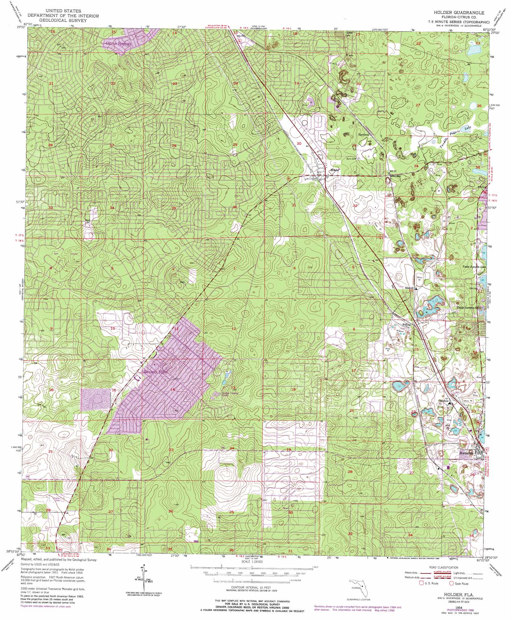
Holder Topo Map Florida
To zoom in, hover over the map of Holder
USGS Topo Quad 28082h4 - 1:24,000 scale
| Topo Map Name: | Holder |
| USGS Topo Quad ID: | 28082h4 |
| Print Size: | ca. 21 1/4" wide x 27" high |
| Southeast Coordinates: | 28.875° N latitude / 82.375° W longitude |
| Map Center Coordinates: | 28.9375° N latitude / 82.4375° W longitude |
| U.S. State: | FL |
| Filename: | O28082H4.jpg |
| Download Map JPG Image: | Holder topo map 1:24,000 scale |
| Map Type: | Topographic |
| Topo Series: | 7.5´ |
| Map Scale: | 1:24,000 |
| Source of Map Images: | United States Geological Survey (USGS) |
| Alternate Map Versions: |
Holder FL 1954, updated 1955 Download PDF Buy paper map Holder FL 1954, updated 1966 Download PDF Buy paper map Holder FL 1954, updated 1988 Download PDF Buy paper map Holder FL 2012 Download PDF Buy paper map Holder FL 2015 Download PDF Buy paper map |
1:24,000 Topo Quads surrounding Holder
Lebanon Station |
Tidewater |
Romeo |
Cotton Plant |
Ocala West |
Yankeetown |
Yankeetown Se |
Dunnellon |
Dunnellon Se |
Shady |
Red Level |
Crystal River |
Holder |
Stokes Ferry |
Lake Panasoffkee Nw |
Ozello |
Homosassa |
Lecanto |
Inverness |
Rutland |
Chassahowitzka Bay |
Chassahowitzka |
Brooksville Nw |
Nobelton |
Wahoo |
> Back to 28082e1 at 1:100,000 scale
> Back to 28082a1 at 1:250,000 scale
> Back to U.S. Topo Maps home
Holder topo map: Gazetteer
Holder: Lakes
Twomile Prairie Lake elevation 10m 32′Holder: Parks
Beverly Hills Community Park elevation 12m 39′Central Ridge District Park elevation 18m 59′
Hernando Park elevation 18m 59′
Holder: Populated Places
Beverly Hills elevation 31m 101′Black Diamond elevation 17m 55′
Citrus Hills elevation 35m 114′
Citrus Springs elevation 29m 95′
Holder elevation 18m 59′
Pine Ridge elevation 29m 95′
Holder: Post Offices
Beverly Hills Post Office elevation 28m 91′Holder Post Office elevation 18m 59′
Holder digital topo map on disk
Buy this Holder topo map showing relief, roads, GPS coordinates and other geographical features, as a high-resolution digital map file on DVD: