Port Lavaca East Topo Map Texas
To zoom in, hover over the map of Port Lavaca East
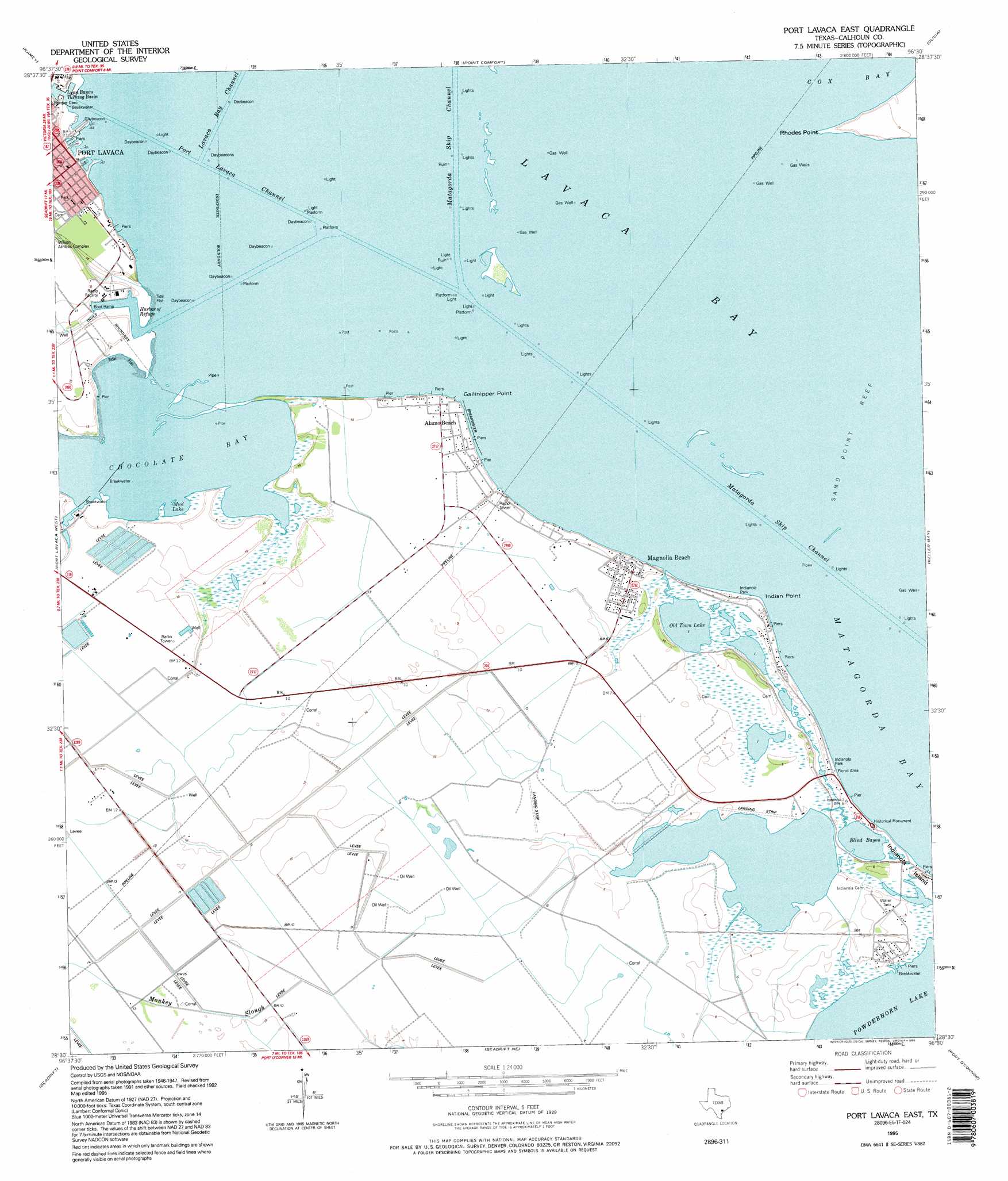
USGS Topo Quad 28096e5 - 1:24,000 scale
| Topo Map Name: | Port Lavaca East |
| USGS Topo Quad ID: | 28096e5 |
| Print Size: | ca. 21 1/4" wide x 27" high |
| Southeast Coordinates: | 28.5° N latitude / 96.5° W longitude |
| Map Center Coordinates: | 28.5625° N latitude / 96.5625° W longitude |
| U.S. State: | TX |
| Filename: | o28096e5.jpg |
| Download Map JPG Image: | Port Lavaca East topo map 1:24,000 scale |
| Map Type: | Topographic |
| Topo Series: | 7.5´ |
| Map Scale: | 1:24,000 |
| Source of Map Images: | United States Geological Survey (USGS) |
| Alternate Map Versions: |
Port Lavaca East TX 1952, updated 1953 Download PDF Buy paper map Port Lavaca East TX 1952, updated 1974 Download PDF Buy paper map Port Lavaca East TX 1952, updated 1977 Download PDF Buy paper map Port Lavaca East TX 1952, updated 1983 Download PDF Buy paper map Port Lavaca East TX 1995, updated 1995 Download PDF Buy paper map Port Lavaca East TX 2010 Download PDF Buy paper map Port Lavaca East TX 2013 Download PDF Buy paper map Port Lavaca East TX 2016 Download PDF Buy paper map |
1:24,000 Topo Quads surrounding Port Lavaca East
Marcado Creek |
La Salle |
Lolita |
La Ward |
Francitas |
Placedo |
Kamey |
Point Comfort |
Olivia |
Turtle Bay |
Green Lake |
Port Lavaca West |
Port Lavaca East |
Keller Bay |
Carancahua Pass |
Austwell |
Seadrift |
Seadrift Ne |
Port O'Connor |
Decros Point |
Tivoli Se |
Mosquito Point |
Long Island |
Pass Cavallo Sw |
> Back to 28096e1 at 1:100,000 scale
> Back to 28096a1 at 1:250,000 scale
> Back to U.S. Topo Maps home
Port Lavaca East topo map: Gazetteer
Port Lavaca East: Airports
Big Dukes Place Airport elevation 1m 3′Port Lavaca East: Bars
Gallinipper Reef (historical) elevation 0m 0′Sand Point Reef elevation 0m 0′
Port Lavaca East: Bays
Chocolate Bay elevation 0m 0′Port Lavaca East: Capes
Gallinipper Point elevation 0m 0′Indian Point elevation 0m 0′
Rhodes Point elevation 1m 3′
Port Lavaca East: Guts
Blind Bayou elevation 1m 3′Port Lavaca East: Harbors
Harbor of Refuge elevation 0m 0′Port Lavaca East: Lakes
Mud Lake elevation 0m 0′Old Town Lake elevation 0m 0′
Port Lavaca East: Populated Places
Alamo Beach elevation 4m 13′Magnolia Beach elevation 3m 9′
Port Lavaca East: Springs
San Luis Springs elevation 0m 0′Port Lavaca East digital topo map on disk
Buy this Port Lavaca East topo map showing relief, roads, GPS coordinates and other geographical features, as a high-resolution digital map file on DVD: