Kamey Topo Map Texas
To zoom in, hover over the map of Kamey
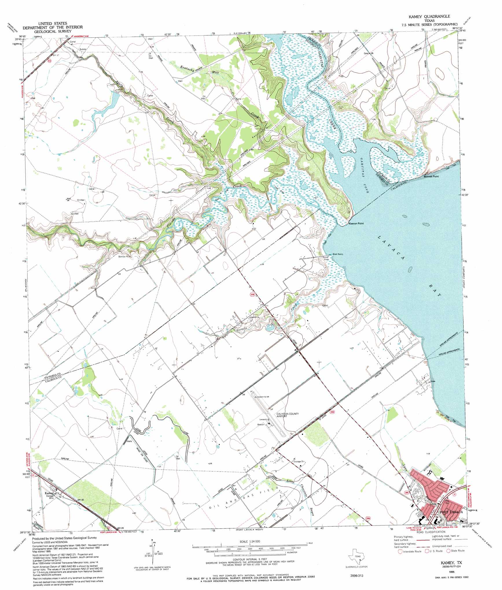
USGS Topo Quad 28096f6 - 1:24,000 scale
| Topo Map Name: | Kamey |
| USGS Topo Quad ID: | 28096f6 |
| Print Size: | ca. 21 1/4" wide x 27" high |
| Southeast Coordinates: | 28.625° N latitude / 96.625° W longitude |
| Map Center Coordinates: | 28.6875° N latitude / 96.6875° W longitude |
| U.S. State: | TX |
| Filename: | o28096f6.jpg |
| Download Map JPG Image: | Kamey topo map 1:24,000 scale |
| Map Type: | Topographic |
| Topo Series: | 7.5´ |
| Map Scale: | 1:24,000 |
| Source of Map Images: | United States Geological Survey (USGS) |
| Alternate Map Versions: |
Kamey TX 1952, updated 1953 Download PDF Buy paper map Kamey TX 1952, updated 1963 Download PDF Buy paper map Kamey TX 1952, updated 1976 Download PDF Buy paper map Kamey TX 1995, updated 1995 Download PDF Buy paper map Kamey TX 2010 Download PDF Buy paper map Kamey TX 2013 Download PDF Buy paper map Kamey TX 2016 Download PDF Buy paper map |
1:24,000 Topo Quads surrounding Kamey
Inez Nw |
Inez |
Edna |
Manson |
Francitas Nw |
Victoria East |
Marcado Creek |
La Salle |
Lolita |
La Ward |
Bloomington |
Placedo |
Kamey |
Point Comfort |
Olivia |
Bloomington Sw |
Green Lake |
Port Lavaca West |
Port Lavaca East |
Keller Bay |
Tivoli |
Austwell |
Seadrift |
Seadrift Ne |
Port O'Connor |
> Back to 28096e1 at 1:100,000 scale
> Back to 28096a1 at 1:250,000 scale
> Back to U.S. Topo Maps home
Kamey topo map: Gazetteer
Kamey: Airports
Calhoun County Airport elevation 9m 29′Kamey: Bays
Garcitas Cove elevation 0m 0′Kamey: Capes
Bennett Point elevation 0m 0′Keeran Point elevation 0m 0′
Kamey: Dams
Texas No Name Number 44 Dam elevation 7m 22′Kamey: Populated Places
Kamey elevation 9m 29′Sixmile elevation 8m 26′
Kamey: Springs
Johnson Spring elevation 9m 29′Kamey: Streams
Agula Creek elevation 1m 3′Garcitas Creek elevation 0m 0′
Kentucky Mutt Creek elevation 0m 0′
Placedo Creek elevation 0m 0′
Sixmile Creek elevation 0m 0′
Kamey digital topo map on disk
Buy this Kamey topo map showing relief, roads, GPS coordinates and other geographical features, as a high-resolution digital map file on DVD: