Rincon Bend Topo Map Texas
To zoom in, hover over the map of Rincon Bend
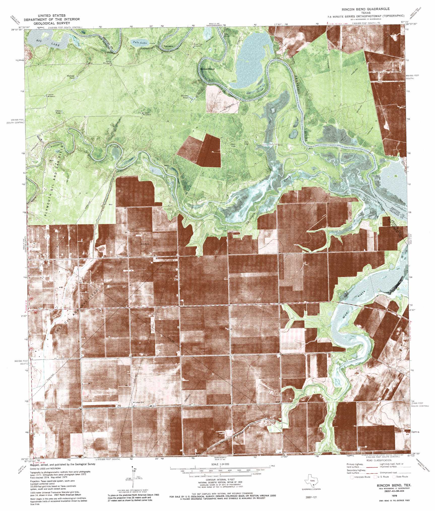
USGS Topo Quad 28097a3 - 1:24,000 scale
| Topo Map Name: | Rincon Bend |
| USGS Topo Quad ID: | 28097a3 |
| Print Size: | ca. 21 1/4" wide x 27" high |
| Southeast Coordinates: | 28° N latitude / 97.25° W longitude |
| Map Center Coordinates: | 28.0625° N latitude / 97.3125° W longitude |
| U.S. State: | TX |
| Filename: | o28097a3.jpg |
| Download Map JPG Image: | Rincon Bend topo map 1:24,000 scale |
| Map Type: | Topographic |
| Topo Series: | 7.5´ |
| Map Scale: | 1:24,000 |
| Source of Map Images: | United States Geological Survey (USGS) |
| Alternate Map Versions: |
Rincon Bend TX 1979, updated 1987 Download PDF Buy paper map Rincon Bend TX 2010 Download PDF Buy paper map Rincon Bend TX 2013 Download PDF Buy paper map Rincon Bend TX 2016 Download PDF Buy paper map |
1:24,000 Topo Quads surrounding Rincon Bend
Burkes Ridge |
Refugio Sw |
Refugio |
Quintana |
Twin Mott Lake |
Papalote |
Cranell |
Woodsboro |
Mission Bay |
Lamar |
Sinton West |
Sinton East |
Rincon Bend |
Bayside |
Rockport |
Odem |
Taft |
Gregory |
Aransas Pass |
Estes |
Annaville |
Corpus Christi |
Portland |
Port Ingleside |
Port Aransas |
> Back to 28097a1 at 1:100,000 scale
> Back to 28096a1 at 1:250,000 scale
> Back to U.S. Topo Maps home
Rincon Bend topo map: Gazetteer
Rincon Bend: Bends
Rincon Bend elevation 2m 6′Tule Bend elevation 4m 13′
Rincon Bend: Lakes
Big Lake elevation 3m 9′Tule Lake elevation 4m 13′
Rincon Bend: Oilfields
Plymouth Gas and Oil Field elevation 12m 39′Taft Oil and Gas Field elevation 12m 39′
Rincon Bend: Populated Places
Black Point (historical) elevation 1m 3′Rincon Bend: Reservoirs
Chico Tank elevation 11m 36′Palomo Tank elevation 11m 36′
Rincon Tank elevation 9m 29′
Rincon Bend: Streams
Chiltipin Creek elevation 0m 0′Rincon Bend digital topo map on disk
Buy this Rincon Bend topo map showing relief, roads, GPS coordinates and other geographical features, as a high-resolution digital map file on DVD: