Refugio Topo Map Texas
To zoom in, hover over the map of Refugio
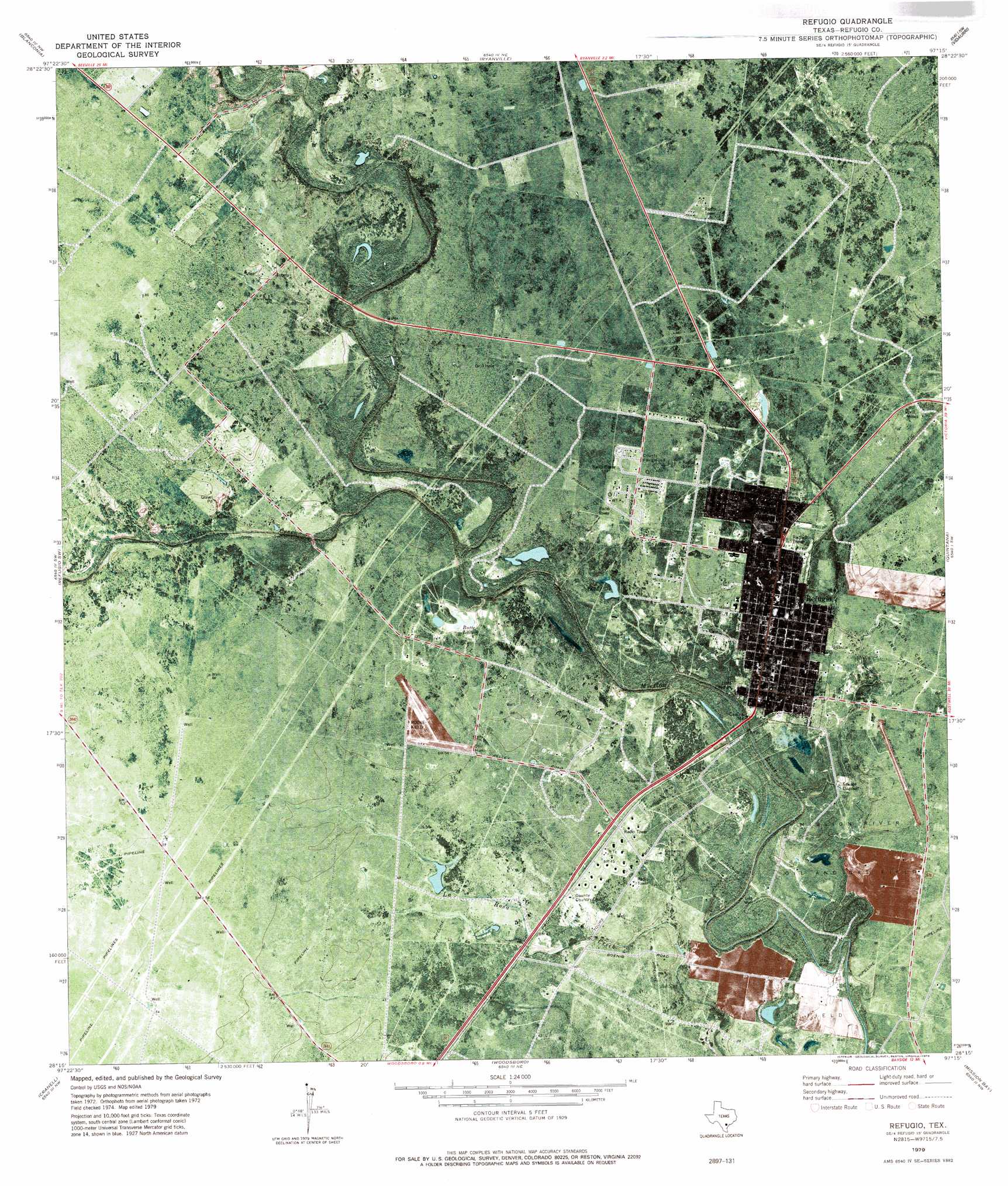
USGS Topo Quad 28097c3 - 1:24,000 scale
| Topo Map Name: | Refugio |
| USGS Topo Quad ID: | 28097c3 |
| Print Size: | ca. 21 1/4" wide x 27" high |
| Southeast Coordinates: | 28.25° N latitude / 97.25° W longitude |
| Map Center Coordinates: | 28.3125° N latitude / 97.3125° W longitude |
| U.S. State: | TX |
| Filename: | o28097c3.jpg |
| Download Map JPG Image: | Refugio topo map 1:24,000 scale |
| Map Type: | Topographic |
| Topo Series: | 7.5´ |
| Map Scale: | 1:24,000 |
| Source of Map Images: | United States Geological Survey (USGS) |
| Alternate Map Versions: |
Refugio TX 1979, updated 1979 Download PDF Buy paper map Refugio TX 2010 Download PDF Buy paper map Refugio TX 2013 Download PDF Buy paper map Refugio TX 2016 Download PDF Buy paper map |
1:24,000 Topo Quads surrounding Refugio
Berclair |
Melo |
Live Oak Lake |
Lott Lake |
Mcfaddin |
Skidmore Ne |
Blanconia |
Ryanville |
Vidaurri |
Lake Pasture |
Burkes Ridge |
Refugio Sw |
Refugio |
Quintana |
Twin Mott Lake |
Papalote |
Cranell |
Woodsboro |
Mission Bay |
Lamar |
Sinton West |
Sinton East |
Rincon Bend |
Bayside |
Rockport |
> Back to 28097a1 at 1:100,000 scale
> Back to 28096a1 at 1:250,000 scale
> Back to U.S. Topo Maps home
Refugio topo map: Gazetteer
Refugio: Airports
Rooke Field elevation 17m 55′Refugio: Dams
Rooke Lake Dam elevation 13m 42′Refugio: Lakes
Butte Lake elevation 8m 26′Duck Lake elevation 8m 26′
Refugio: Oilfields
Melon Creek Oil and Gas Field elevation 13m 42′Mission River Oil and Gas Field elevation 8m 26′
Refugio Oil Field elevation 20m 65′
Refugio: Parks
Lions City Park elevation 7m 22′Refugio City Park elevation 8m 26′
Refugio: Populated Places
Refugio elevation 14m 45′Refugio: Reservoirs
Rooke Lake elevation 13m 42′Refugio: Streams
Blanco Creek elevation 4m 13′Dog Branch elevation 9m 29′
Dry Creek elevation 1m 3′
Medio Creek elevation 4m 13′
Refugio digital topo map on disk
Buy this Refugio topo map showing relief, roads, GPS coordinates and other geographical features, as a high-resolution digital map file on DVD: