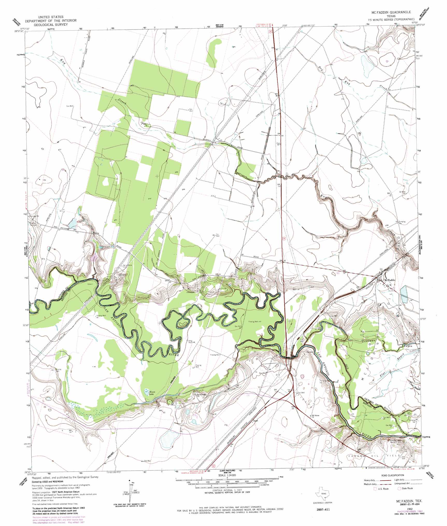
Mcfaddin Topo Map Texas
To zoom in, hover over the map of Mcfaddin
USGS Topo Quad 28097e1 - 1:24,000 scale
| Topo Map Name: | Mcfaddin |
| USGS Topo Quad ID: | 28097e1 |
| Print Size: | ca. 21 1/4" wide x 27" high |
| Southeast Coordinates: | 28.5° N latitude / 97° W longitude |
| Map Center Coordinates: | 28.5625° N latitude / 97.0625° W longitude |
| U.S. State: | TX |
| Filename: | o28097e1.jpg |
| Download Map JPG Image: | Mcfaddin topo map 1:24,000 scale |
| Map Type: | Topographic |
| Topo Series: | 7.5´ |
| Map Scale: | 1:24,000 |
| Source of Map Images: | United States Geological Survey (USGS) |
| Alternate Map Versions: |
McFaddin TX 1962, updated 1964 Download PDF Buy paper map McFaddin TX 1962, updated 1984 Download PDF Buy paper map McFaddin TX 1962, updated 1987 Download PDF Buy paper map McFaddin TX 2010 Download PDF Buy paper map McFaddin TX 2013 Download PDF Buy paper map McFaddin TX 2016 Download PDF Buy paper map |
1:24,000 Topo Quads surrounding Mcfaddin
Ander |
Schroeder |
Victoria West |
Victoria East |
Marcado Creek |
Hensley Lake |
Fannin |
Raisin |
Bloomington |
Placedo |
Live Oak Lake |
Lott Lake |
Mcfaddin |
Bloomington Sw |
Green Lake |
Ryanville |
Vidaurri |
Lake Pasture |
Tivoli |
Austwell |
Refugio |
Quintana |
Twin Mott Lake |
Tivoli Sw |
Tivoli Se |
> Back to 28097e1 at 1:100,000 scale
> Back to 28096a1 at 1:250,000 scale
> Back to U.S. Topo Maps home
Mcfaddin topo map: Gazetteer
Mcfaddin: Channels
Old River elevation 9m 29′Mcfaddin: Guts
Flat Bayou elevation 9m 29′Mcfaddin: Lakes
Hines Lake elevation 14m 45′Mcfaddin: Oilfields
Anaqua Oil Field elevation 18m 59′Huff Oil Field elevation 21m 68′
McFaddin Oil Field elevation 21m 68′
Mcfaddin: Populated Places
Inari elevation 23m 75′McFaddin elevation 23m 75′
Mcfaddin digital topo map on disk
Buy this Mcfaddin topo map showing relief, roads, GPS coordinates and other geographical features, as a high-resolution digital map file on DVD: