Melo Topo Map Texas
To zoom in, hover over the map of Melo
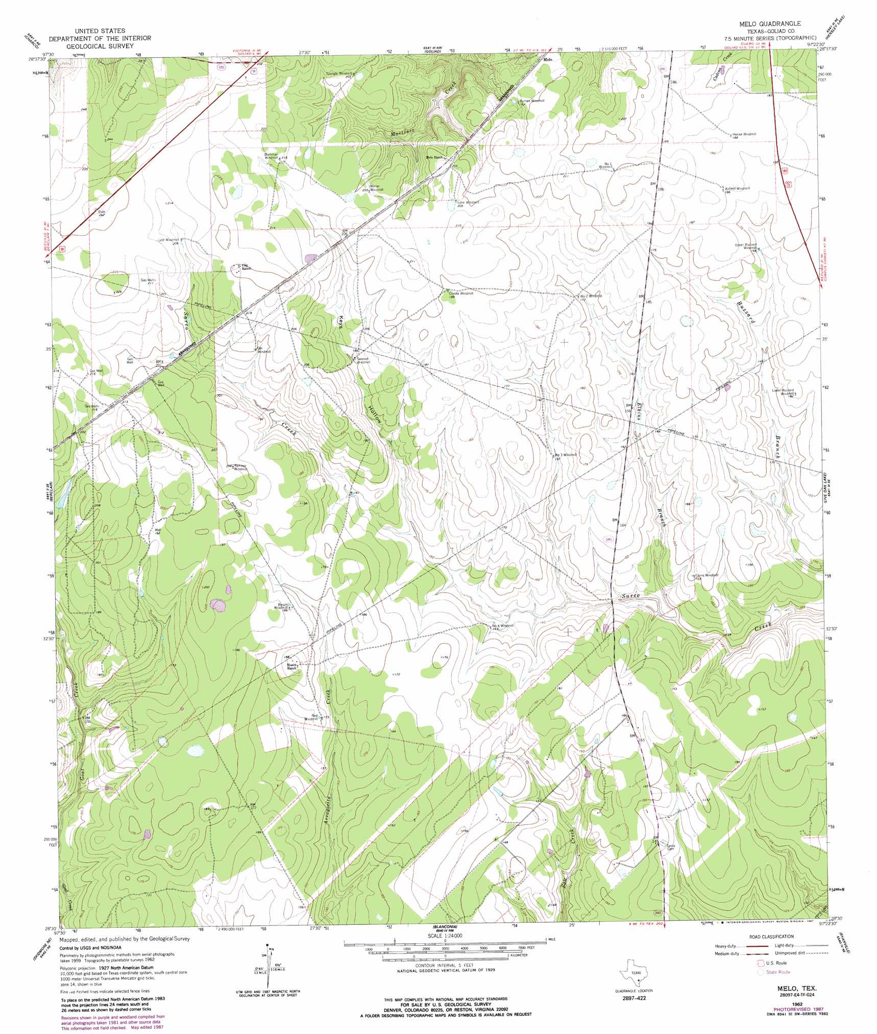
USGS Topo Quad 28097e4 - 1:24,000 scale
| Topo Map Name: | Melo |
| USGS Topo Quad ID: | 28097e4 |
| Print Size: | ca. 21 1/4" wide x 27" high |
| Southeast Coordinates: | 28.5° N latitude / 97.375° W longitude |
| Map Center Coordinates: | 28.5625° N latitude / 97.4375° W longitude |
| U.S. State: | TX |
| Filename: | o28097e4.jpg |
| Download Map JPG Image: | Melo topo map 1:24,000 scale |
| Map Type: | Topographic |
| Topo Series: | 7.5´ |
| Map Scale: | 1:24,000 |
| Source of Map Images: | United States Geological Survey (USGS) |
| Alternate Map Versions: |
Melo TX 1962, updated 1964 Download PDF Buy paper map Melo TX 1962, updated 1968 Download PDF Buy paper map Melo TX 1962, updated 1987 Download PDF Buy paper map Melo TX 2010 Download PDF Buy paper map Melo TX 2013 Download PDF Buy paper map Melo TX 2016 Download PDF Buy paper map |
1:24,000 Topo Quads surrounding Melo
Choate |
Runge Se |
Weesatche |
Ander |
Schroeder |
Berclair Nw |
Charco |
Goliad |
Hensley Lake |
Fannin |
Lazy F Ranch |
Berclair |
Melo |
Live Oak Lake |
Lott Lake |
Beeville East |
Skidmore Ne |
Blanconia |
Ryanville |
Vidaurri |
Skidmore |
Burkes Ridge |
Refugio Sw |
Refugio |
Quintana |
> Back to 28097e1 at 1:100,000 scale
> Back to 28096a1 at 1:250,000 scale
> Back to U.S. Topo Maps home
Melo topo map: Gazetteer
Melo: Populated Places
Melo elevation 58m 190′Sarco elevation 43m 141′
Melo: Streams
Elkins Branch elevation 37m 121′Melo: Valleys
Keys Hollow elevation 47m 154′Melo digital topo map on disk
Buy this Melo topo map showing relief, roads, GPS coordinates and other geographical features, as a high-resolution digital map file on DVD: