Tuleta Topo Map Texas
To zoom in, hover over the map of Tuleta
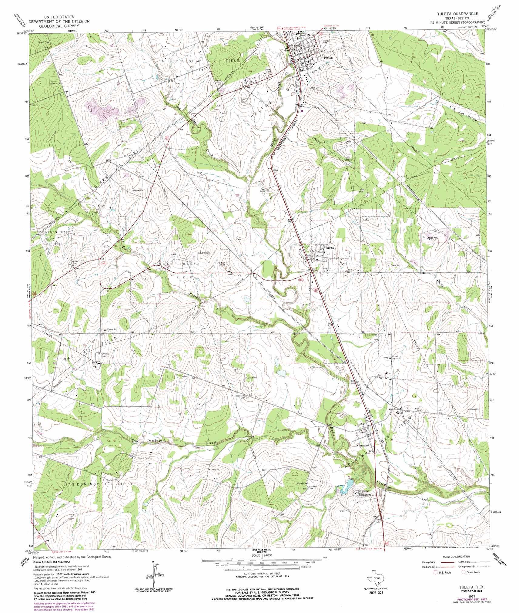
USGS Topo Quad 28097e7 - 1:24,000 scale
| Topo Map Name: | Tuleta |
| USGS Topo Quad ID: | 28097e7 |
| Print Size: | ca. 21 1/4" wide x 27" high |
| Southeast Coordinates: | 28.5° N latitude / 97.75° W longitude |
| Map Center Coordinates: | 28.5625° N latitude / 97.8125° W longitude |
| U.S. State: | TX |
| Filename: | o28097e7.jpg |
| Download Map JPG Image: | Tuleta topo map 1:24,000 scale |
| Map Type: | Topographic |
| Topo Series: | 7.5´ |
| Map Scale: | 1:24,000 |
| Source of Map Images: | United States Geological Survey (USGS) |
| Alternate Map Versions: |
Tuleta TX 1963, updated 1965 Download PDF Buy paper map Tuleta TX 1963, updated 1987 Download PDF Buy paper map Tuleta TX 2010 Download PDF Buy paper map Tuleta TX 2013 Download PDF Buy paper map Tuleta TX 2016 Download PDF Buy paper map |
1:24,000 Topo Quads surrounding Tuleta
Coy City |
Lenz |
Kenedy |
Choate |
Runge Se |
Pawnee |
Monteola |
Tulsita |
Berclair Nw |
Charco |
Ray Point |
Mineral |
Tuleta |
Lazy F Ranch |
Berclair |
Oakville |
Cadiz |
Beeville West |
Beeville East |
Skidmore Ne |
George West |
Mulos Hills |
Clareville |
Skidmore |
Burkes Ridge |
> Back to 28097e1 at 1:100,000 scale
> Back to 28096a1 at 1:250,000 scale
> Back to U.S. Topo Maps home
Tuleta topo map: Gazetteer
Tuleta: Bridges
Medio Creek Bridge elevation 72m 236′Tuleta: Dams
Dougherty Reservoir Dam elevation 79m 259′Tuleta: Oilfields
Cosden West Oil Field elevation 110m 360′Dirks Oil Field elevation 123m 403′
Normanna Gas Field elevation 78m 255′
Pettus Oil Field elevation 123m 403′
Ray Oil Field elevation 107m 351′
San Domingo Oil Field elevation 103m 337′
Tulsita Oil Field elevation 121m 396′
West Tuleta Oil Field elevation 96m 314′
Tuleta: Populated Places
Normanna elevation 82m 269′Pettus elevation 91m 298′
Tuleta elevation 99m 324′
Tuleta: Reservoirs
Dougherty Reservoir elevation 79m 259′Tuleta: Streams
Dry Medio Creek elevation 85m 278′San Domingo Creek elevation 64m 209′
Toro Creek elevation 76m 249′
Tuleta digital topo map on disk
Buy this Tuleta topo map showing relief, roads, GPS coordinates and other geographical features, as a high-resolution digital map file on DVD: