Berclair Nw Topo Map Texas
To zoom in, hover over the map of Berclair Nw
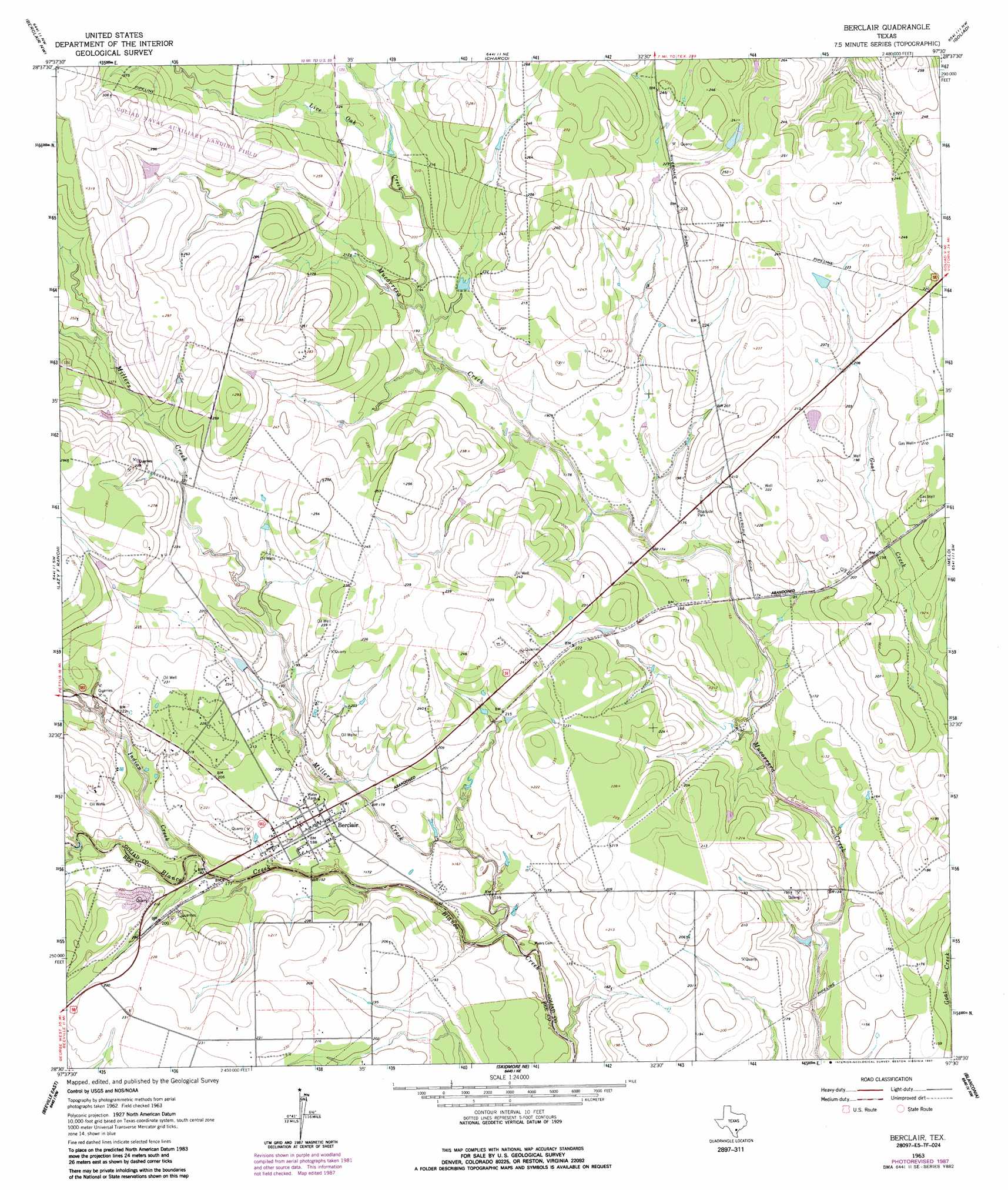
USGS Topo Quad 28097f6 - 1:24,000 scale
| Topo Map Name: | Berclair Nw |
| USGS Topo Quad ID: | 28097f6 |
| Print Size: | ca. 21 1/4" wide x 27" high |
| Southeast Coordinates: | 28.625° N latitude / 97.625° W longitude |
| Map Center Coordinates: | 28.6875° N latitude / 97.6875° W longitude |
| U.S. State: | TX |
| Filename: | o28097f6.jpg |
| Download Map JPG Image: | Berclair Nw topo map 1:24,000 scale |
| Map Type: | Topographic |
| Topo Series: | 7.5´ |
| Map Scale: | 1:24,000 |
| Source of Map Images: | United States Geological Survey (USGS) |
| Alternate Map Versions: |
Berclair NW TX 1963, updated 1965 Download PDF Buy paper map Berclair NW TX 1963, updated 1987 Download PDF Buy paper map Berclair NW TX 2010 Download PDF Buy paper map Berclair NW TX 2013 Download PDF Buy paper map Berclair NW TX 2016 Download PDF Buy paper map |
1:24,000 Topo Quads surrounding Berclair Nw
Karnes City |
Helena |
Runge |
Yorktown West |
Yorktown East |
Lenz |
Kenedy |
Choate |
Runge Se |
Weesatche |
Monteola |
Tulsita |
Berclair Nw |
Charco |
Goliad |
Mineral |
Tuleta |
Lazy F Ranch |
Berclair |
Melo |
Cadiz |
Beeville West |
Beeville East |
Skidmore Ne |
Blanconia |
> Back to 28097e1 at 1:100,000 scale
> Back to 28096a1 at 1:250,000 scale
> Back to U.S. Topo Maps home
Berclair Nw topo map: Gazetteer
Berclair Nw: Oilfields
Dial Gas Field elevation 79m 259′Hordes Creek Gas Field elevation 61m 200′
Berclair Nw: Streams
Chicken Creek elevation 46m 150′Berclair Nw digital topo map on disk
Buy this Berclair Nw topo map showing relief, roads, GPS coordinates and other geographical features, as a high-resolution digital map file on DVD: