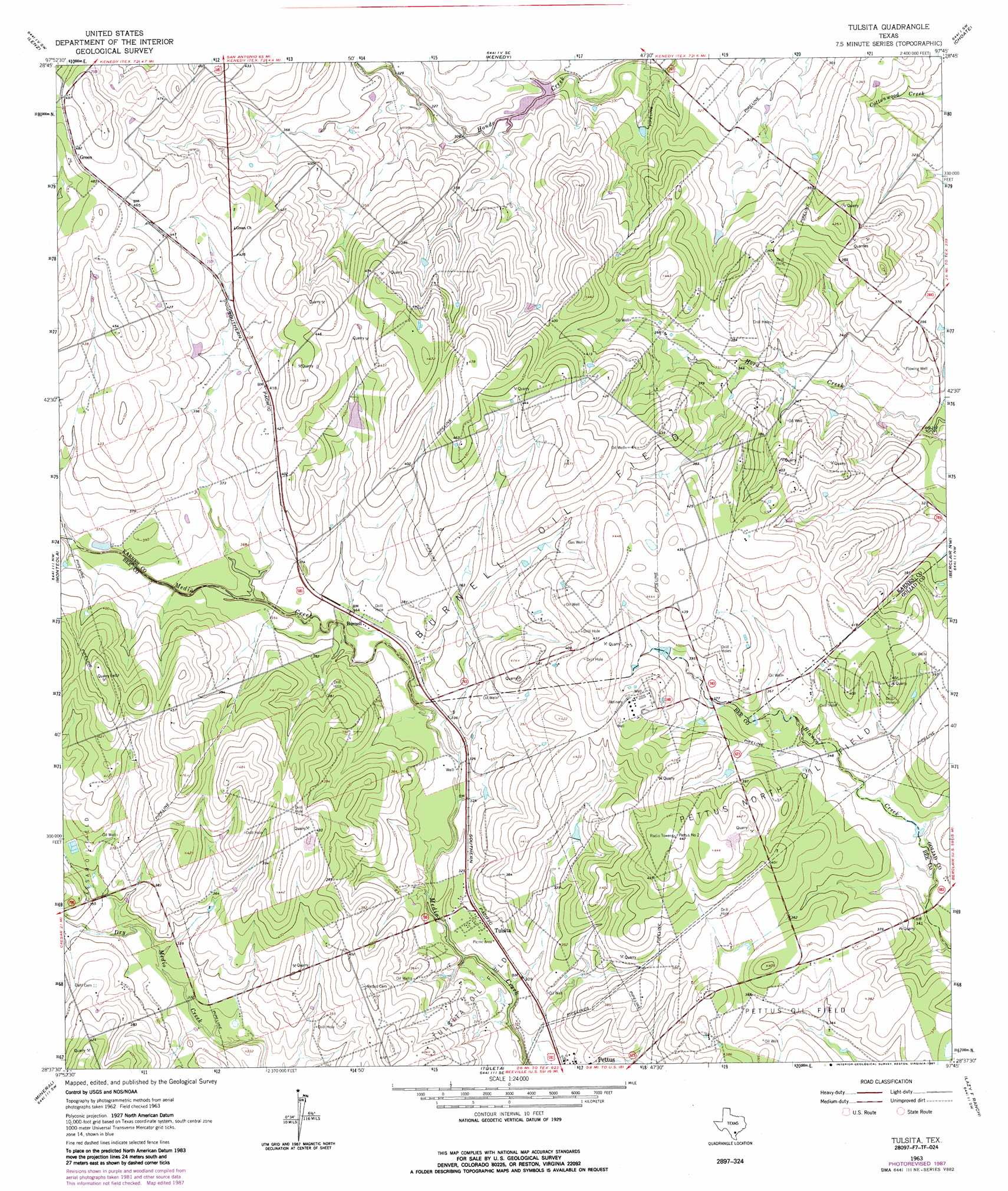
Tulsita Topo Map Texas
To zoom in, hover over the map of Tulsita
USGS Topo Quad 28097f7 - 1:24,000 scale
| Topo Map Name: | Tulsita |
| USGS Topo Quad ID: | 28097f7 |
| Print Size: | ca. 21 1/4" wide x 27" high |
| Southeast Coordinates: | 28.625° N latitude / 97.75° W longitude |
| Map Center Coordinates: | 28.6875° N latitude / 97.8125° W longitude |
| U.S. State: | TX |
| Filename: | o28097f7.jpg |
| Download Map JPG Image: | Tulsita topo map 1:24,000 scale |
| Map Type: | Topographic |
| Topo Series: | 7.5´ |
| Map Scale: | 1:24,000 |
| Source of Map Images: | United States Geological Survey (USGS) |
| Alternate Map Versions: |
Tulsita TX 1963, updated 1965 Download PDF Buy paper map Tulsita TX 1963, updated 1987 Download PDF Buy paper map Tulsita TX 2010 Download PDF Buy paper map Tulsita TX 2013 Download PDF Buy paper map Tulsita TX 2016 Download PDF Buy paper map |
1:24,000 Topo Quads surrounding Tulsita
Falls City |
Karnes City |
Helena |
Runge |
Yorktown West |
Coy City |
Lenz |
Kenedy |
Choate |
Runge Se |
Pawnee |
Monteola |
Tulsita |
Berclair Nw |
Charco |
Ray Point |
Mineral |
Tuleta |
Lazy F Ranch |
Berclair |
Oakville |
Cadiz |
Beeville West |
Beeville East |
Skidmore Ne |
> Back to 28097e1 at 1:100,000 scale
> Back to 28096a1 at 1:250,000 scale
> Back to U.S. Topo Maps home
Tulsita topo map: Gazetteer
Tulsita: Airports
Porter Ranch Airport elevation 120m 393′Tulsita: Dams
Soil Conservation Service Site 1 Dam elevation 92m 301′Texas No Name Number 16 Dam elevation 100m 328′
Tulsita: Oilfields
Burnell Oil Field elevation 135m 442′Pettus North Oil Field elevation 122m 400′
Tulsita: Populated Places
Burnell elevation 104m 341′Green elevation 147m 482′
Tulsita elevation 97m 318′
Tulsita: Reservoirs
Soil Conservation Service Site 1 Reservoir elevation 92m 301′Tulsita digital topo map on disk
Buy this Tulsita topo map showing relief, roads, GPS coordinates and other geographical features, as a high-resolution digital map file on DVD: