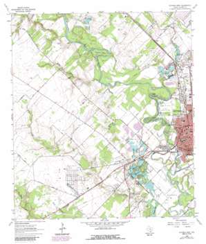
Victoria West Topo Map Texas
To zoom in, hover over the map of Victoria West
USGS Topo Quad 28097g1 - 1:24,000 scale
| Topo Map Name: | Victoria West |
| USGS Topo Quad ID: | 28097g1 |
| Print Size: | ca. 21 1/4" wide x 27" high |
| Southeast Coordinates: | 28.75° N latitude / 97° W longitude |
| Map Center Coordinates: | 28.8125° N latitude / 97.0625° W longitude |
| U.S. State: | TX |
| Filename: | o28097g1.jpg |
| Download Map JPG Image: | Victoria West topo map 1:24,000 scale |
| Map Type: | Topographic |
| Topo Series: | 7.5´ |
| Map Scale: | 1:24,000 |
| Source of Map Images: | United States Geological Survey (USGS) |
| Alternate Map Versions: |
Victoria West TX 1964, updated 1965 Download PDF Buy paper map Victoria West TX 1964, updated 1984 Download PDF Buy paper map Victoria West TX 1964, updated 1987 Download PDF Buy paper map Victoria West TX 1964, updated 1987 Download PDF Buy paper map Victoria West TX 2010 Download PDF Buy paper map Victoria West TX 2013 Download PDF Buy paper map Victoria West TX 2016 Download PDF Buy paper map |
1:24,000 Topo Quads surrounding Victoria West
> Back to 28097e1 at 1:100,000 scale
> Back to 28096a1 at 1:250,000 scale
> Back to U.S. Topo Maps home
Victoria West topo map: Gazetteer
Victoria West: Airports
One O'Connor Plaza-Tower Heliport elevation 29m 95′Victoria Bank and Trust Motor Garage Heliport elevation 29m 95′
Victoria West: Bends
Foxes Bend elevation 20m 65′Grovers Bend elevation 19m 62′
Powers Bend elevation 23m 75′
Victoria West: Bridges
Southern Pacific Railroad Guadalupe Bridge elevation 11m 36′Victoria West: Islands
Pleasure Island elevation 16m 52′Victoria West: Lakes
Optimist Ponds elevation 20m 65′Pridham Lake elevation 10m 32′
Saxet Lakes elevation 12m 39′
Victoria West: Oilfields
Pridham Lake Oil Field elevation 26m 85′Victoria Oil Field elevation 14m 45′
Victoria West: Parks
Memorial Park elevation 29m 95′Riverside Park elevation 21m 68′
Riverside Park elevation 19m 62′
Victoria West: Populated Places
Aloe elevation 32m 104′Chipley elevation 18m 59′
Dupre elevation 21m 68′
Victoria elevation 29m 95′
Victoria West: Post Offices
US Post Office elevation 26m 85′Victoria West: Streams
Mission Creek elevation 21m 68′Spring Creek elevation 15m 49′
Wright Creek elevation 17m 55′
Victoria West: Summits
Goldmans Hill elevation 29m 95′Victoria West: Trails
Riverside Park Trail elevation 20m 65′Victoria West digital topo map on disk
Buy this Victoria West topo map showing relief, roads, GPS coordinates and other geographical features, as a high-resolution digital map file on DVD:


