George West Topo Map Texas
To zoom in, hover over the map of George West
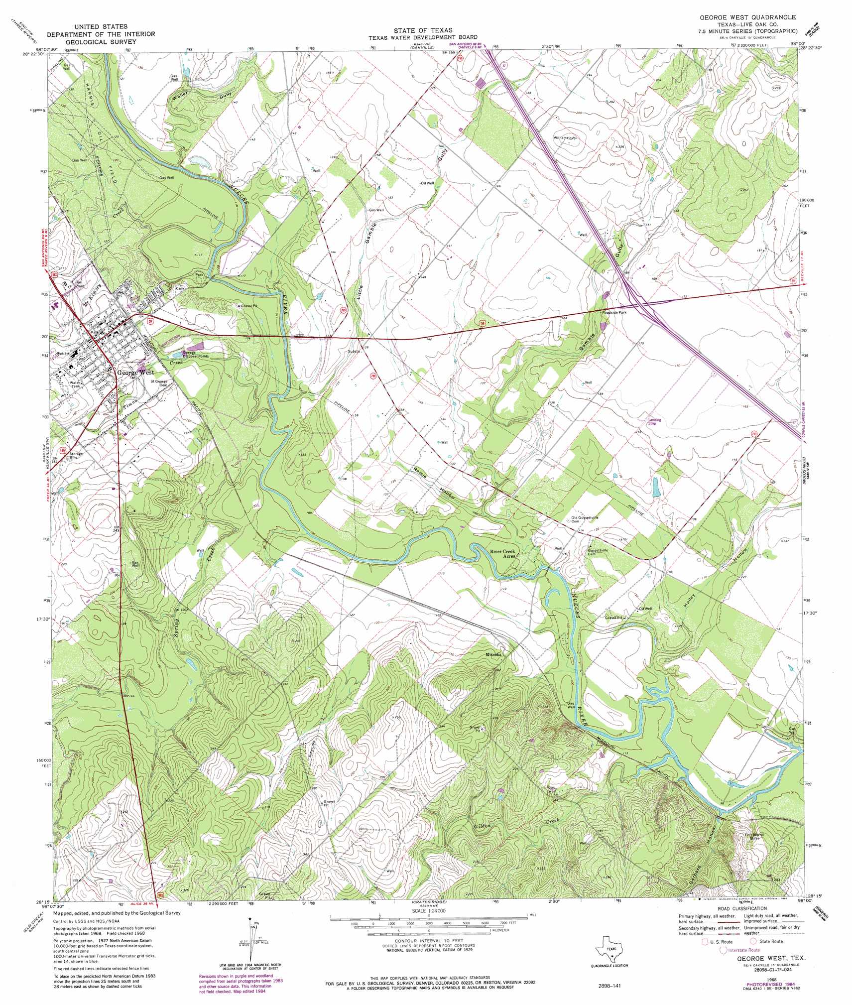
USGS Topo Quad 28098c1 - 1:24,000 scale
| Topo Map Name: | George West |
| USGS Topo Quad ID: | 28098c1 |
| Print Size: | ca. 21 1/4" wide x 27" high |
| Southeast Coordinates: | 28.25° N latitude / 98° W longitude |
| Map Center Coordinates: | 28.3125° N latitude / 98.0625° W longitude |
| U.S. State: | TX |
| Filename: | o28098c1.jpg |
| Download Map JPG Image: | George West topo map 1:24,000 scale |
| Map Type: | Topographic |
| Topo Series: | 7.5´ |
| Map Scale: | 1:24,000 |
| Source of Map Images: | United States Geological Survey (USGS) |
| Alternate Map Versions: |
George West TX 1968, updated 1972 Download PDF Buy paper map George West TX 1968, updated 1986 Download PDF Buy paper map George West TX 2010 Download PDF Buy paper map George West TX 2013 Download PDF Buy paper map George West TX 2016 Download PDF Buy paper map |
1:24,000 Topo Quads surrounding George West
Willow Hollow Tank |
Comanche Hills |
Ray Point |
Mineral |
Tuleta |
Calliham |
Three Rivers |
Oakville |
Cadiz |
Beeville West |
Live Oak Hollow |
Oakville Sw |
George West |
Mulos Hills |
Clareville |
Clegg Ne |
Elm Creek |
Crater Ridge |
Dinero |
Tynan |
Clegg |
Anna Rose |
Midway |
Sandia |
Mathis |
> Back to 28098a1 at 1:100,000 scale
> Back to 28098a1 at 1:250,000 scale
> Back to U.S. Topo Maps home
George West topo map: Gazetteer
George West: Airports
Live Oak County Airport elevation 37m 121′George West: Dams
Harris Dam elevation 40m 131′George West: Populated Places
George West elevation 48m 157′Mikeska elevation 48m 157′
River Creek Acres elevation 29m 95′
George West: Reservoirs
Harris Lake elevation 40m 131′George West: Streams
Gilden Creek elevation 29m 95′McKimzey Creek elevation 27m 88′
Spring Creek elevation 28m 91′
Timon Creek elevation 30m 98′
George West: Valleys
Gamble Gully elevation 29m 95′Gerhard Hollow elevation 28m 91′
Hailey Hollow elevation 30m 98′
Little Gamble Gully elevation 31m 101′
Ramie Hollow elevation 30m 98′
Waller Gully elevation 31m 101′
George West digital topo map on disk
Buy this George West topo map showing relief, roads, GPS coordinates and other geographical features, as a high-resolution digital map file on DVD: