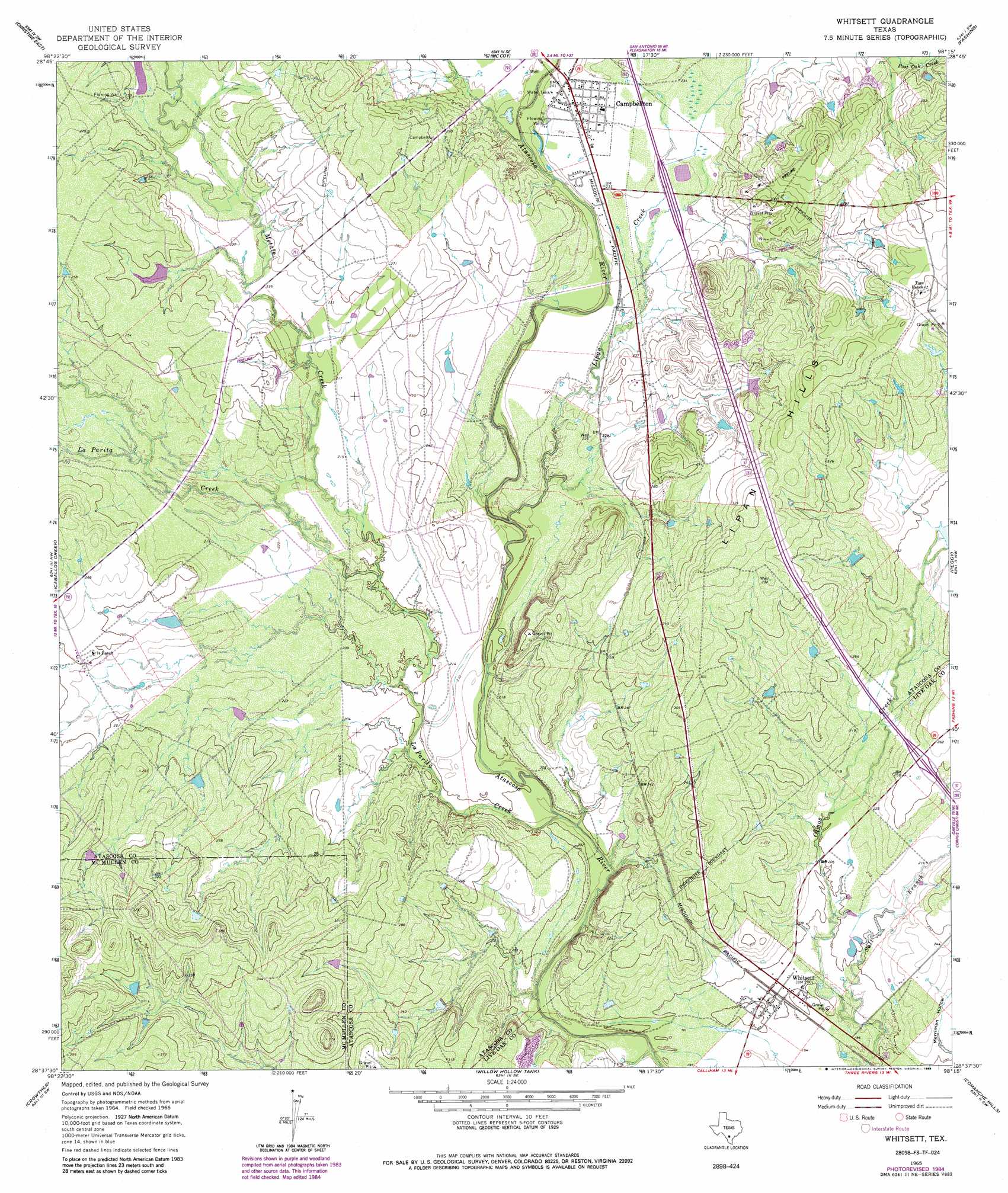
Whitsett Topo Map Texas
To zoom in, hover over the map of Whitsett
USGS Topo Quad 28098f3 - 1:24,000 scale
| Topo Map Name: | Whitsett |
| USGS Topo Quad ID: | 28098f3 |
| Print Size: | ca. 21 1/4" wide x 27" high |
| Southeast Coordinates: | 28.625° N latitude / 98.25° W longitude |
| Map Center Coordinates: | 28.6875° N latitude / 98.3125° W longitude |
| U.S. State: | TX |
| Filename: | o28098f3.jpg |
| Download Map JPG Image: | Whitsett topo map 1:24,000 scale |
| Map Type: | Topographic |
| Topo Series: | 7.5´ |
| Map Scale: | 1:24,000 |
| Source of Map Images: | United States Geological Survey (USGS) |
| Alternate Map Versions: |
Whitsett TX 1965, updated 1968 Download PDF Buy paper map Whitsett TX 1965, updated 1988 Download PDF Buy paper map Whitsett TX 2010 Download PDF Buy paper map Whitsett TX 2012 Download PDF Buy paper map Whitsett TX 2016 Download PDF Buy paper map |
1:24,000 Topo Quads surrounding Whitsett
Jourdanton |
Pleasanton |
Leal |
Three Oaks |
Falls City |
Christine West |
Christine East |
Mccoy |
Fashing |
Coy City |
Cross Ne |
Caballos Creek |
Whitsett |
Peggy |
Pawnee |
Cross |
Crowther |
Willow Hollow Tank |
Comanche Hills |
Ray Point |
Tilden |
Calliham Nw |
Calliham |
Three Rivers |
Oakville |
> Back to 28098e1 at 1:100,000 scale
> Back to 28098a1 at 1:250,000 scale
> Back to U.S. Topo Maps home
Whitsett topo map: Gazetteer
Whitsett: Dams
74 Ranch Dam Number 3 elevation 73m 239′74 Ranch Dam Number 4 elevation 73m 239′
Tom Ranch Lake Number 1 Dam elevation 85m 278′
Tom Ranch Lake Number 2 Dam elevation 73m 239′
Whitsett: Populated Places
Campbellton elevation 73m 239′Whitsett elevation 61m 200′
Whitsett: Reservoirs
Lake Number 3 elevation 73m 239′Lake Number 4 elevation 73m 239′
Tom Ranch Lake Number 1 elevation 85m 278′
Tom Ranch Lake Number 2 elevation 73m 239′
Whitsett: Streams
La Parita Creek elevation 54m 177′Lipan Creek elevation 62m 203′
Metate Creek elevation 61m 200′
Salt Branch elevation 55m 180′
Whitsett: Summits
Lipan Hills elevation 101m 331′Whitsett digital topo map on disk
Buy this Whitsett topo map showing relief, roads, GPS coordinates and other geographical features, as a high-resolution digital map file on DVD: