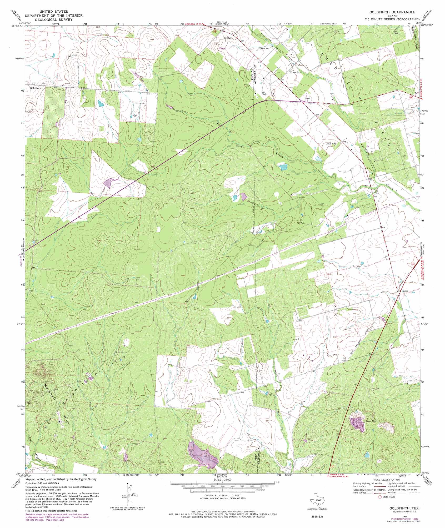
Goldfinch Topo Map Texas
To zoom in, hover over the map of Goldfinch
USGS Topo Quad 28098g7 - 1:24,000 scale
| Topo Map Name: | Goldfinch |
| USGS Topo Quad ID: | 28098g7 |
| Print Size: | ca. 21 1/4" wide x 27" high |
| Southeast Coordinates: | 28.75° N latitude / 98.75° W longitude |
| Map Center Coordinates: | 28.8125° N latitude / 98.8125° W longitude |
| U.S. State: | TX |
| Filename: | o28098g7.jpg |
| Download Map JPG Image: | Goldfinch topo map 1:24,000 scale |
| Map Type: | Topographic |
| Topo Series: | 7.5´ |
| Map Scale: | 1:24,000 |
| Source of Map Images: | United States Geological Survey (USGS) |
| Alternate Map Versions: |
Goldfinch TX 1968, updated 1971 Download PDF Buy paper map Goldfinch TX 1968, updated 1982 Download PDF Buy paper map Goldfinch TX 2010 Download PDF Buy paper map Goldfinch TX 2012 Download PDF Buy paper map Goldfinch TX 2016 Download PDF Buy paper map |
1:24,000 Topo Quads surrounding Goldfinch
Moore |
Ghost Hill |
Bigfoot |
Rossville |
Poteet |
Pearsall North |
Schattel Nw |
Schattel |
Dobrowolski |
Jourdanton |
Pearsall South |
Keystone Ranch |
Goldfinch |
Charlotte |
Christine West |
Dilley Ne |
Las Flores |
Hindes |
San Miguel Ranch |
Cross Ne |
Burns Ranch |
Cayman Lake |
Zella |
Pertle Creek |
Cross |
> Back to 28098e1 at 1:100,000 scale
> Back to 28098a1 at 1:250,000 scale
> Back to U.S. Topo Maps home
Goldfinch topo map: Gazetteer
Goldfinch: Dams
County Line Tank Dam elevation 156m 511′Miracle Lake Dam elevation 138m 452′
Goldfinch: Oilfields
West Charlotte Oil Field elevation 149m 488′Goldfinch: Populated Places
Davis elevation 135m 442′Goldfinch elevation 156m 511′
Goldfinch: Reservoirs
County Line Tank elevation 156m 511′Miracle Lake elevation 138m 452′
Goldfinch: Streams
Hackberry Creek elevation 125m 410′West Clear Creek elevation 135m 442′
Goldfinch: Summits
Marshall Hills elevation 165m 541′Goldfinch digital topo map on disk
Buy this Goldfinch topo map showing relief, roads, GPS coordinates and other geographical features, as a high-resolution digital map file on DVD: