Dos Hermanos Peaks Topo Map Texas
To zoom in, hover over the map of Dos Hermanos Peaks
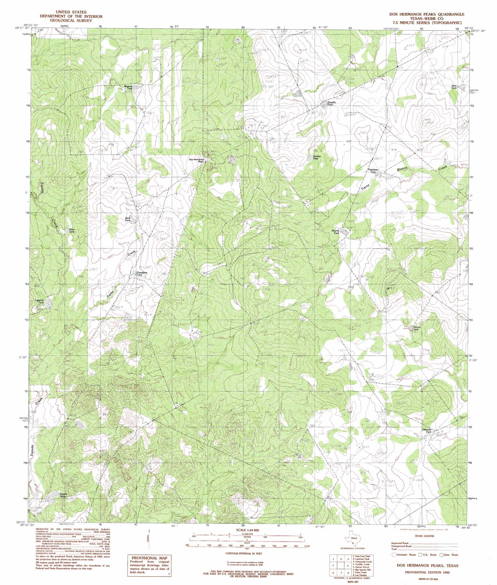
USGS Topo Quad 28099a7 - 1:24,000 scale
| Topo Map Name: | Dos Hermanos Peaks |
| USGS Topo Quad ID: | 28099a7 |
| Print Size: | ca. 21 1/4" wide x 27" high |
| Southeast Coordinates: | 28° N latitude / 99.75° W longitude |
| Map Center Coordinates: | 28.0625° N latitude / 99.8125° W longitude |
| U.S. State: | TX |
| Filename: | o28099a7.jpg |
| Download Map JPG Image: | Dos Hermanos Peaks topo map 1:24,000 scale |
| Map Type: | Topographic |
| Topo Series: | 7.5´ |
| Map Scale: | 1:24,000 |
| Source of Map Images: | United States Geological Survey (USGS) |
| Alternate Map Versions: |
Dos Hermanos Peaks TX 1982, updated 1982 Download PDF Buy paper map Dos Hermanos Peaks TX 2010 Download PDF Buy paper map Dos Hermanos Peaks TX 2013 Download PDF Buy paper map Dos Hermanos Peaks TX 2016 Download PDF Buy paper map |
1:24,000 Topo Quads surrounding Dos Hermanos Peaks
San Pedro Creek |
Dentonio |
Farias Tank |
Dabney Tank |
Catarina |
Chupadera Creek |
East Losa Tank |
Landrum Tank |
Velenzuela Creek |
Piloncillo Hill |
Bull Hollow Tank |
Tordillo Creek |
Dos Hermanos Peaks |
Galvan Ranch |
Telephone Tanks |
Big Apache Hill |
Pinto Creek |
Las Tiendas |
Spohn Ranch |
|
Palafox Sw |
San Pedro Hill |
Cerritos Blancos |
Nido Ranch |
> Back to 28099a1 at 1:100,000 scale
> Back to 28098a1 at 1:250,000 scale
> Back to U.S. Topo Maps home
Dos Hermanos Peaks topo map: Gazetteer
Dos Hermanos Peaks: Dams
Apache Ranch Lake Dam elevation 186m 610′Dos Hermanos Peaks: Reservoirs
Apache Ranch Lake elevation 186m 610′Espita Tank elevation 198m 649′
Dos Hermanos Peaks: Streams
Espita Creek elevation 196m 643′Dos Hermanos Peaks: Summits
Dos Hermanos Peaks elevation 243m 797′Dos Hermanos Peaks digital topo map on disk
Buy this Dos Hermanos Peaks topo map showing relief, roads, GPS coordinates and other geographical features, as a high-resolution digital map file on DVD: