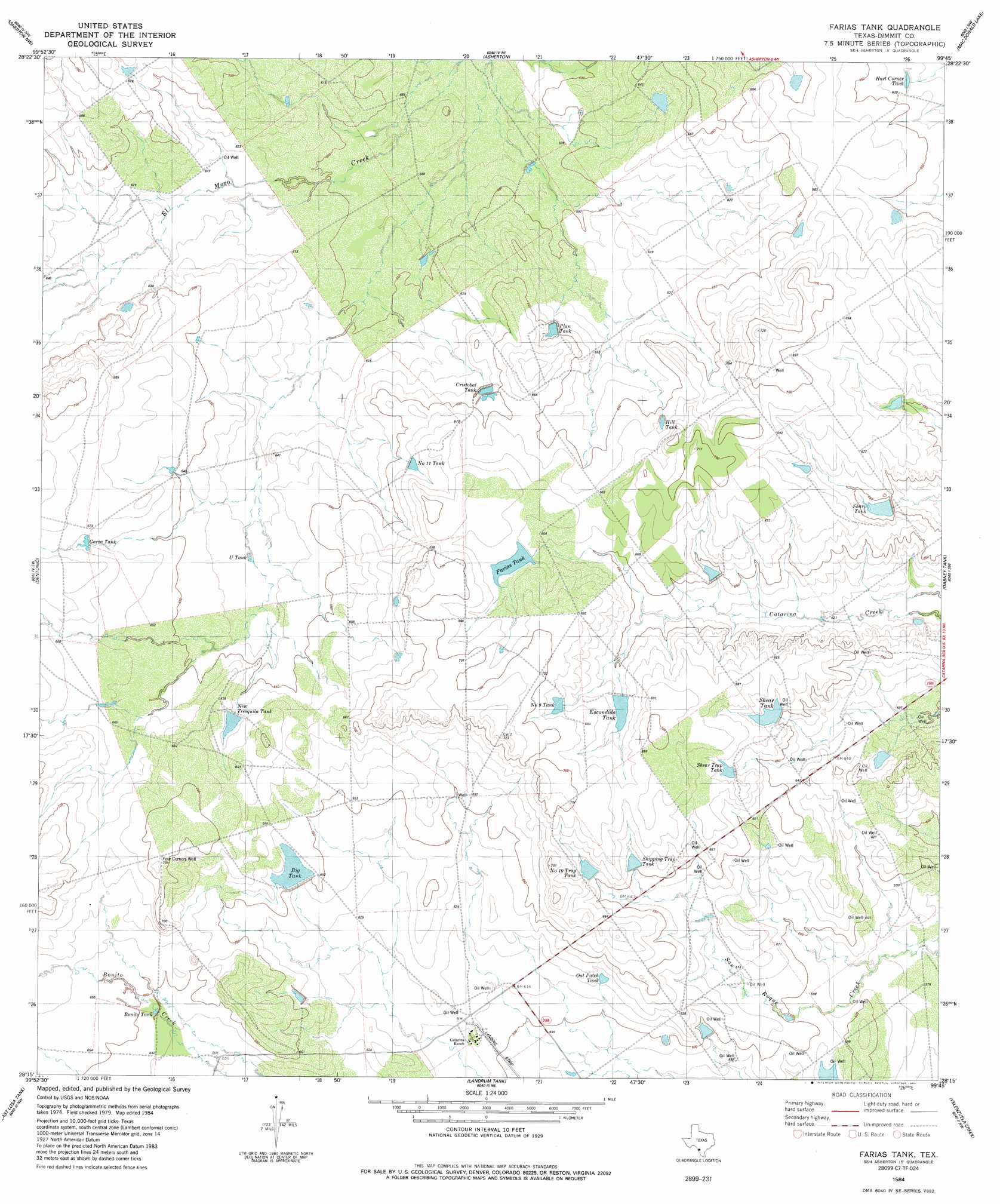
Farias Tank Topo Map Texas
To zoom in, hover over the map of Farias Tank
USGS Topo Quad 28099c7 - 1:24,000 scale
| Topo Map Name: | Farias Tank |
| USGS Topo Quad ID: | 28099c7 |
| Print Size: | ca. 21 1/4" wide x 27" high |
| Southeast Coordinates: | 28.25° N latitude / 99.75° W longitude |
| Map Center Coordinates: | 28.3125° N latitude / 99.8125° W longitude |
| U.S. State: | TX |
| Filename: | o28099c7.jpg |
| Download Map JPG Image: | Farias Tank topo map 1:24,000 scale |
| Map Type: | Topographic |
| Topo Series: | 7.5´ |
| Map Scale: | 1:24,000 |
| Source of Map Images: | United States Geological Survey (USGS) |
| Alternate Map Versions: |
Farias Tank TX 1984, updated 1984 Download PDF Buy paper map Farias Tank TX 2010 Download PDF Buy paper map Farias Tank TX 2013 Download PDF Buy paper map Farias Tank TX 2016 Download PDF Buy paper map |
1:24,000 Topo Quads surrounding Farias Tank
Cayetano Creek |
Carrizo Springs West |
Carrizo Springs East |
Brundage |
Big Wells |
Palo Blanco Tank |
Asherton Nw |
Asherton |
Macdonald Lake |
Valley Wells |
San Pedro Creek |
Dentonio |
Farias Tank |
Dabney Tank |
Catarina |
Chupadera Creek |
East Losa Tank |
Landrum Tank |
Velenzuela Creek |
Piloncillo Hill |
Bull Hollow Tank |
Tordillo Creek |
Dos Hermanos Peaks |
Galvan Ranch |
Telephone Tanks |
> Back to 28099a1 at 1:100,000 scale
> Back to 28098a1 at 1:250,000 scale
> Back to U.S. Topo Maps home
Farias Tank topo map: Gazetteer
Farias Tank: Airports
Briscoes Catarina Ranch Airport elevation 185m 606′Farias Tank: Dams
Dolph Briscoe Lake Number 1 Dam elevation 200m 656′Dolph Briscoe Lake Number 2 Dam elevation 205m 672′
Dolph Briscoe Lake Number 3 Dam elevation 195m 639′
Farias Tank: Populated Places
Gilson Groves elevation 177m 580′Farias Tank: Reservoirs
Dolph Briscoe Lake Number 1 elevation 200m 656′Dolph Briscoe Lake Number 2 elevation 205m 672′
Dolph Briscoe Lake Number 3 elevation 195m 639′
Farias Tank digital topo map on disk
Buy this Farias Tank topo map showing relief, roads, GPS coordinates and other geographical features, as a high-resolution digital map file on DVD: