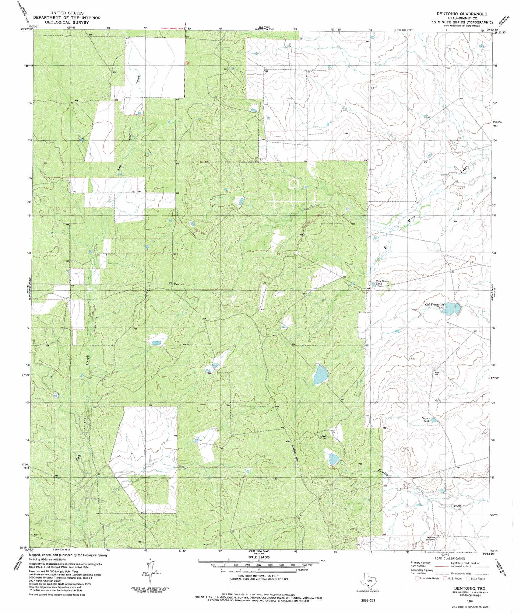
Dentonio Topo Map Texas
To zoom in, hover over the map of Dentonio
USGS Topo Quad 28099c8 - 1:24,000 scale
| Topo Map Name: | Dentonio |
| USGS Topo Quad ID: | 28099c8 |
| Print Size: | ca. 21 1/4" wide x 27" high |
| Southeast Coordinates: | 28.25° N latitude / 99.875° W longitude |
| Map Center Coordinates: | 28.3125° N latitude / 99.9375° W longitude |
| U.S. State: | TX |
| Filename: | o28099c8.jpg |
| Download Map JPG Image: | Dentonio topo map 1:24,000 scale |
| Map Type: | Topographic |
| Topo Series: | 7.5´ |
| Map Scale: | 1:24,000 |
| Source of Map Images: | United States Geological Survey (USGS) |
| Alternate Map Versions: |
Dentonio TX 1984, updated 1984 Download PDF Buy paper map Dentonio TX 2010 Download PDF Buy paper map Dentonio TX 2013 Download PDF Buy paper map Dentonio TX 2016 Download PDF Buy paper map |
1:24,000 Topo Quads surrounding Dentonio
Farias Ranch |
Cayetano Creek |
Carrizo Springs West |
Carrizo Springs East |
Brundage |
Indio Tank |
Palo Blanco Tank |
Asherton Nw |
Asherton |
Macdonald Lake |
Tovar Creek East |
San Pedro Creek |
Dentonio |
Farias Tank |
Dabney Tank |
Salt Well |
Chupadera Creek |
East Losa Tank |
Landrum Tank |
Velenzuela Creek |
Bull Hollow Tank |
Tordillo Creek |
Dos Hermanos Peaks |
Galvan Ranch |
> Back to 28099a1 at 1:100,000 scale
> Back to 28098a1 at 1:250,000 scale
> Back to U.S. Topo Maps home
Dentonio topo map: Gazetteer
Dentonio: Dams
Dolph Briscoe Lake Number 5 Dam elevation 209m 685′Dullnig Lake Dam elevation 237m 777′
George Lake Dam elevation 235m 770′
Dentonio: Reservoirs
Dolph Briscoe Lake Number 5 elevation 209m 685′Dullnig Lake elevation 237m 777′
George Lake elevation 235m 770′
Dentonio digital topo map on disk
Buy this Dentonio topo map showing relief, roads, GPS coordinates and other geographical features, as a high-resolution digital map file on DVD: