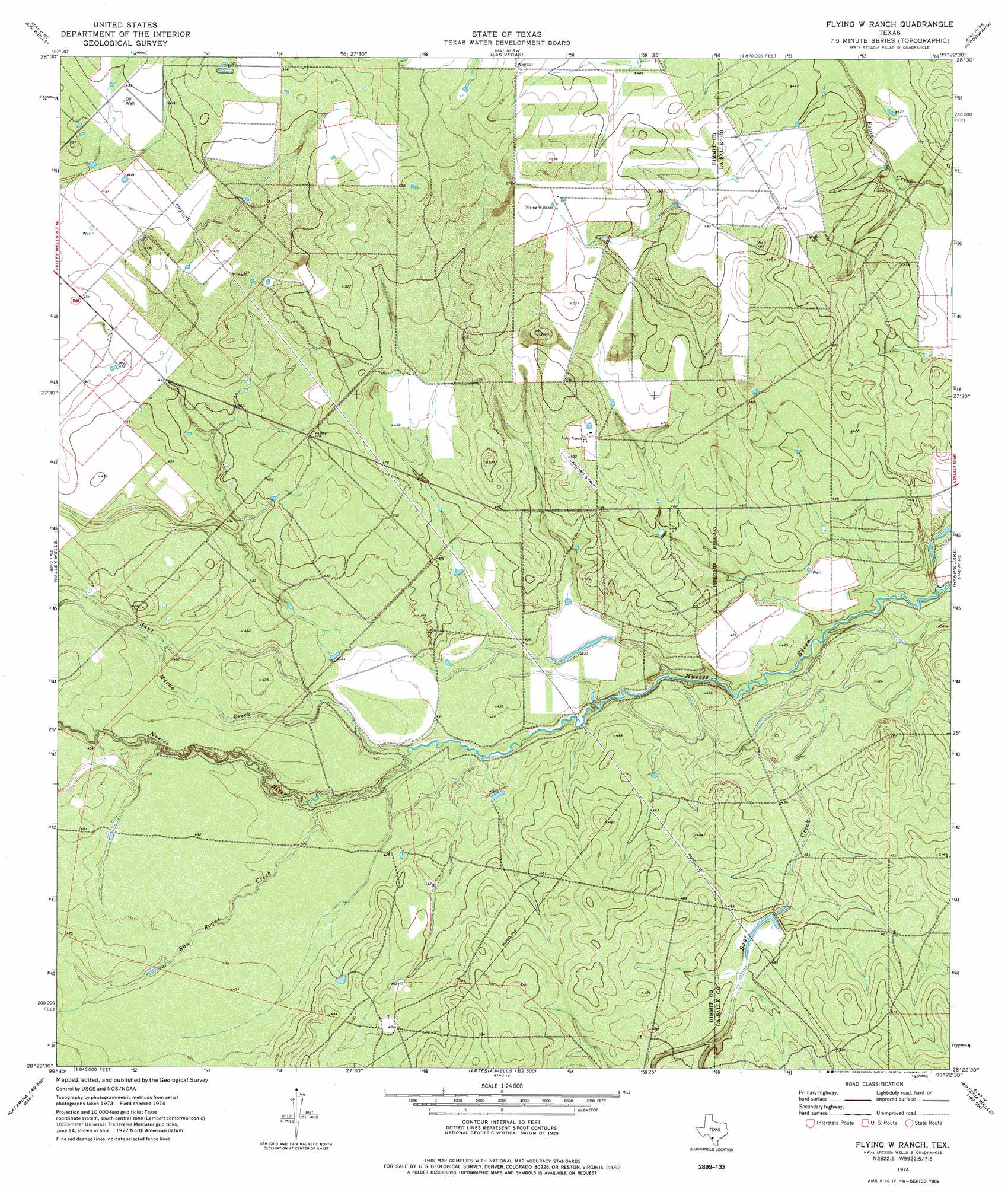
Flying W Ranch Topo Map Texas
To zoom in, hover over the map of Flying W Ranch
USGS Topo Quad 28099d4 - 1:24,000 scale
| Topo Map Name: | Flying W Ranch |
| USGS Topo Quad ID: | 28099d4 |
| Print Size: | ca. 21 1/4" wide x 27" high |
| Southeast Coordinates: | 28.375° N latitude / 99.375° W longitude |
| Map Center Coordinates: | 28.4375° N latitude / 99.4375° W longitude |
| U.S. State: | TX |
| Filename: | o28099d4.jpg |
| Download Map JPG Image: | Flying W Ranch topo map 1:24,000 scale |
| Map Type: | Topographic |
| Topo Series: | 7.5´ |
| Map Scale: | 1:24,000 |
| Source of Map Images: | United States Geological Survey (USGS) |
| Alternate Map Versions: |
Flying W Ranch TX 1974, updated 1977 Download PDF Buy paper map Flying W Ranch TX 2010 Download PDF Buy paper map Flying W Ranch TX 2013 Download PDF Buy paper map Flying W Ranch TX 2016 Download PDF Buy paper map |
1:24,000 Topo Quads surrounding Flying W Ranch
Woodard Lake |
Sugar Creek |
Snake Creek |
Woodward Ne |
Dilley |
Brundage |
Big Wells |
Las Vegas |
Woodward |
Millett |
Macdonald Lake |
Valley Wells |
Flying W Ranch |
Harris Lake |
Cotulla |
Dabney Tank |
Catarina |
Blocker Tank |
Artesia Wells |
Holland Dam |
Velenzuela Creek |
Piloncillo Hill |
Mesteno Creek North |
Atlee |
Caiman Creek Nw |
> Back to 28099a1 at 1:100,000 scale
> Back to 28098a1 at 1:250,000 scale
> Back to U.S. Topo Maps home
Flying W Ranch topo map: Gazetteer
Flying W Ranch: Dams
Ritchie Dam elevation 125m 410′Flying W Ranch: Reservoirs
Ritchie Reservoir elevation 125m 410′Flying W Ranch: Streams
Sage Creek elevation 131m 429′Sage Creek elevation 125m 410′
San Roque Creek elevation 128m 419′
Sauz Mocho Creek elevation 126m 413′
Flying W Ranch digital topo map on disk
Buy this Flying W Ranch topo map showing relief, roads, GPS coordinates and other geographical features, as a high-resolution digital map file on DVD: