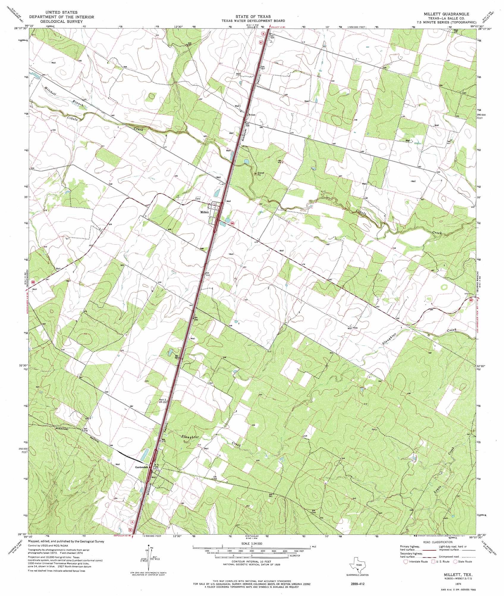
Millett Topo Map Texas
To zoom in, hover over the map of Millett
USGS Topo Quad 28099e2 - 1:24,000 scale
| Topo Map Name: | Millett |
| USGS Topo Quad ID: | 28099e2 |
| Print Size: | ca. 21 1/4" wide x 27" high |
| Southeast Coordinates: | 28.5° N latitude / 99.125° W longitude |
| Map Center Coordinates: | 28.5625° N latitude / 99.1875° W longitude |
| U.S. State: | TX |
| Filename: | o28099e2.jpg |
| Download Map JPG Image: | Millett topo map 1:24,000 scale |
| Map Type: | Topographic |
| Topo Series: | 7.5´ |
| Map Scale: | 1:24,000 |
| Source of Map Images: | United States Geological Survey (USGS) |
| Alternate Map Versions: |
Millett TX 1974, updated 1977 Download PDF Buy paper map Millett TX 2010 Download PDF Buy paper map Millett TX 2013 Download PDF Buy paper map Millett TX 2016 Download PDF Buy paper map |
1:24,000 Topo Quads surrounding Millett
West Ranch |
Divot |
Derby |
Pearsall South |
Keystone Ranch |
Snake Creek |
Woodward Ne |
Dilley |
Dilley Ne |
Las Flores |
Las Vegas |
Woodward |
Millett |
Burns Ranch |
Cayman Lake |
Flying W Ranch |
Harris Lake |
Cotulla |
Los Angeles |
Dull |
Blocker Tank |
Artesia Wells |
Holland Dam |
Charco Marrano Creek |
The White Kitchen |
> Back to 28099e1 at 1:100,000 scale
> Back to 28098a1 at 1:250,000 scale
> Back to U.S. Topo Maps home
Millett topo map: Gazetteer
Millett: Populated Places
Gardendale elevation 180m 590′Millett elevation 147m 482′
Millett: Streams
Mitchell Branch elevation 145m 475′Millett digital topo map on disk
Buy this Millett topo map showing relief, roads, GPS coordinates and other geographical features, as a high-resolution digital map file on DVD: