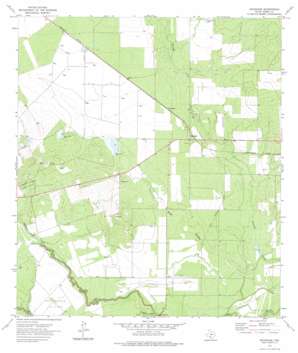
Brundage Topo Map Texas
To zoom in, hover over the map of Brundage
USGS Topo Quad 28099e6 - 1:24,000 scale
| Topo Map Name: | Brundage |
| USGS Topo Quad ID: | 28099e6 |
| Print Size: | ca. 21 1/4" wide x 27" high |
| Southeast Coordinates: | 28.5° N latitude / 99.625° W longitude |
| Map Center Coordinates: | 28.5625° N latitude / 99.6875° W longitude |
| U.S. State: | TX |
| Filename: | o28099e6.jpg |
| Download Map JPG Image: | Brundage topo map 1:24,000 scale |
| Map Type: | Topographic |
| Topo Series: | 7.5´ |
| Map Scale: | 1:24,000 |
| Source of Map Images: | United States Geological Survey (USGS) |
| Alternate Map Versions: |
Brundage TX 1972, updated 1975 Download PDF Buy paper map Brundage TX 2010 Download PDF Buy paper map Brundage TX 2013 Download PDF Buy paper map Brundage TX 2016 Download PDF Buy paper map |
1:24,000 Topo Quads surrounding Brundage
> Back to 28099e1 at 1:100,000 scale
> Back to 28098a1 at 1:250,000 scale
> Back to U.S. Topo Maps home
Brundage topo map: Gazetteer
Brundage: Airports
Quatro Ranch Airport elevation 154m 505′Brundage: Dams
Bermuda Dam elevation 156m 511′Reynolds and Wilson Lake Number 1 Dam elevation 171m 561′
Reynolds and Wilson Lake Number 2 Dam elevation 159m 521′
Reynolds-Wilson Lake Dam elevation 159m 521′
Brundage: Oilfields
East Thirteen Oil Field elevation 154m 505′Indian Mound Oil Field elevation 166m 544′
Brundage: Populated Places
Brundage elevation 163m 534′Brundage: Reservoirs
Bermuda Lake elevation 156m 511′Reynolds and Wilson Lake Number 1 elevation 171m 561′
Reynolds and Wilson Lake Number 2 elevation 159m 521′
Reynolds-Wilson Lake elevation 159m 521′
Brundage: Streams
El Barrosa Creek elevation 153m 501′Soldier Slough elevation 149m 488′
Brundage: Valleys
Stag Hollow elevation 146m 479′Brundage digital topo map on disk
Buy this Brundage topo map showing relief, roads, GPS coordinates and other geographical features, as a high-resolution digital map file on DVD:


