Dilley Topo Map Texas
To zoom in, hover over the map of Dilley
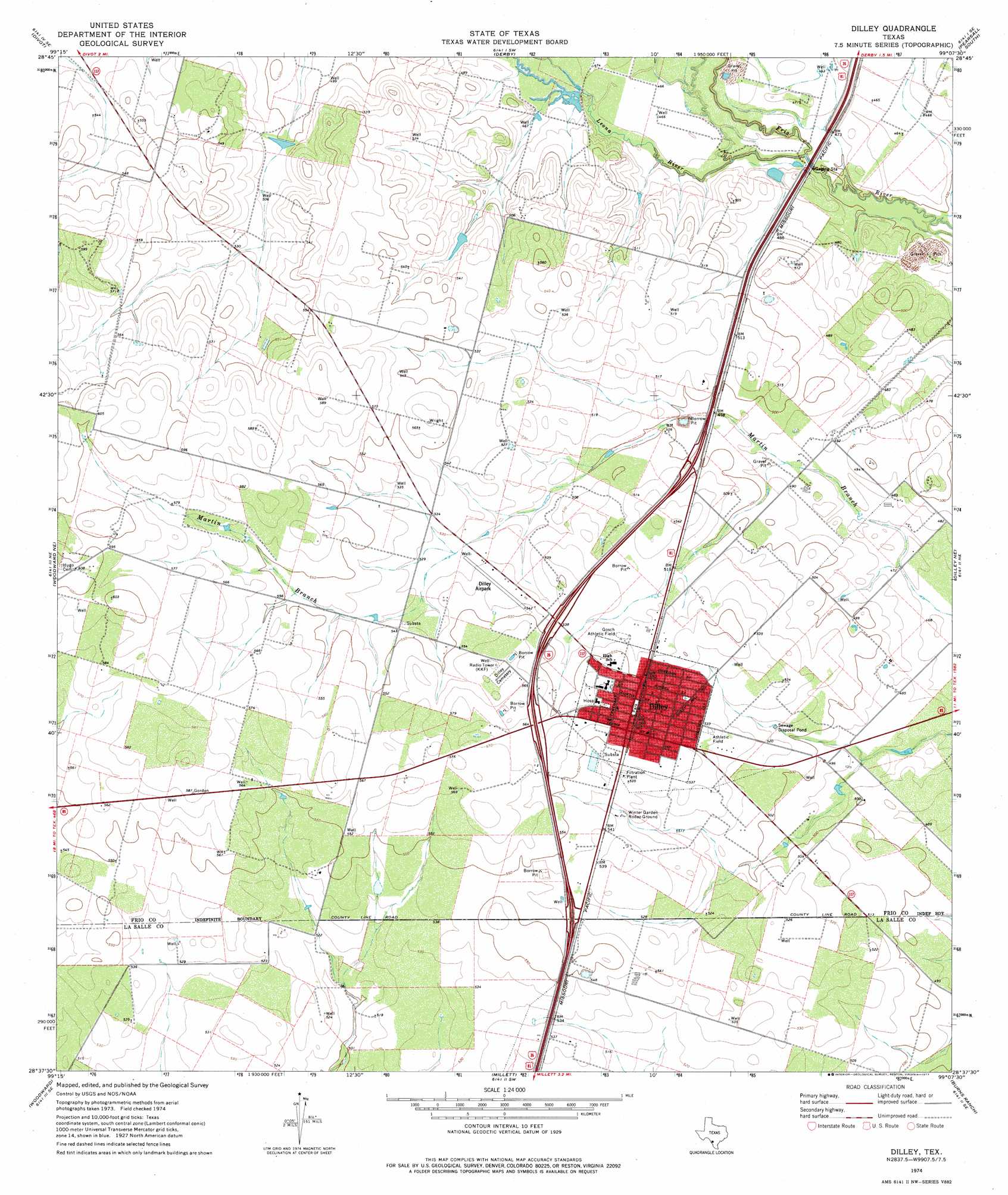
USGS Topo Quad 28099f2 - 1:24,000 scale
| Topo Map Name: | Dilley |
| USGS Topo Quad ID: | 28099f2 |
| Print Size: | ca. 21 1/4" wide x 27" high |
| Southeast Coordinates: | 28.625° N latitude / 99.125° W longitude |
| Map Center Coordinates: | 28.6875° N latitude / 99.1875° W longitude |
| U.S. State: | TX |
| Filename: | o28099f2.jpg |
| Download Map JPG Image: | Dilley topo map 1:24,000 scale |
| Map Type: | Topographic |
| Topo Series: | 7.5´ |
| Map Scale: | 1:24,000 |
| Source of Map Images: | United States Geological Survey (USGS) |
| Alternate Map Versions: |
Dilley TX 1974, updated 1977 Download PDF Buy paper map Dilley TX 2010 Download PDF Buy paper map Dilley TX 2013 Download PDF Buy paper map Dilley TX 2016 Download PDF Buy paper map |
1:24,000 Topo Quads surrounding Dilley
Johnnie Little Hill |
Holcomb Reservoir |
Halff Ranch |
Pearsall North |
Schattel Nw |
West Ranch |
Divot |
Derby |
Pearsall South |
Keystone Ranch |
Snake Creek |
Woodward Ne |
Dilley |
Dilley Ne |
Las Flores |
Las Vegas |
Woodward |
Millett |
Burns Ranch |
Cayman Lake |
Flying W Ranch |
Harris Lake |
Cotulla |
Los Angeles |
Dull |
> Back to 28099e1 at 1:100,000 scale
> Back to 28098a1 at 1:250,000 scale
> Back to U.S. Topo Maps home
Dilley topo map: Gazetteer
Dilley: Airports
Dilley Airpark elevation 164m 538′Dilley: Dams
Derby Dam elevation 147m 482′Dilley: Parks
Dilley City Park elevation 163m 534′Gosch Athletic Field elevation 164m 538′
Dilley: Populated Places
Dilley elevation 171m 561′Hilltop elevation 159m 521′
Hilltop Colonia elevation 158m 518′
Dilley: Reservoirs
Bennett Reservoir elevation 147m 482′Dilley: Streams
Leona River elevation 137m 449′Dilley digital topo map on disk
Buy this Dilley topo map showing relief, roads, GPS coordinates and other geographical features, as a high-resolution digital map file on DVD: