La Pryor Se Topo Map Texas
To zoom in, hover over the map of La Pryor Se
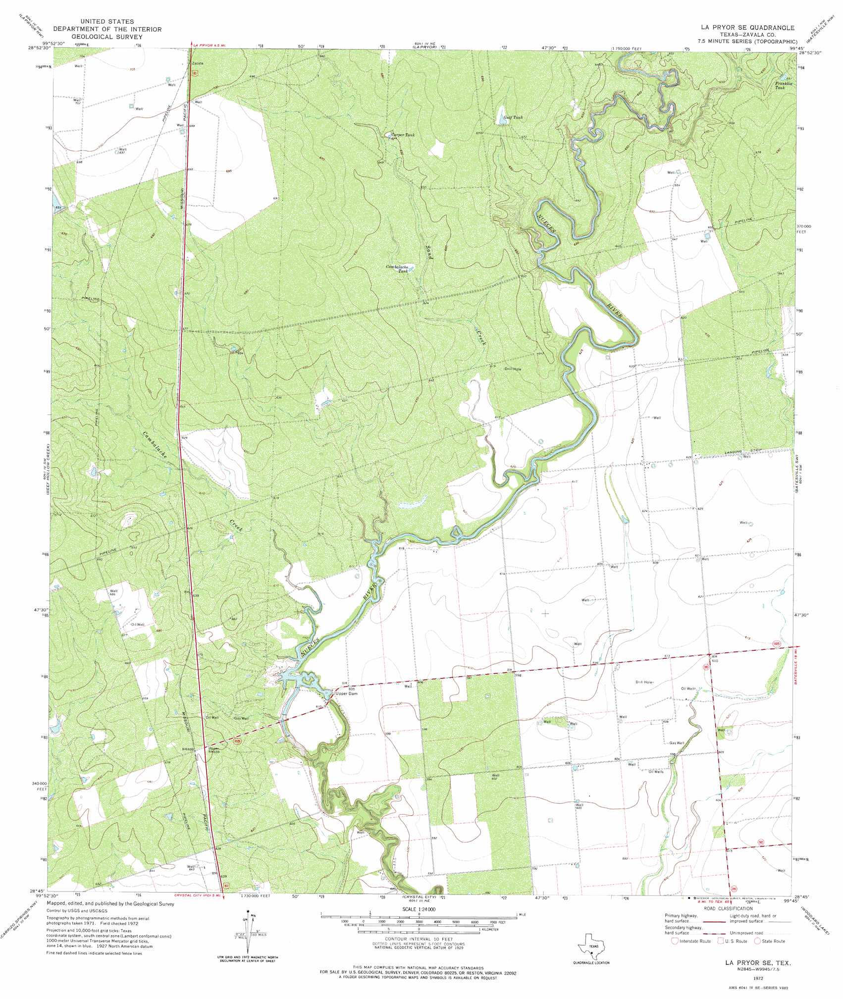
USGS Topo Quad 28099g7 - 1:24,000 scale
| Topo Map Name: | La Pryor Se |
| USGS Topo Quad ID: | 28099g7 |
| Print Size: | ca. 21 1/4" wide x 27" high |
| Southeast Coordinates: | 28.75° N latitude / 99.75° W longitude |
| Map Center Coordinates: | 28.8125° N latitude / 99.8125° W longitude |
| U.S. State: | TX |
| Filename: | o28099g7.jpg |
| Download Map JPG Image: | La Pryor Se topo map 1:24,000 scale |
| Map Type: | Topographic |
| Topo Series: | 7.5´ |
| Map Scale: | 1:24,000 |
| Source of Map Images: | United States Geological Survey (USGS) |
| Alternate Map Versions: |
La Pryor SE TX 1972, updated 1974 Download PDF Buy paper map La Pryor SE TX 2010 Download PDF Buy paper map La Pryor SE TX 2013 Download PDF Buy paper map La Pryor SE TX 2016 Download PDF Buy paper map |
1:24,000 Topo Quads surrounding La Pryor Se
Olmos Creek |
Sand Mountain |
Pulliam Ranch |
Batesville Hill |
Lone Tree Hill |
Chacon Creek Ne |
La Pryor Nw |
La Pryor |
Batesville Nw |
Batesville |
Chacon Creek Se |
Beef Hollow Creek |
La Pryor Se |
Batesville Sw |
Loma Vista |
Cometa |
Carrizo Springs Nw |
Crystal City |
Woodard Lake |
Sugar Creek |
Cayetano Creek |
Carrizo Springs West |
Carrizo Springs East |
Brundage |
Big Wells |
> Back to 28099e1 at 1:100,000 scale
> Back to 28098a1 at 1:250,000 scale
> Back to U.S. Topo Maps home
La Pryor Se topo map: Gazetteer
La Pryor Se: Airports
H and F Properties Airport elevation 191m 626′La Pryor Se: Dams
T C Stricklin Lake Dam elevation 201m 659′Upper Dam elevation 186m 610′
Upper Lake Dam elevation 185m 606′
La Pryor Se: Populated Places
Nueces Campsite Lots Colonia elevation 186m 610′La Pryor Se: Reservoirs
Cambalache Tank elevation 194m 636′Carper Tank elevation 198m 649′
Franklin Tank elevation 198m 649′
Gulf Tank elevation 204m 669′
T C Stricklin Lake elevation 201m 659′
Upper Lake elevation 185m 606′
La Pryor Se: Streams
Cambalache Creek elevation 183m 600′Sand Creek elevation 181m 593′
La Pryor Se digital topo map on disk
Buy this La Pryor Se topo map showing relief, roads, GPS coordinates and other geographical features, as a high-resolution digital map file on DVD: