Holcomb Reservoir Topo Map Texas
To zoom in, hover over the map of Holcomb Reservoir
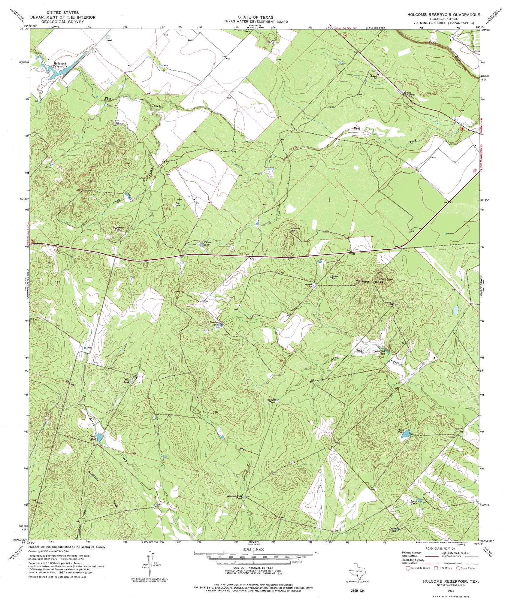
USGS Topo Quad 28099h3 - 1:24,000 scale
| Topo Map Name: | Holcomb Reservoir |
| USGS Topo Quad ID: | 28099h3 |
| Print Size: | ca. 21 1/4" wide x 27" high |
| Southeast Coordinates: | 28.875° N latitude / 99.25° W longitude |
| Map Center Coordinates: | 28.9375° N latitude / 99.3125° W longitude |
| U.S. State: | TX |
| Filename: | o28099h3.jpg |
| Download Map JPG Image: | Holcomb Reservoir topo map 1:24,000 scale |
| Map Type: | Topographic |
| Topo Series: | 7.5´ |
| Map Scale: | 1:24,000 |
| Source of Map Images: | United States Geological Survey (USGS) |
| Alternate Map Versions: |
Holcomb Reservoir TX 1974, updated 1977 Download PDF Buy paper map Holcomb Reservoir TX 2010 Download PDF Buy paper map Holcomb Reservoir TX 2013 Download PDF Buy paper map Holcomb Reservoir TX 2016 Download PDF Buy paper map |
1:24,000 Topo Quads surrounding Holcomb Reservoir
Garner Field Ne |
Irishman Hill |
Frio Town Ne |
Yancey |
Biry |
Lone Tree Hill |
Gross Tank |
Frio Town |
Wilson Ranch |
Moore |
Batesville |
Johnnie Little Hill |
Holcomb Reservoir |
Halff Ranch |
Pearsall North |
Loma Vista |
West Ranch |
Divot |
Derby |
Pearsall South |
Sugar Creek |
Snake Creek |
Woodward Ne |
Dilley |
Dilley Ne |
> Back to 28099e1 at 1:100,000 scale
> Back to 28098a1 at 1:250,000 scale
> Back to U.S. Topo Maps home
Holcomb Reservoir topo map: Gazetteer
Holcomb Reservoir: Dams
Holcomb Reservoir Dam elevation 196m 643′Holcomb Reservoir: Reservoirs
Devils Tank elevation 206m 675′English Hills Tank elevation 196m 643′
Fish Tank elevation 188m 616′
Garden Tank elevation 214m 702′
Hill Tank elevation 224m 734′
Holcomb Reservoir elevation 198m 649′
Leona Tank elevation 204m 669′
Live Oak Tank elevation 182m 597′
Llave Tank elevation 189m 620′
Tutiga Tank elevation 200m 656′
Willow Tank elevation 205m 672′
Holcomb Reservoir: Streams
Jack Creek elevation 189m 620′Holcomb Reservoir: Summits
English Hills elevation 215m 705′Pilot Knob elevation 233m 764′
Holcomb Reservoir digital topo map on disk
Buy this Holcomb Reservoir topo map showing relief, roads, GPS coordinates and other geographical features, as a high-resolution digital map file on DVD: