Indio Creek Topo Map Texas
To zoom in, hover over the map of Indio Creek
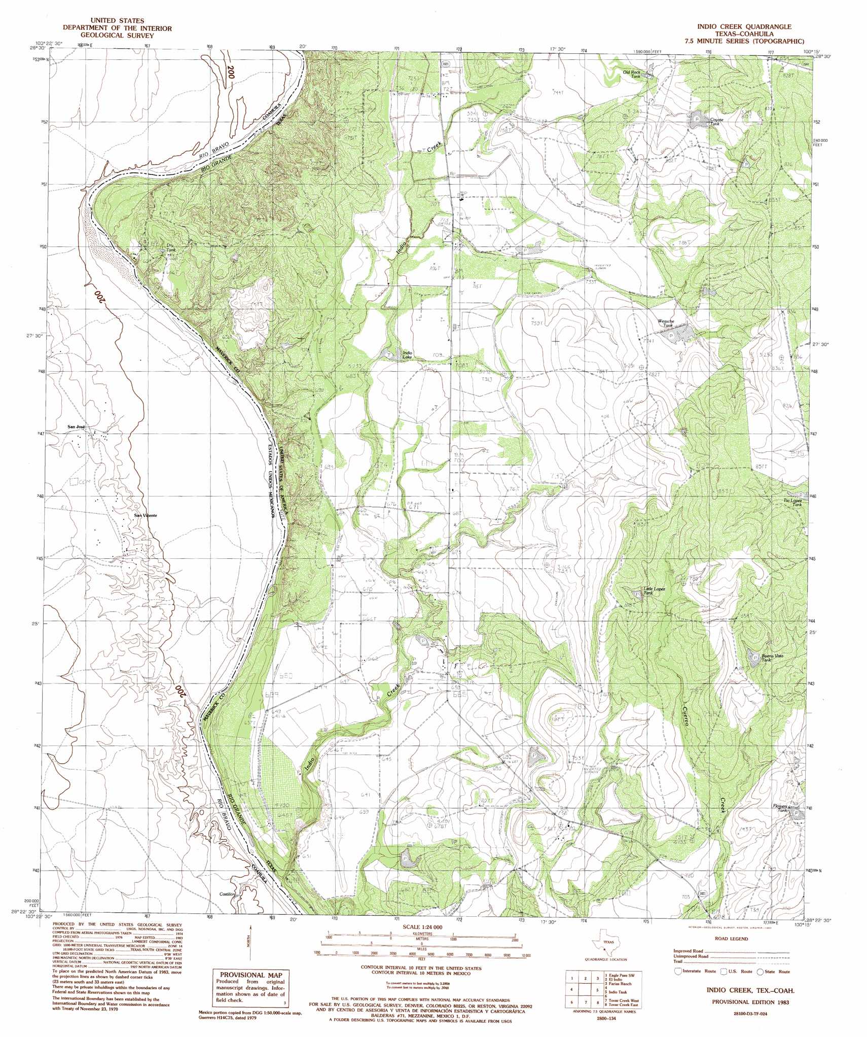
USGS Topo Quad 28100d3 - 1:24,000 scale
| Topo Map Name: | Indio Creek |
| USGS Topo Quad ID: | 28100d3 |
| Print Size: | ca. 21 1/4" wide x 27" high |
| Southeast Coordinates: | 28.375° N latitude / 100.25° W longitude |
| Map Center Coordinates: | 28.4375° N latitude / 100.3125° W longitude |
| U.S. State: | TX |
| Filename: | o28100d3.jpg |
| Download Map JPG Image: | Indio Creek topo map 1:24,000 scale |
| Map Type: | Topographic |
| Topo Series: | 7.5´ |
| Map Scale: | 1:24,000 |
| Source of Map Images: | United States Geological Survey (USGS) |
| Alternate Map Versions: |
Indio Creek TX 1983, updated 1983 Download PDF Buy paper map Indio Creek TX 2010 Download PDF Buy paper map Indio Creek TX 2012 Download PDF Buy paper map Indio Creek TX 2016 Download PDF Buy paper map |
1:24,000 Topo Quads surrounding Indio Creek
Eagle Pass West |
Eagle Pass East |
Eagle Pass Ne |
Sacatosa Tank |
Cometa |
Eagle Pass Sw |
El Indio |
Farias Ranch |
Cayetano Creek |
|
Indio Creek |
Indio Tank |
Palo Blanco Tank |
||
Tovar Creek West |
Tovar Creek East |
San Pedro Creek |
||
San Ambrosia Creek 3 Ne |
Salt Well |
Chupadera Creek |
> Back to 28100a1 at 1:100,000 scale
> Back to 28100a1 at 1:250,000 scale
> Back to U.S. Topo Maps home
Indio Creek topo map: Gazetteer
Indio Creek: Canals
Mav Company elevation 223m 731′Indio Creek: Lakes
Indio Lake elevation 210m 688′Indio Creek: Streams
Indio Creek elevation 184m 603′Indio Creek digital topo map on disk
Buy this Indio Creek topo map showing relief, roads, GPS coordinates and other geographical features, as a high-resolution digital map file on DVD: