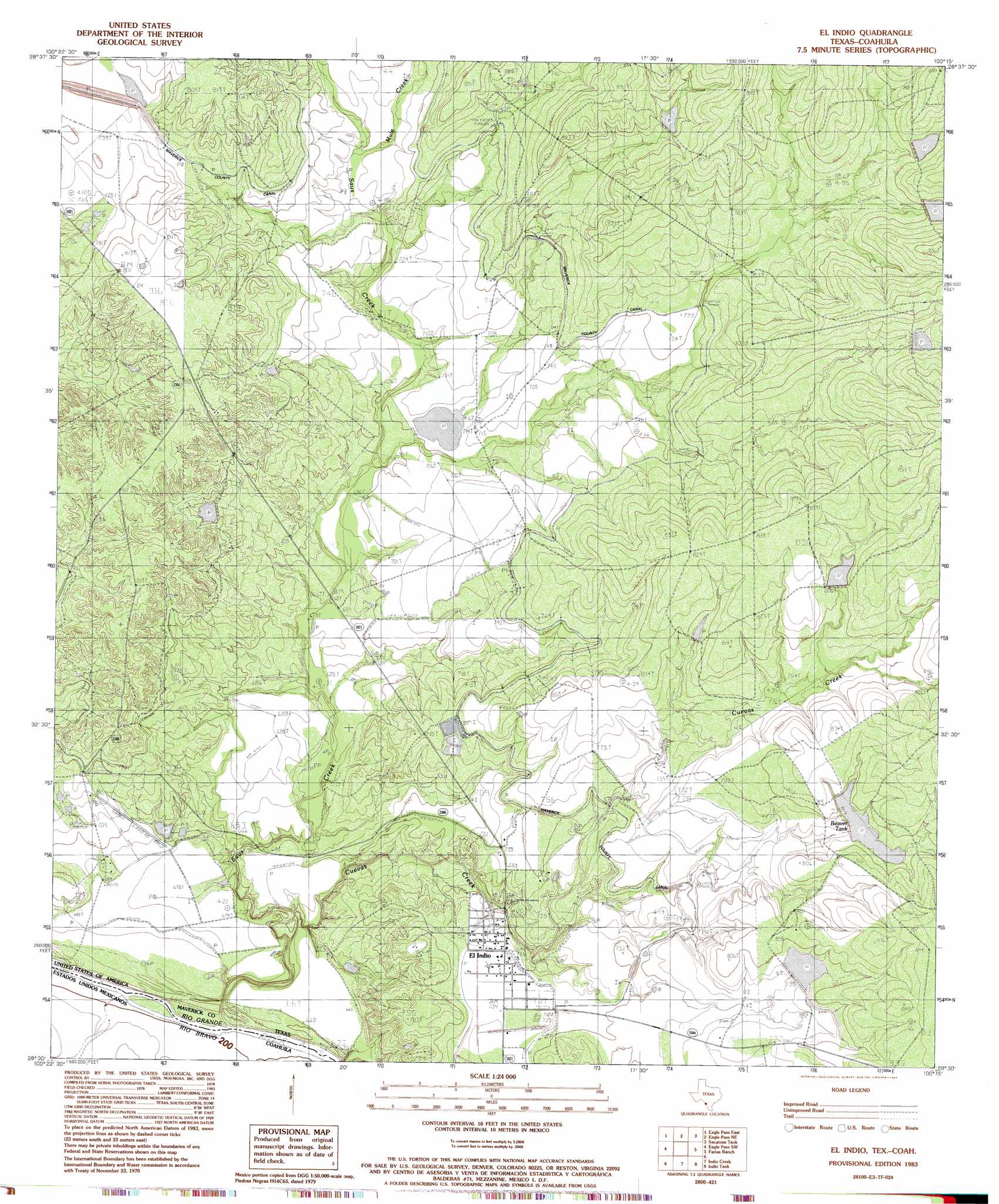
El Indio Topo Map Texas
To zoom in, hover over the map of El Indio
USGS Topo Quad 28100e3 - 1:24,000 scale
| Topo Map Name: | El Indio |
| USGS Topo Quad ID: | 28100e3 |
| Print Size: | ca. 21 1/4" wide x 27" high |
| Southeast Coordinates: | 28.5° N latitude / 100.25° W longitude |
| Map Center Coordinates: | 28.5625° N latitude / 100.3125° W longitude |
| U.S. State: | TX |
| Filename: | o28100e3.jpg |
| Download Map JPG Image: | El Indio topo map 1:24,000 scale |
| Map Type: | Topographic |
| Topo Series: | 7.5´ |
| Map Scale: | 1:24,000 |
| Source of Map Images: | United States Geological Survey (USGS) |
| Alternate Map Versions: |
El Indio TX 1983, updated 1983 Download PDF Buy paper map El Indio TX 2010 Download PDF Buy paper map El Indio TX 2012 Download PDF Buy paper map El Indio TX 2016 Download PDF Buy paper map |
1:24,000 Topo Quads surrounding El Indio
Quemado Se |
Deadmans Hill |
Indian Tank |
Chacon Creek Sw |
Chacon Creek Se |
Eagle Pass West |
Eagle Pass East |
Eagle Pass Ne |
Sacatosa Tank |
Cometa |
Eagle Pass Sw |
El Indio |
Farias Ranch |
Cayetano Creek |
|
Indio Creek |
Indio Tank |
Palo Blanco Tank |
||
Tovar Creek West |
Tovar Creek East |
San Pedro Creek |
> Back to 28100e1 at 1:100,000 scale
> Back to 28100a1 at 1:250,000 scale
> Back to U.S. Topo Maps home
El Indio topo map: Gazetteer
El Indio: Dams
Halsell Lake Number 2 Dam elevation 244m 800′Winship Lake Number 2 Dam elevation 241m 790′
El Indio: Populated Places
El Indio elevation 224m 734′El Indio: Reservoirs
Beaver Tank elevation 241m 790′Halsell Lake Number 2 elevation 244m 800′
Winship Lake Number 2 elevation 241m 790′
El Indio: Streams
Cuevas Creek elevation 195m 639′Mule Creek elevation 222m 728′
Saus Creek elevation 193m 633′
El Indio digital topo map on disk
Buy this El Indio topo map showing relief, roads, GPS coordinates and other geographical features, as a high-resolution digital map file on DVD: