Chacon Creek Ne Topo Map Texas
To zoom in, hover over the map of Chacon Creek Ne
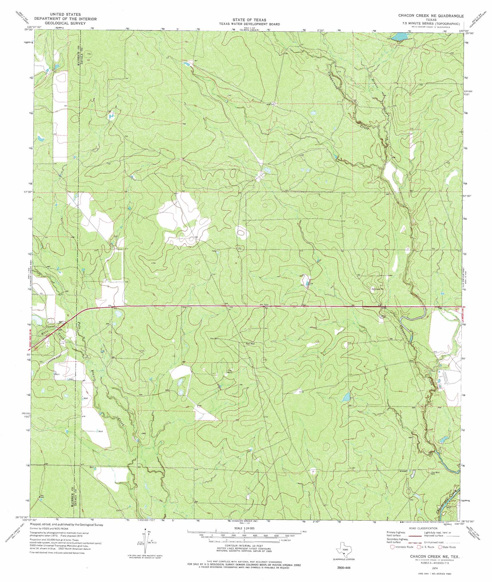
USGS Topo Quad 28100h1 - 1:24,000 scale
| Topo Map Name: | Chacon Creek Ne |
| USGS Topo Quad ID: | 28100h1 |
| Print Size: | ca. 21 1/4" wide x 27" high |
| Southeast Coordinates: | 28.875° N latitude / 100° W longitude |
| Map Center Coordinates: | 28.9375° N latitude / 100.0625° W longitude |
| U.S. State: | TX |
| Filename: | o28100h1.jpg |
| Download Map JPG Image: | Chacon Creek Ne topo map 1:24,000 scale |
| Map Type: | Topographic |
| Topo Series: | 7.5´ |
| Map Scale: | 1:24,000 |
| Source of Map Images: | United States Geological Survey (USGS) |
| Alternate Map Versions: |
Chacon Creek NE TX 1974, updated 1977 Download PDF Buy paper map Chacon Creek NE TX 2010 Download PDF Buy paper map Chacon Creek NE TX 2012 Download PDF Buy paper map Chacon Creek NE TX 2016 Download PDF Buy paper map |
1:24,000 Topo Quads surrounding Chacon Creek Ne
Anacacho |
Odlaw |
Cline |
Hacienda |
Uvalde |
Peloncillo Peak |
Goofy Lake |
Olmos Creek |
Sand Mountain |
Pulliam Ranch |
Trosado Tank |
Chacon Creek Nw |
Chacon Creek Ne |
La Pryor Nw |
La Pryor |
Indian Tank |
Chacon Creek Sw |
Chacon Creek Se |
Beef Hollow Creek |
La Pryor Se |
Eagle Pass Ne |
Sacatosa Tank |
Cometa |
Carrizo Springs Nw |
Crystal City |
> Back to 28100e1 at 1:100,000 scale
> Back to 28100a1 at 1:250,000 scale
> Back to U.S. Topo Maps home
Chacon Creek Ne topo map: Gazetteer
Chacon Creek Ne: Dams
Finley Lake Dam elevation 212m 695′Griffin Cattle Company Lake Dam elevation 221m 725′
Chacon Creek Ne: Reservoirs
Finley Lake elevation 212m 695′Griffin Cattle Company Lake elevation 221m 725′
Chacon Creek Ne: Streams
Dinner Creek elevation 209m 685′Mula Creek elevation 207m 679′
Chacon Creek Ne digital topo map on disk
Buy this Chacon Creek Ne topo map showing relief, roads, GPS coordinates and other geographical features, as a high-resolution digital map file on DVD: