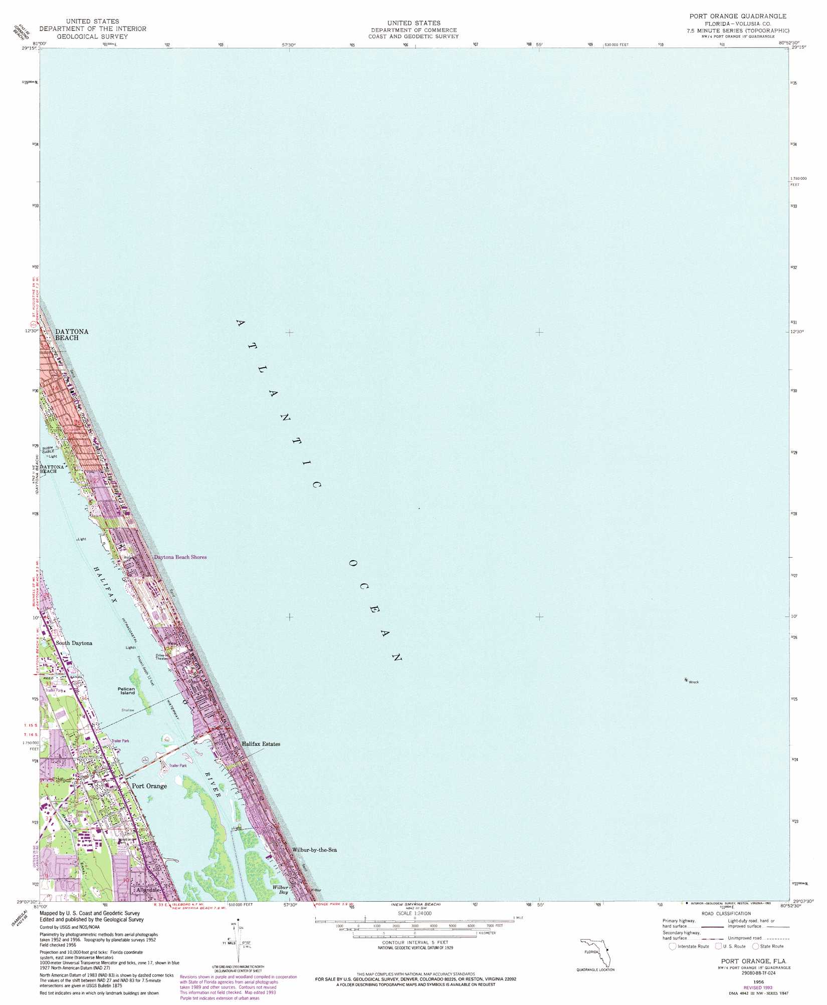
Port Orange Topo Map Florida
To zoom in, hover over the map of Port Orange
USGS Topo Quad 29080b8 - 1:24,000 scale
| Topo Map Name: | Port Orange |
| USGS Topo Quad ID: | 29080b8 |
| Print Size: | ca. 21 1/4" wide x 27" high |
| Southeast Coordinates: | 29.125° N latitude / 80.875° W longitude |
| Map Center Coordinates: | 29.1875° N latitude / 80.9375° W longitude |
| U.S. State: | FL |
| Filename: | O29080B8.jpg |
| Download Map JPG Image: | Port Orange topo map 1:24,000 scale |
| Map Type: | Topographic |
| Topo Series: | 7.5´ |
| Map Scale: | 1:24,000 |
| Source of Map Images: | United States Geological Survey (USGS) |
| Alternate Map Versions: |
Port Orange FL 1956, updated 1960 Download PDF Buy paper map Port Orange FL 1956, updated 1971 Download PDF Buy paper map Port Orange FL 1956, updated 1972 Download PDF Buy paper map Port Orange FL 1956, updated 1993 Download PDF Buy paper map Port Orange FL 2012 Download PDF Buy paper map Port Orange FL 2015 Download PDF Buy paper map |
1:24,000 Topo Quads surrounding Port Orange
Flagler Beach West |
Flagler Beach East |
|||
Favoretta |
Ormond Beach |
|||
Daytona Beach Nw |
Daytona Beach |
Port Orange |
||
Daytona Beach Sw |
Samsula |
New Smyrna Beach |
||
Lake Helen |
Lake Ashby |
Edgewater |
Ariel |
> Back to 29080a1 at 1:100,000 scale
> Back to 29080a1 at 1:250,000 scale
> Back to U.S. Topo Maps home
Port Orange topo map: Gazetteer
Port Orange: Islands
Pelican Island elevation 0m 0′Port Orange: Populated Places
Blue Skies Mobile Home Village elevation 0m 0′Daytona Beach Shores elevation 5m 16′
Halifax Estates elevation 6m 19′
Halifax Trailer Park elevation 0m 0′
Port Orange elevation 2m 6′
Suwannee Mobile Home Park elevation 3m 9′
Tanglewood Mobile Estates elevation 3m 9′
Waters Edge Mobile Home Park elevation 2m 6′
Wilbur-by-the-Sea elevation 7m 22′
Port Orange: Post Offices
Port Orange Post Office elevation 2m 6′Wilbur-By-The-Sea Post Office (historical) elevation 7m 22′
Port Orange digital topo map on disk
Buy this Port Orange topo map showing relief, roads, GPS coordinates and other geographical features, as a high-resolution digital map file on DVD: