Juniper Springs Topo Map Florida
To zoom in, hover over the map of Juniper Springs
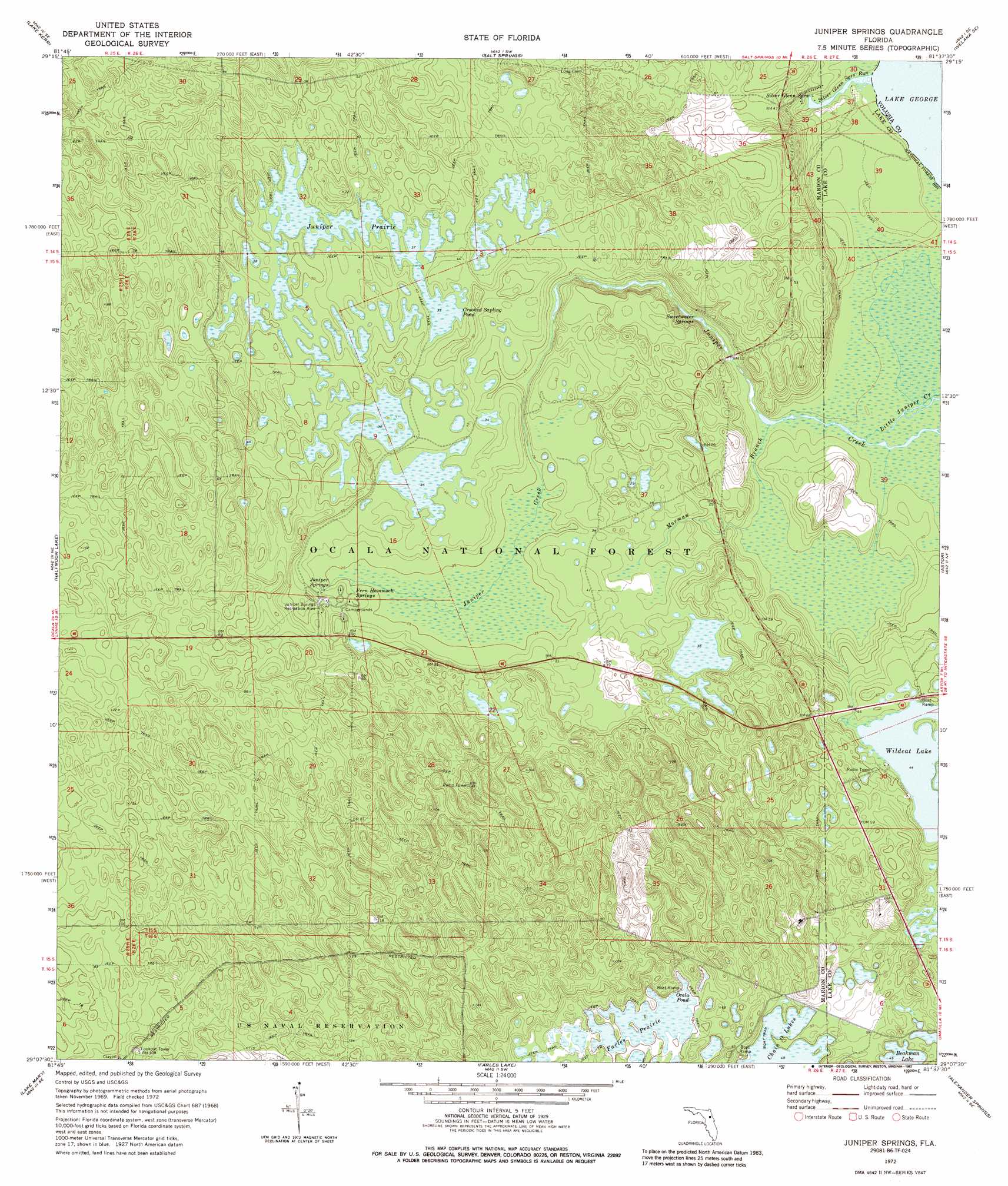
USGS Topo Quad 29081b6 - 1:24,000 scale
| Topo Map Name: | Juniper Springs |
| USGS Topo Quad ID: | 29081b6 |
| Print Size: | ca. 21 1/4" wide x 27" high |
| Southeast Coordinates: | 29.125° N latitude / 81.625° W longitude |
| Map Center Coordinates: | 29.1875° N latitude / 81.6875° W longitude |
| U.S. State: | FL |
| Filename: | O29081B6.jpg |
| Download Map JPG Image: | Juniper Springs topo map 1:24,000 scale |
| Map Type: | Topographic |
| Topo Series: | 7.5´ |
| Map Scale: | 1:24,000 |
| Source of Map Images: | United States Geological Survey (USGS) |
| Alternate Map Versions: |
Juniper Springs FL 1972, updated 1973 Download PDF Buy paper map Juniper Springs FL 1972, updated 1987 Download PDF Buy paper map Juniper Springs FL 2012 Download PDF Buy paper map Juniper Springs FL 2015 Download PDF Buy paper map |
| FStopo: | US Forest Service topo Juniper Springs is available: Download FStopo PDF Download FStopo TIF |
1:24,000 Topo Quads surrounding Juniper Springs
Eureka Dam |
Lake Delancy |
Welaka |
Crescent City |
Saint Johns Park |
Fort Mccoy |
Lake Kerr |
Salt Springs |
Welaka Se |
Seville |
Lynne |
Halfmoon Lake |
Juniper Springs |
Astor |
Pierson |
Lake Weir |
Lake Mary |
Farles Lake |
Alexander Springs |
Lake Woodruff |
Lady Lake |
Emeralda Island |
Umatilla |
Paisley |
Pine Lakes |
> Back to 29081a1 at 1:100,000 scale
> Back to 29080a1 at 1:250,000 scale
> Back to U.S. Topo Maps home
Juniper Springs topo map: Gazetteer
Juniper Springs: Flats
Juniper Prairie elevation 10m 32′Juniper Springs: Islands
Pats Island elevation 16m 52′Juniper Springs: Lakes
Crooked Sapling Pond elevation 10m 32′Ocala Pond elevation 14m 45′
Wildcat Lake elevation 13m 42′
Juniper Springs: Parks
Juniper Springs Recreation Area elevation 12m 39′Silver Glen Springs Recreation Area elevation 6m 19′
Juniper Springs: Springs
Fern Hammock Springs elevation 9m 29′Juniper Springs elevation 9m 29′
Silver Glen Springs elevation 2m 6′
Sweetwater Springs elevation 4m 13′
Juniper Springs: Streams
Morman Branch elevation 1m 3′Silver Glen Springs Run elevation 0m 0′
Juniper Springs: Trails
Ocala National Recreation Trail elevation 12m 39′Juniper Springs digital topo map on disk
Buy this Juniper Springs topo map showing relief, roads, GPS coordinates and other geographical features, as a high-resolution digital map file on DVD: