Favoretta Topo Map Florida
To zoom in, hover over the map of Favoretta
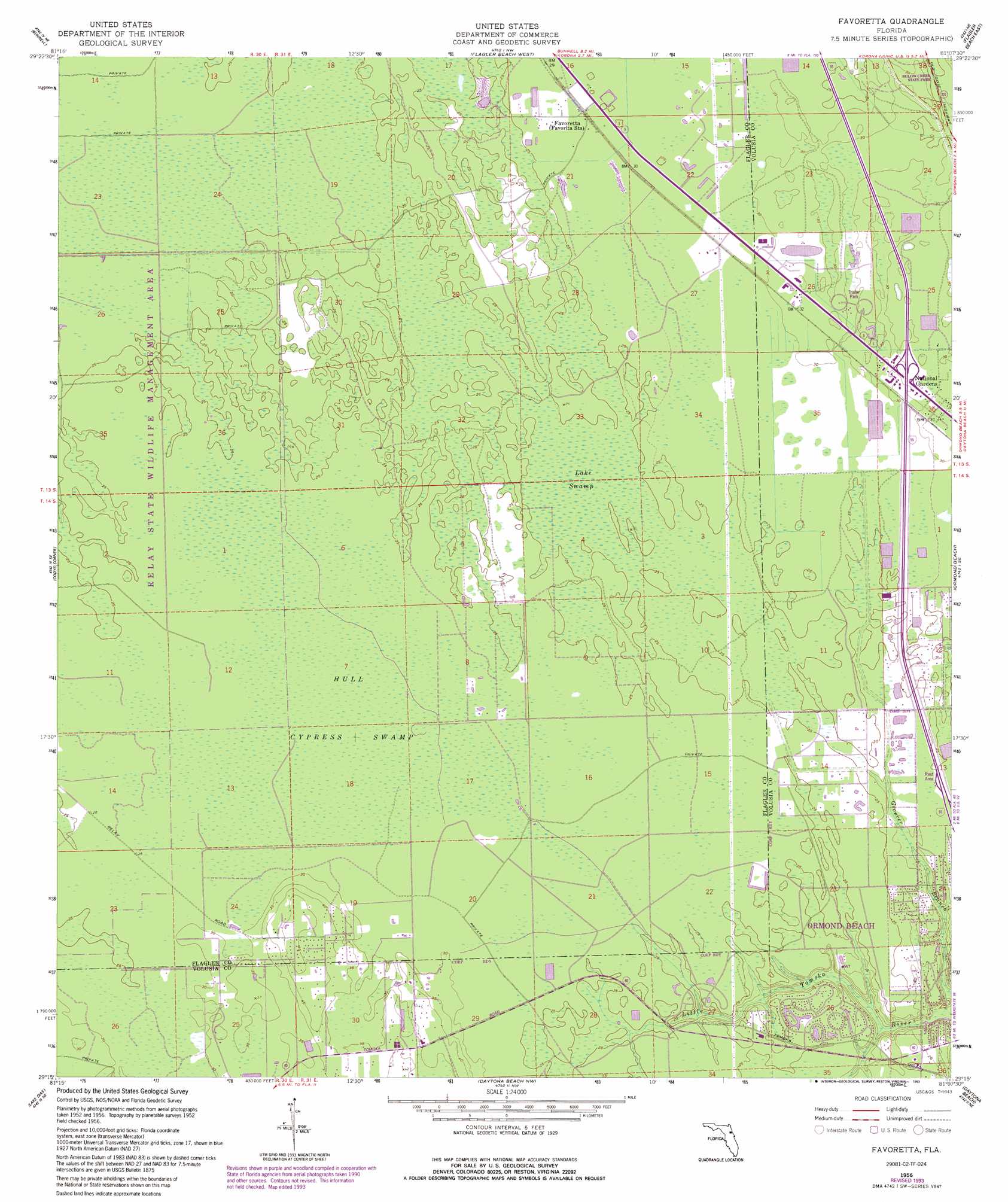
USGS Topo Quad 29081c2 - 1:24,000 scale
| Topo Map Name: | Favoretta |
| USGS Topo Quad ID: | 29081c2 |
| Print Size: | ca. 21 1/4" wide x 27" high |
| Southeast Coordinates: | 29.25° N latitude / 81.125° W longitude |
| Map Center Coordinates: | 29.3125° N latitude / 81.1875° W longitude |
| U.S. State: | FL |
| Filename: | O29081C2.jpg |
| Download Map JPG Image: | Favoretta topo map 1:24,000 scale |
| Map Type: | Topographic |
| Topo Series: | 7.5´ |
| Map Scale: | 1:24,000 |
| Source of Map Images: | United States Geological Survey (USGS) |
| Alternate Map Versions: |
Favoretta FL 1956, updated 1960 Download PDF Buy paper map Favoretta FL 1956, updated 1972 Download PDF Buy paper map Favoretta FL 1956, updated 1980 Download PDF Buy paper map Favoretta FL 1956, updated 1988 Download PDF Buy paper map Favoretta FL 1956, updated 1993 Download PDF Buy paper map Favoretta FL 2012 Download PDF Buy paper map Favoretta FL 2015 Download PDF Buy paper map |
1:24,000 Topo Quads surrounding Favoretta
Dinner Island |
Espanola |
Beverly Beach |
||
Saint Johns Park |
Bunnell |
Flagler Beach West |
Flagler Beach East |
|
Seville |
Codys Corner |
Favoretta |
Ormond Beach |
|
Pierson |
Lake Dias |
Daytona Beach Nw |
Daytona Beach |
Port Orange |
Lake Woodruff |
De Land |
Daytona Beach Sw |
Samsula |
New Smyrna Beach |
> Back to 29081a1 at 1:100,000 scale
> Back to 29080a1 at 1:250,000 scale
> Back to U.S. Topo Maps home
Favoretta topo map: Gazetteer
Favoretta: Airports
Big 'G' Airport elevation 9m 29′Dan Rice Airport elevation 12m 39′
Favoretta: Lakes
Lake Swamp elevation 7m 22′Favoretta: Populated Places
Favoretta elevation 9m 29′National Gardens elevation 9m 29′
Favoretta: Swamps
Hull Cypress Swamp elevation 8m 26′Favoretta digital topo map on disk
Buy this Favoretta topo map showing relief, roads, GPS coordinates and other geographical features, as a high-resolution digital map file on DVD: