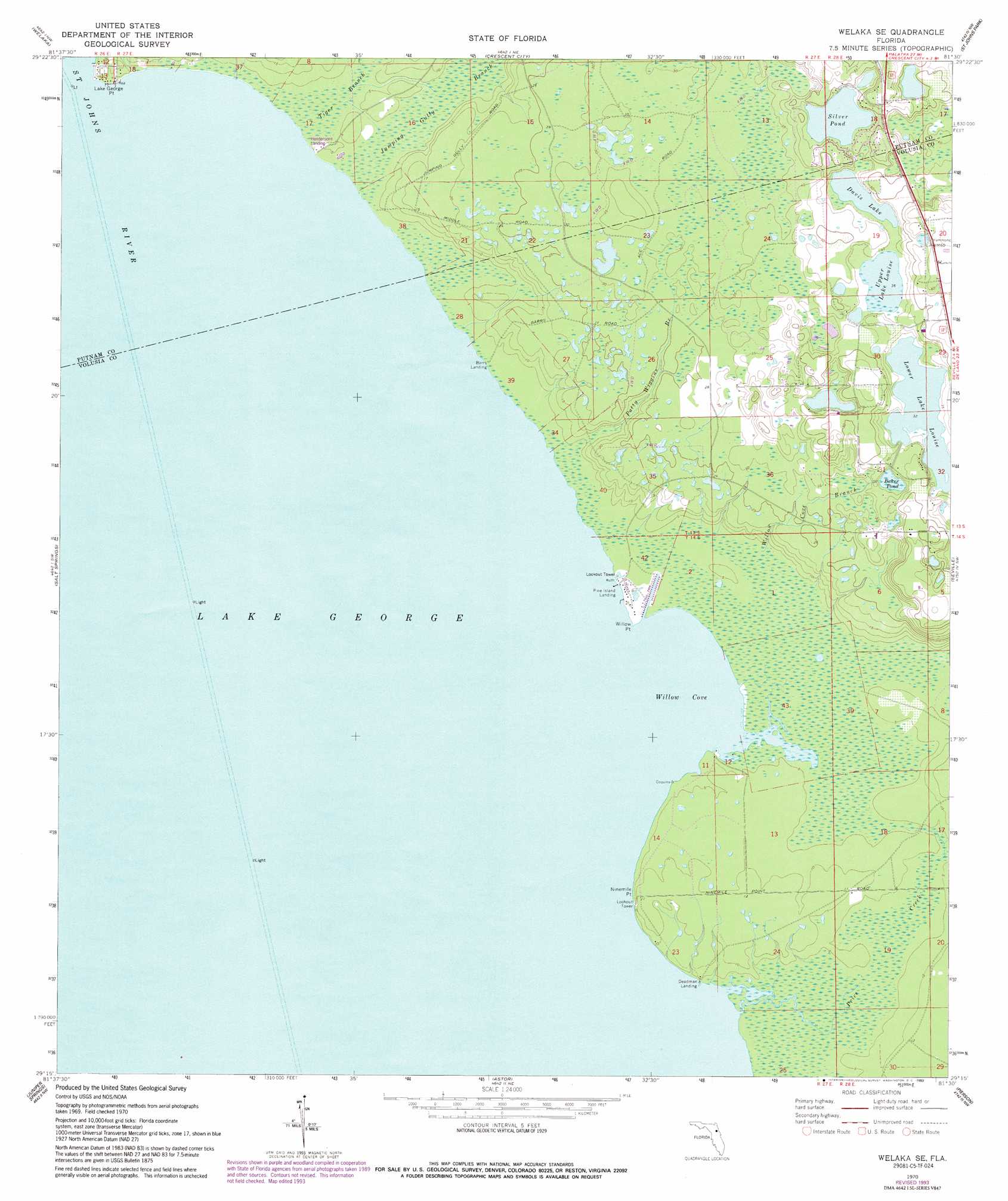
Welaka Se Topo Map Florida
To zoom in, hover over the map of Welaka Se
USGS Topo Quad 29081c5 - 1:24,000 scale
| Topo Map Name: | Welaka Se |
| USGS Topo Quad ID: | 29081c5 |
| Print Size: | ca. 21 1/4" wide x 27" high |
| Southeast Coordinates: | 29.25° N latitude / 81.5° W longitude |
| Map Center Coordinates: | 29.3125° N latitude / 81.5625° W longitude |
| U.S. State: | FL |
| Filename: | O29081C5.jpg |
| Download Map JPG Image: | Welaka Se topo map 1:24,000 scale |
| Map Type: | Topographic |
| Topo Series: | 7.5´ |
| Map Scale: | 1:24,000 |
| Source of Map Images: | United States Geological Survey (USGS) |
| Alternate Map Versions: |
Welaka SE FL 1970, updated 1972 Download PDF Buy paper map Welaka SE FL 1970, updated 1981 Download PDF Buy paper map Welaka SE FL 1970, updated 1986 Download PDF Buy paper map Welaka SE FL 1970, updated 1993 Download PDF Buy paper map Welaka SE FL 2012 Download PDF Buy paper map Welaka SE FL 2015 Download PDF Buy paper map |
1:24,000 Topo Quads surrounding Welaka Se
Rodman |
Satsuma |
San Mateo |
Dinner Island |
Espanola |
Lake Delancy |
Welaka |
Crescent City |
Saint Johns Park |
Bunnell |
Lake Kerr |
Salt Springs |
Welaka Se |
Seville |
Codys Corner |
Halfmoon Lake |
Juniper Springs |
Astor |
Pierson |
Lake Dias |
Lake Mary |
Farles Lake |
Alexander Springs |
Lake Woodruff |
De Land |
> Back to 29081a1 at 1:100,000 scale
> Back to 29080a1 at 1:250,000 scale
> Back to U.S. Topo Maps home
Welaka Se topo map: Gazetteer
Welaka Se: Bays
Willow Cove elevation 0m 0′Welaka Se: Capes
Lake George Point elevation 1m 3′Lake George Point elevation 1m 3′
Ninemile Point elevation 1m 3′
Willow Point elevation 0m 0′
Welaka Se: Lakes
Baker Pond elevation 9m 29′Davis Lake elevation 11m 36′
Lake George elevation 0m 0′
Lower Lake Louise elevation 9m 29′
Silver Pond elevation 13m 42′
Upper Lake Louise elevation 10m 32′
Welaka Se: Populated Places
Deadman Landing elevation 1m 3′Welaka Se: Streams
Patty Wiggins Branch elevation 1m 3′Willow Cove Branch elevation 1m 3′
Welaka Se: Swamps
Jumping Gully Branch elevation 1m 3′Price Creek elevation 1m 3′
Tiger Branch elevation 1m 3′
Welaka Se digital topo map on disk
Buy this Welaka Se topo map showing relief, roads, GPS coordinates and other geographical features, as a high-resolution digital map file on DVD: