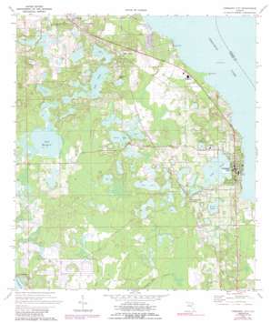
Crescent City Topo Map Florida
To zoom in, hover over the map of Crescent City
USGS Topo Quad 29081d5 - 1:24,000 scale
| Topo Map Name: | Crescent City |
| USGS Topo Quad ID: | 29081d5 |
| Print Size: | ca. 21 1/4" wide x 27" high |
| Southeast Coordinates: | 29.375° N latitude / 81.5° W longitude |
| Map Center Coordinates: | 29.4375° N latitude / 81.5625° W longitude |
| U.S. State: | FL |
| Filename: | O29081D5.jpg |
| Download Map JPG Image: | Crescent City topo map 1:24,000 scale |
| Map Type: | Topographic |
| Topo Series: | 7.5´ |
| Map Scale: | 1:24,000 |
| Source of Map Images: | United States Geological Survey (USGS) |
| Alternate Map Versions: |
Crescent City FL 1970, updated 1972 Download PDF Buy paper map Crescent City FL 1970, updated 1989 Download PDF Buy paper map Crescent City FL 1994, updated 1998 Download PDF Buy paper map Crescent City FL 2012 Download PDF Buy paper map Crescent City FL 2015 Download PDF Buy paper map |
1:24,000 Topo Quads surrounding Crescent City
> Back to 29081a1 at 1:100,000 scale
> Back to 29080a1 at 1:250,000 scale
> Back to U.S. Topo Maps home
Crescent City topo map: Gazetteer
Crescent City: Airports
Eagles Nest Aerodrome elevation 12m 39′Inhome Medical Landing Heliport elevation 16m 52′
Jim Finlay Farm Airport elevation 11m 36′
Thunderbird Air Park elevation 18m 59′
Crescent City: Capes
Hurricane Point elevation 1m 3′Weidernoch Point elevation 1m 3′
Crescent City: Lakes
Argenta Lake elevation 14m 45′Clear Lake elevation 11m 36′
Como Lake elevation 12m 39′
Dream Pond elevation 14m 45′
Lake Lillie elevation 13m 42′
Lake Lula elevation 12m 39′
Lake Omega elevation 15m 49′
Lake Trowed elevation 14m 45′
Margaret Lake elevation 11m 36′
Round Lake elevation 13m 42′
Silver Lake elevation 11m 36′
Stella Lake elevation 12m 39′
Trowel Lake elevation 14m 45′
Crescent City: Parks
North Park elevation 13m 42′Crescent City: Populated Places
Babbitts Mobile Home Park elevation 2m 6′Bass Capital Mobile Home Park elevation 15m 49′
Crescent City elevation 16m 52′
Crescent City Station elevation 18m 59′
Denver elevation 21m 68′
Hammond elevation 10m 32′
Hide - a - Way Cove Mobile Home Park elevation 4m 13′
Huntington elevation 16m 52′
Lake Como elevation 21m 68′
Lake Crescent Mobile Home Park elevation 2m 6′
Mount Royal elevation 12m 39′
Crescent City: Post Offices
Crescent City Post Office elevation 15m 49′Lake Como Post Office elevation 22m 72′
Pomona Park Post Office elevation 20m 65′
Crescent City digital topo map on disk
Buy this Crescent City topo map showing relief, roads, GPS coordinates and other geographical features, as a high-resolution digital map file on DVD:


