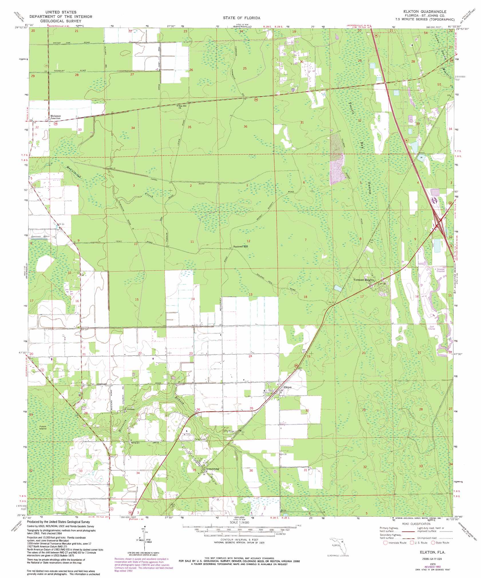
Elkton Topo Map Florida
To zoom in, hover over the map of Elkton
USGS Topo Quad 29081g4 - 1:24,000 scale
| Topo Map Name: | Elkton |
| USGS Topo Quad ID: | 29081g4 |
| Print Size: | ca. 21 1/4" wide x 27" high |
| Southeast Coordinates: | 29.75° N latitude / 81.375° W longitude |
| Map Center Coordinates: | 29.8125° N latitude / 81.4375° W longitude |
| U.S. State: | FL |
| Filename: | O29081G4.jpg |
| Download Map JPG Image: | Elkton topo map 1:24,000 scale |
| Map Type: | Topographic |
| Topo Series: | 7.5´ |
| Map Scale: | 1:24,000 |
| Source of Map Images: | United States Geological Survey (USGS) |
| Alternate Map Versions: |
Elkton FL 1937 Download PDF Buy paper map Elkton FL 1970, updated 1973 Download PDF Buy paper map Elkton FL 1970, updated 1988 Download PDF Buy paper map Elkton FL 1970, updated 1992 Download PDF Buy paper map Elkton FL 2012 Download PDF Buy paper map Elkton FL 2015 Download PDF Buy paper map |
1:24,000 Topo Quads surrounding Elkton
Fleming Island |
Orangedale |
Durbin |
South Ponte Vedra Beach |
|
Green Cove Springs |
Picolata |
Bakersville |
Saint Augustine |
|
Bostwick |
Riverdale |
Elkton |
Saint Augustine Beach |
|
Palatka |
Hastings |
Spuds |
Dinner Island Ne |
Matanzas Inlet |
Satsuma |
San Mateo |
Dinner Island |
Espanola |
Beverly Beach |
> Back to 29081e1 at 1:100,000 scale
> Back to 29080a1 at 1:250,000 scale
> Back to U.S. Topo Maps home
Elkton topo map: Gazetteer
Elkton: Airports
Revels Strip elevation 8m 26′Elkton: Populated Places
Armstrong elevation 11m 36′Coquina Crossing Mobile Home Park elevation 14m 45′
Elkton elevation 10m 32′
Molasses Junction elevation 7m 22′
Vermont Heights elevation 14m 45′
Elkton: Streams
Moccasin Branch elevation 1m 3′Elkton: Summits
Squirrel Hill elevation 9m 29′Elkton: Swamps
Trestle Bay Swamp elevation 11m 36′Elkton digital topo map on disk
Buy this Elkton topo map showing relief, roads, GPS coordinates and other geographical features, as a high-resolution digital map file on DVD: