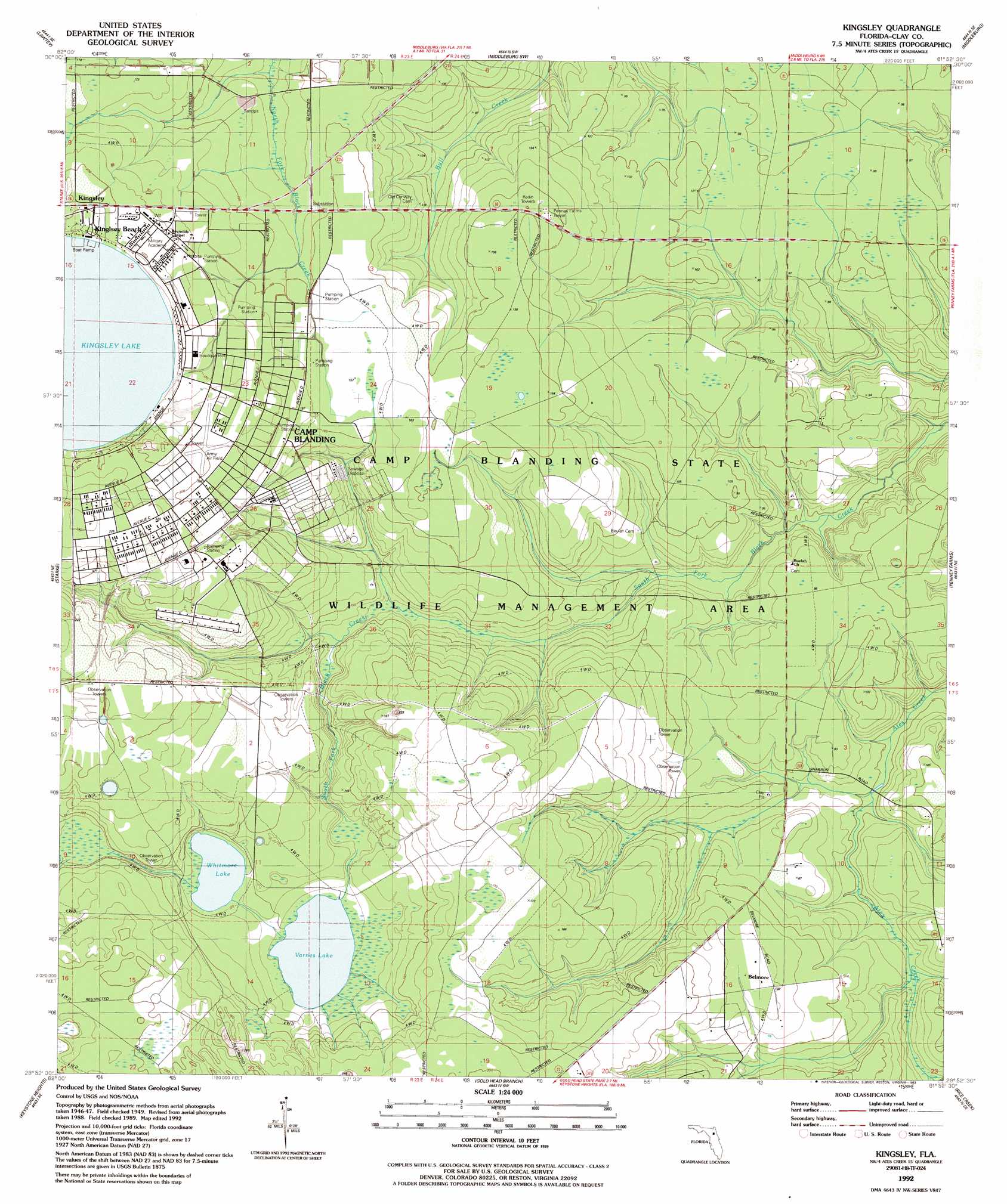
Kingsley Topo Map Florida
To zoom in, hover over the map of Kingsley
USGS Topo Quad 29081h8 - 1:24,000 scale
| Topo Map Name: | Kingsley |
| USGS Topo Quad ID: | 29081h8 |
| Print Size: | ca. 21 1/4" wide x 27" high |
| Southeast Coordinates: | 29.875° N latitude / 81.875° W longitude |
| Map Center Coordinates: | 29.9375° N latitude / 81.9375° W longitude |
| U.S. State: | FL |
| Filename: | O29081H8.jpg |
| Download Map JPG Image: | Kingsley topo map 1:24,000 scale |
| Map Type: | Topographic |
| Topo Series: | 7.5´ |
| Map Scale: | 1:24,000 |
| Source of Map Images: | United States Geological Survey (USGS) |
| Alternate Map Versions: |
Kingsley FL 1949, updated 1953 Download PDF Buy paper map Kingsley FL 1949, updated 1978 Download PDF Buy paper map Kingsley FL 1949, updated 1990 Download PDF Buy paper map Kingsley FL 1992, updated 1993 Download PDF Buy paper map Kingsley FL 2012 Download PDF Buy paper map Kingsley FL 2015 Download PDF Buy paper map |
1:24,000 Topo Quads surrounding Kingsley
Manning |
Maxville |
Fiftone |
Jacksonville Heights |
Orange Park |
Raiford |
Lawtey |
Middleburg Sw |
Middleburg |
Fleming Island |
Sampson |
Starke |
Kingsley |
Penney Farms |
Green Cove Springs |
Waldo |
Keystone Heights |
Gold Head Branch |
Rice Creek |
Bostwick |
Orange Heights |
Melrose |
Putnam Hall |
Baywood |
Palatka |
> Back to 29081e1 at 1:100,000 scale
> Back to 29080a1 at 1:250,000 scale
> Back to U.S. Topo Maps home
Kingsley topo map: Gazetteer
Kingsley: Lakes
Kingsley Lake elevation 53m 173′Varnes Lake elevation 32m 104′
Whitmore Lake elevation 35m 114′
Kingsley: Parks
Camp Blanding State Wildlife Management Area elevation 39m 127′Kingsley: Populated Places
Belmore elevation 36m 118′Kingsley elevation 61m 200′
Kingsley Beach elevation 58m 190′
Kingsley digital topo map on disk
Buy this Kingsley topo map showing relief, roads, GPS coordinates and other geographical features, as a high-resolution digital map file on DVD: